Managing Hazards
Managing Hazards. Revision notes. What is a Natural Hazard?. A Natural Hazard is any natural event that has the potential to endanger human life, the economy and property.

Managing Hazards
E N D
Presentation Transcript
Managing Hazards Revision notes
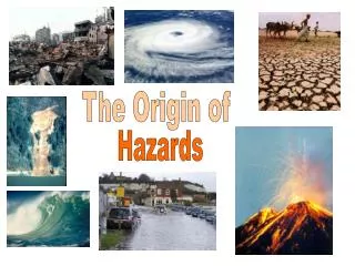
What is a Natural Hazard? A Natural Hazard is any natural event that has the potential to endanger human life, the economy and property. This unit is all about the management of hazards. You have studied tropical storms (hurricanes), earthquakes and volcanoes. For each hazard you will look at it’s causes, the effects it has (on people, the environment and the economy) and how the hazard is managed (in terms of prediction, prevention of damage, preparation of communities) You will be expected to do this for both MEDCs and LEDCs
TROPICAL STORMS Tropical Storms occur between the two tropics- Cancer and Capricorn. It is in this area where the temperature of the sea occurs at over 27˚C; which is the essential factor needed to kick-start a tropical storm. The highest number of storms exist in the North Pacific Ocean. The most affected area being South East Asia receives an average of 26 storms per year. The least affected area is Indiawhere there is an average of 2 tropical storms per year. Tropical storms become hurricanes when their wind speed is over 74miles per hour (a category 1 storm). Our 2 cases studies were the worst category of hurricane, category 5, with wind speeds over 149miles per hour.
Hurricane Floyd - MEDC casestudy • Location • *Hurricane Floyd struck on the 16th September 1999 and followed the eastern coast of America all of the way from Florida to Maine until it eventually died out. • *It formed in the gulf of Mexico out at sea before hitting the Caribbean islands and mainland America. • The width of the hurricane was estimated to reach around 500km and it was classified as a category 5 hurricane • Prevention, preparation and prediction measures limited human losses Effects *Hurricane Floyd claimed the lives of 79 people. *42 973 homes sustained some degree of damage *14 states from Florida to Maine were effected *Agricultural costs were estimated at $1 billion *47 people died in North Carolina after 500mm of rain flooded 30 000sq km Costs of rebuilding £4 Billion Solutions and Management Prediction - The National Hurricane Centre tracked the storm using its satellites, this allowed 4 million people to be evacuated. Preparation - The evacuation was well planned, supported by the army and hundreds of hurricane shelters. Prevention - People in the USA are educated on how to survive a hurricane by the government, tips given include turning off gas, removing loose objects from outside and stocking up on medical supplies, a radio, food and water. Buildings are well constructed to withstand high winds, floods and storm surges. Aid – The USA relies on internal aid for it’s own government, the US government gave £1.5 billion and whilst FEMA (federal Emergency Management Agency) gave £0.8Billion *The path of Hurricane Floyd
Orissa Cyclone – LEDC (Hurricane) Location On 29th of October 1999, a cyclone (hurricane) emerged from the Bay of Bengal. With winds up to 300 km/h and 30 feet tidal waves, it affected the state of Orissa for more than 36 hours. The impacts on people and the environment were massive because of poor preparation. • Effects • 20,000 people and 700,000 cattle died. • 90 million trees have been uprooted or damaged. • 20 million people were made homeless • 5 million farmers are out of work • 1.2 million hectares of standing cropland were destroyed. • £1.5Billion damage • Solutions • Preparation and Prediction – The Indian government saw the development of the cyclone on it’s satellites but couldn’t warn people because of low literacy rates (49%), poor access to radios and the isolated nature of many villages. • Prevention - There are only 27 cyclone shelters in this region for over 20 million people who live in the state. Building codes do not protect buildings against the forces of cyclones. • Response - It took three days for relief efforts to begin. Five days after the storm, the co-ordination centre consisted of six workers, two telephones and a fax machine. Fishermen have now been issued with radios following the storm so that they can warn each other and people on land if there are future cyclones. • Aid - India turned down a United Nations offer for an international fund-raiser, but countries including the US, Britain, Canada and Germany sent donations. About $20.8m had been pledged by March. The Indian government tried to deal with the disaster on it’s own initially.
The Structure Of The Earth Tectonics is the study of the Earth’s internal structure and the movement of tectonic plates that make up the Earth’s crust. Mantle-Molten rock, mainly silicates. Convection currents move the plates above Core-Iron and nickel, temperatures reach 3700 degrees C and the pressure are very high. Crust-Hard surface made of two different types of layers:Continental- Thicker, older less denseOceanic- Thinner, younger, dense (heavier) Outer Core-Less pressure, made from Iron and Nickel; its molten!
Location of Volcanoes and earthquakes. Volcanoes and earthquakes mainly occur along plate boundaries where magma can escape from the earth’s mantle or where stresses build up between 2 plates rubbing together. An exception to this includes Hawaii, which is found in the middle of the Pacific plate over a hot spot. Examples of plate margin types are linked to the map. Earthquake location Constructive margin Destructive margin Collision margin Conservative margin
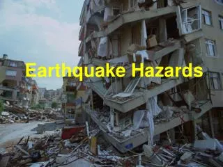
Location Kobe is located in the south east of Japan, near a destructive plate margin. Although further from the plate margin than most of the cities in Japan Kobe is found on a fault line. The quake measured 6.9 on the Richter scale. The Pacific plate is being pushed under the Eurasian plate, stresses build up and when they are released the Earth shakes. The focus was only 16km below the crust. It happened on the 17th Jan 1995 at 5.46am. KOBE, JAPAN – An earthquake in an MEDC • Effects • More than 5000 died in the quake • 300,000 were made home less • More than 102,000 buildings were destroyed in Kobe, especially the older wooden buildings. • Estimated cost to rebuild the basics = £100 billion. • The worst affected area was the centre. This was because it was built on easily moving ground which LIQUIFIED, allowing building to collapse and sink. Solutions Preparation – A lot of the buildings in Kobe and Japan made after the 1960s are earthquake proof (necessary by law) with counterweights on the roofs and cross steel frames. Many of the damaged buildings in Kobe were built before this period and were made of wood, which caught fire. People are educated on earthquake preparation in Japan. Prediction – Japan has the world’s most comprehensive prediction programme with thousands of seismometers and monitoring stations in Japan designed to give warning. Kobe hadn’t had an earthquake in 400years and had less prediction equipment than other areas of Japan. Responses – Fires broke out and emergency services struggled to put them out because of the scale of the damage, blocked roads and broken water pipes. Aid did not reach Kobe from other parts of Japan because of damaged roads and rail links. Water, electricity, gas, telephone services were fully working by July 1995. The railways were back in service by August 1995. A year after the earthquake, 80% of the port was working but the Hanshin Expressway was still closed. Aid – The Japanese rejected international offers of aid and dealt with the earthquake itself. All of the homeless people were dealt with reasonably quickly and the city recovered thanks to government money.
IZMIT EARTHQUAKE Location and background. The epicenter at Izmit in Turkey's heavily populated northwest - struck at 0302 hours local time on 17 August. The geographical fault involved was the North Anatolian Fault. The Izmit quake - August 1999 Effects Social More than 20,000 died The earthquake left some 17,000 people dead and 200 000 homeless. Tens of thousands spent 2 years after the quake living in tents Economic Many shopkeepers unable to re-open businesses after thousands migrated after the quake Many roads needed fixing as well as rail and telecommunications Environmental 700,000 tonnes of oil was set ablaze 65,000 buildings were destroyed because of poor construction The Turkish landmass is a small tectonic plate which is being squeezed like a pip between the two bigger plates, the Eurasian and Arabian. It is therefore moving west, so it is a conservative plate boundary. Solutions/Responses Responses - The response was very slow after the quake. Lives were lost due to inefficiency. Foreign aid was and resources (food, tents) were given by the Red Cross. After the quake 5000 people were trained in earthquake rescue, but people lived in tents for over two years after the quake which shows a lack of efficiency. However building codes have not improved in Izmit.
Mount Pinatubo • Effects • 847 People Killed - 300 from collapsing roofs 100 from the mud flow, the rest from disease in the evacuation centres including measles. • 650,000 workers lost jobs • $700 Million Damages • 1.2million people lost homes • Electricity went off, water was contaminated, road links were destroyed, and telephone links were cut • Location • On the Island of Luzon in the Philippines in South East Asia. Next to the Eurasian and Philippine Plate. • It exploded in 1991 • It is one of a chain of volcano's known as the Luzon volcanic arc, which is the result of the Oceanic Philippine plate being subducted under the lighter Continental Eurasian plate. • The Volcano is slightly offset from the plate boundary as, when the Oceanic plate is subducted it is melted and forced away as molten magma by the high pressures exerted on it. It then resurfaces as the density of the molten magma becomes lower than that of the rock, and so it pushes it up through the small cracks and explodes out through a volcano.