Download

1 / 17
170 likes | 315 Views
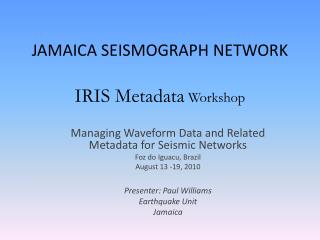
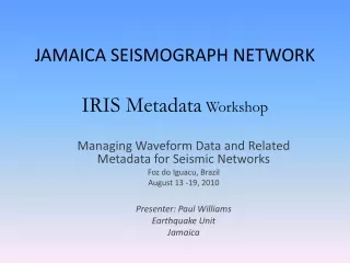
JAMAICA SEISMIC NETWORK IRIS Data Management Workshop. Managing Data from Seismic Networks Bogota, Colombia July 24, 2014 – July 31, 2014 Earthquake Unit University of the West Indies, Mona Campus Jamaica

E N D
JAMAICA SEISMIC NETWORKIRIS Data Management Workshop Managing Data from Seismic Networks Bogota, Colombia July 24, 2014 – July 31, 2014 Earthquake Unit University of the West Indies, Mona Campus Jamaica _________________________________________________________________________________________________________________ Paul Williams – Network Manager/Engineer Paul Coleman – Information Technologist
FACTS ABOUT JAMAICA • Location = 18 N, 76-78 W ~400Km E of Grand Cayman and 150km S of SE Cuba. • Area of 11424 km sq. with length of island east to west 243 km and width of maximum distance N- S 80 km • Mountainous with half of island above height of 305m and the highest mountain of 2256m in the east. • Population of 2.8 million. • Experiences moderate to high seismicity with most activities in the east of the Island. • A history of having damaging earthquakes
The Earthquake UnitMISSION STATEMENT Through operating the Jamaica Seismograph Network and affiliating with other Caribbean and Regional Networks the Earthquake Unit seeks to understand earthquake processes in and around Jamaica and advise the society about earthquake hazard thereby encouraging community awareness and the application of mitigative strategies to development. PW/EQU/UWI-Mona
Work of the Earthquake Unit • The Unit operates the Jamaica Seismograph Network, Jamaica Strong Motion Network and the GPS Monitoring Network. • Archives and records all earthquake related data for Jamaica. • Collaborates/conducts relative research on Jamaica seismicity and tectonics. • Performs national and site specific seismic hazard assessment for national and private entities.
Earthquake Unit contd. • Informs the public about felt earthquake and conduct awareness campaign. Provides bulletin to the Office of Disaster Preparedness and Emergency management (ODPEM) and the media after felt earthquake. • Operates the National Data Centre (NDC) for Jamaica in keeping with the CTBTO • Hosts tours by schools and other community groups at the Central Recording Station.
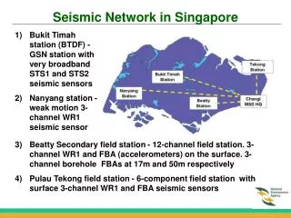
DATA ACQUISITION AND ANALYSIS LOCAL STATIONS ANALOG & DIGITAL BROADBAND seismic station ANALOG TELEMETRY UHF&VHF SEISMICSTATIONS FROM OTHER NETWORKS. Cayman, USGS-GSN etc. DIGITAL TELEMETRY SPREAD SPECTRUM SEISLOG/SEISAN PC-SDA/PC-SDP DATA ACQ AND PROCESSING EXPORTING DATA TO EW SERVER CTBTO STATIONS INTERNET EARTHWORM SERVER WAVE SERVER CONTINUOUS RECORDING SEISCOMP SEEDLINK SERVER NDC-IN-A BOX SERVER CTBTO ROUTER EQU SWITCH ADMINISTRATIVE WORK AND ANALYSIS MYSQL EARTHWORM DATA ANALYSIS WORKSTATION
Seismometers in use at the JSN Mark Product L-4C Guralp CMG 40T Guralp CMG-6TD Guralp CMG 3ESPC
Accelerograph in use at the JSMN • Guralp 5T REFTEK 130-SMA Kinemetrics K2
PLANS FOR THE NETWORK FOR THE NEXT 3 YEARS • Upgrade all the short period stations to digital broadband using Guralp instruments (total 8). • Expand the strong motion accelerograph network by adding 40 accelerographs. • To improve and expand the data communication network. • Aquire geophysical equipment for seismic surveys and microzonation studies
THE END PAW-IRIS_July 2014