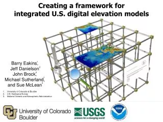
Creating a framework for integrated U.S . digital elevation models
Creating a framework for integrated U.S . digital elevation models. Barry Eakins, Jeff Danielson John Brock, Michael Sutherland, and Sue McLean. 1. 2. 2. 1. 3. University of Colorado at Boulder U.S. Geological Survey National Oceanic and Atmospheric Administration.

Creating a framework for integrated U.S . digital elevation models
E N D
Presentation Transcript
Creating a framework forintegrated U.S. digital elevation models Barry Eakins, Jeff Danielson John Brock, Michael Sutherland, and Sue McLean 1 2 2 1 3 University of Colorado at Boulder U.S. Geological Survey National Oceanic and Atmospheric Administration
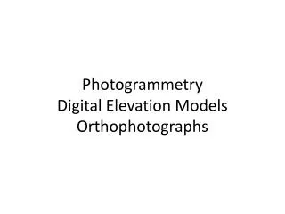
Coastal DEM Framework Goal Goal: For users to discover and access publicly available integrated bathymetric-topographic DEMs and color, shaded-relief hillshade images (e.g., geotiffs) of U.S. coasts and Great Lakes • At a range of pre-determined cell sizes (e.g., ⅓ arc-seconds, 3 arc-seconds) • In different vertical datums (e.g., NAVD 88, MHW) and coordinate systems (e.g., geographic, UTM zone) • Models built by different Federal / State agencies, universities, private sector • Models covering different temporal ranges (e.g., morphologic change analysis) Santa Barbara, CA coastal DEM
Coastal Zone Sea-level rise Ecosystem management and habitat research Spatial planning Morphologic change Shoreline mapping Hazard mitigation and Community preparedness
U.S. National Ocean Policy National Ocean Policy Implementation Plan The National Ocean Policy Implementation Plan translates the National Ocean Policy into on-the-ground actions that will help Americans all across the Nation sustain and enjoy our ocean resources. • I. The Ocean Economy: Supporting Economic Growth (Appendix p. 2) • Advance our mapping and charting capabilities and products to support a range of economic activities. • 2017 • Improve and implement coastal change analysis products and a sustained and seamless description of coastal and marine elevation extending from on-shore coastal areas (Coastal National Elevation Dataset) through the U.S. Exclusive Economic Zone (EEZ) and extended continental shelf, including elevation models and derived map products, for local, State, and Federal managers. [IWG-OCM, DOI (USGS), USACE, NOAA] [OMI]
USGS EROS Data Center National Elevation Dataset • Topography only • 1, 1/3 and 1/9 arc-second • NAD 83 geographic • NAVD 88 • Updated bi-monthly USGS NED Coastal NED • Integrated bathy-topo • 1/9 arc-second and 2meter • NAD 83 geographic and UTM • NAVD 88 • Limited coverage Mobile Bay, AL coastal DEM
NOAA NGDC US Coastal Relief Model • Integrated bathy-topo • 3 arc-second • NAD 83 geographic • “sea level” • 1999-2005 US CRM ETOPO1 Tsunami inundation DEMs • Integrated bathy-topo • 1/3 arc-second • WGS 84 geographic • NAVD 88, MHW Global relief • Integrated bathy-topo • 1 arc-minute • WGS 84 geographic • “sea level” Sand Point, AK coastal DEM
DEM Time-Length Scales Modified after Cowell and Thom [1997]. DEM cell size needs to be three times smaller than the features they can resolve.
Coastal DEM Framework Components • Comprehensive suite of seamless, integrated, consistent, and regularly updated bathymetric-topographic models of all U.S. coastal and marine areas • Topobathy digital elevation models • Color images for map visualization • Standardized, robust procedures and tools • Data processing • DEM development and evaluation • DEM updating as new data are collected • Thorough documentation on source data and model development • Spatially referenced metadata • ISO/FGDC-compliant xml • Technical reports • Online tools for public search, discovery, transformation, and retrieval
Tentative Specifications and Plans Develop Standardized Procedures (Jan 2014) • Data processing • Coastal DEM development and assessment – specifications, interpolation, resampling • Coastal DEM updating as new data collected • Metadata documentation • Common access Tentative Specifications: UTM Zone Suite • 1 and 3 meter cell sizes • Near-shore, Lidar based, hydro-enforced • NAVD 88 vertical datum (MHW via online tools) • NAD 83 • Nesting – Consistent resampling • Cell alignment (pixel edge) • Multi-temporal (pre- and post-event)
Tentative Specifications and Plans Geographic Suite • 1/9, 1/3, 1, 3, and 9 arc-seconds • Shoreline to deep ocean • Lidar, hydrographic soundings, and single-beam and multibeam sonar • NAVD 88 • Nesting, telescoping • Grid-node alignment DEMs telescoping offshore DEM cell nesting
Web Access Tools Common Tools • On-demand conversion to common vertical datums and coordinate systems, and common file formats • Extraction of coastal DEMs and/or spatially referenced, color hillshade images (e.g., geotiffs) • Merging of adjacent coastal DEMs in a user’s area of interest • Select by temporal coverage (e.g., 2005-2011) Screen capture of current NGDC grid extract tool We seek your input on what you require in coastal DEMs.
Test Case: Sandy-Impacted Coasts NOAA funded to test procedures and produce integrated models along Sandy-impacted NY-NJ coast.
Pre and Post Hurricane Sandy Mantoloking, New Jersey (Barnegat Peninsula) (USGS EAARL-B) Courtesy Wayne Wright and John Brock, USGS
Test Case: DEMs of NY-NJ Coasts NOAA’s National Geophysical Data Center (NGDC) will work collaboratively with USGS’s Earth Resources Observation & Science (EROS) Center to develop draft procedures for building seamless bathymetric-topographic digital elevation models (DEMs) of the Nation. These procedures will be tested and implemented by building DEMs of the New York-New Jersey shoreline that were impacted by storm-surge from Hurricane Sandy in 2012 that accurately reflect the post-storm morphology. NOAA Project deliverables Coverage of coastal DEMs for each deliverable date Separate web discovery and access.
Questions? barry.eakins@noaa.gov daniels@usgs.gov