Download
1 / 16
170 likes | 237 Views
Explore the geological wonders of Jal Az-Zor in Kuwait, including Burgan Arch and Wadi Al-Batin. Discover ancient flood evidence and Tertiary formations. Detailed site descriptions and observations provide insights into the landscape's unique features and history.

E N D
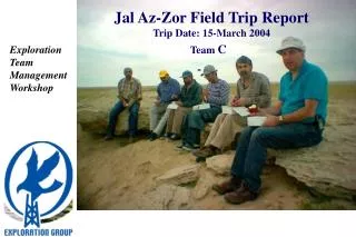
Jal Az-Zor Field Trip Report Trip Date: 15-March 2004 Team C • Exploration Team Management Workshop
Jal Az-Zor Field Trip Report15-March 2004 Jal Az-Zor Burgan Arch Wadi Al-Batin • Shaded Relief Map Of Kuwait • This Map show 3 main main Features • Wadi Al-Batin • Jal Az-Zor • Burgan Arch Wadi Al-Batin is an extension of anceint river coming from Arabia, and in the next page there are some evidence of this theory and Jal Az-Zor is ascarpment where the eastern flank has beenerode, and we have an explanation fro that also in the next pages 2
Jal Az-Zor Field Trip Report15-March 2004 Evidence of Ancient Floods in the Heart of Saudi Arabia 3
Jal Az-Zor Field Trip Report15-March 2004 S3 S2 The Trip program S1 4
Jal Az-Zor Field Trip Report15-March 2004 Tertiary Formations 5
Jal Az-Zor Field Trip Report15-March 2004 Area Cross-Section Fawn medium to very coarse grained gritty pebbly cross-bedded sandstone with spares carbonate and gypsum cement; pebbles of quartzite and fine-grained igneous rock-types. Site 3 Talus-no exposure Dibdibah Fars Off white to fawn medium to coarse-grained pebbly sandstone showing facies changes along bed. At base- lenses of fine to medium-grained even-grained clean washed sandstone. Main part is of medium to coarse grained pebbly calcareous sandstone with lamellibranches, gastropods and minor coral fragments. Pebbles at top are tabular of sandy chalky limestone upper part is of pebbly sandstone, pebbles of quartzite and igneous rocks with irregular probably disconformable basal contact. Beds of chalky limestone nodules set in greenish-gray sandstone and fractured red claystone Site 1 Thin-bedded red-off-white calcareous sandstone Thinly interbedded greenish-gray silty gypsiferous sand and red silty claystone with recrystalized gypsum as veins and septa Greenish –gray silty slightly gypsiferous sand Medium to fine-grained off-white well sorted sand and barely cemented sandstone: grains of quartz with 5-10 percent feldspar, trace opaque mineral local nodular patches with chalky carbonate cement and numerous small lamellibranches and gastropods; local yellowish color banding; fractures with carbonate filling toward top. Red fissile claystone with recrystalized gypsum White well sorted medium-grained sand. Medium to coarse-grained sandstone with sparse pebbles and fine –grained silty sand Red silty gypsiferous clay-discontinuous Greenish-gray medium-grained silty sand with gritty lenses Outwash- no exposure Site 2 Thinly bedded red; yellow and off-white limestone; lower part is sandy, contains pebbles, nodules of chalky limestone, upper part lacks sand and has bedding planes crowded with clausinella sp Yellow, speckled and mottled orange and black, clayey sand-somewhat gypsiferous Gray-weathered fawn localy red medium, even grained sandstone with gypsum cement; slightly feldspathic, locally cross-bedded with intercalation of un-cemented sand and small rounded pebbles of red clay 6
Jal Az-Zor Field Trip Report15-March 2004 • Observations in Site 1: • The Jal Az-Zor escarpment formed because of the eroded happen to the east flank done by water of Arabian Gulf (Pic.1). • The key lithological feature of the escarpment is coarse grained pebbly calcareous sandstone to limestone and clay pebbles forming Dibdibah and lower Fars formations (P.3 & 4) • This unit did not extend farther toward the southern side of the escarpment. • This unit looks like trough on the seismic interpretation (because the waves travel from low velocity to high velocity), we can easy find the contact between these two formation and it is also represent agood seismic reflector (Pic.5) S1 Pic. 1 Pic. 2 Pic. 3 Pic. 4 Pic. 5 7
Jal Az-Zor Field Trip Report15-March 2004 • Observations in Site 2: • Thinly bedded red; yellow and off-white limestone; lower part is sandy, contains pebbles, nodules of chalky limestone, upper part lacks sand(P.2-4) • Also in The second part of this site wen saw a large population of joints and different oreintations. • Salman studeid this in 1979 and came up with 2 main oreintations. S2 Pic. 2 Pic. 1 Tertiary Joints trend Pic. 3 Pic. 4 Regional stress field indicators from Jal Az-Zor outcrop Tertiary section (After Salman, 1979) Pic. 6 Pic. 7 8
Jal Az-Zor Field Trip Report15-March 2004 • Joints trend variations: • The variations in trends which have been observed in The Escarpment could be due to one or more of the followings reasons: • Multi-modal data sets • more than one set of fault trends • orthogonal and conjugate fracture sets • Stresses associated with local wrench / strike-slip movements • Variations in lithologies with differing elastic/rock mechanic properties • Local modifications in the stress field adjacent to larger regional structural elements. 9
Jal Az-Zor Field Trip Report15-March 2004 S3 • Observations in Site 3: • Dibdibah Deposites • Fawn medium to very coarse grained gritty pebbly cross-bedded sandstone with spares carbonate and gypsum cement; pebbles of quartzite and fine-grained igneous rock-types • In this sit we saw 3 clear graded bedding cycles, with well rounded pebbles of igneous rocks ( long transportation from the Arabian Shield) in the base and getting finer upward • This section is the top section of the Escarpments Pic. 2 Pic. 1 Cycle 2 Cycle 2 Cycle 1 Pic. 3 10
Jal Az-Zor Field Trip Report15-March 2004 Sketch and Explanation of the Jal Az-Zor Escarpment and this is our personal opinion Rus Structure Map Explanation From the Rus structural Map we think that dibdiba basin deposites was affected by the structure of Rus which we see plunging to the north of Kuwait Bay, and that is obvious also from the change of the depostes direction coming through Wadi Al-Batin. But also we think that the elongation of the escarpments is also a result of a deep fault and we can see that obvious from the satellite images and also that is clear for Bubian Island. Anyway, we think that a full structural understanding of this area need more study and more than one day visit. 11
Jal Az-Zor Field Trip Report15-March 2004 Sketch and Explanation of the Jal Az-Zor Escarpment and this is our personal opinion Dibdibah deposits before before before before Dibdibah deposits Fars Ghar after Fars Ghar 12
وادي الباطن جال الزور خريطة الارتفاعات السطحية لدولة الكويت اعلى ارتفاع منخفض