Download
1 / 19
210 likes | 719 Views
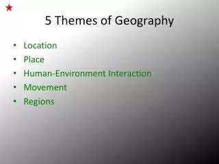
5 Themes of Geography. Geography 12 Activation Assignment. The Five Themes of Geography. Geography is the study of the earth and everything on it. When geographers study the earth, they examine or look at it through a five lenses: location place human/environment interaction movement

E N D
5 Themes of Geography Geography 12 Activation Assignment
The Five Themes of Geography • Geography is the study of the earth and everything on it. • When geographers study the earth, they examine or look at it through a five lenses: • location • place • human/environment interaction • movement • regions
1. Location – Absolute position • Every point on Earth has a specific, absolute, location • Geographers use • parallels of latitude – measured north and south of the equator • meridians of longitude – measured east and west of the Prime Meridian • …to determine absolute location
Every point on earth corresponds to a number showing latitude, plus a number showing longitude. http://www.lakelandsd.com/tutorial/instructions.html
Use the link to find the specific location of the following places • http://www.findlatitudeandlongitude.com/ • The border between Canada and the United States in BC, east of Vancouver • Your town • The most southern point of Canada’s border with the US • The farthest east you can get in Canada • The farthest west you can get in Canada • The farthest north you can get on this map in Canada
Location can also be relative – that is relative to another place • Relative location – how one place is connected to another • Where are you, relative to Prince George? • Fort St. James is Northwest of Prince George, both are located on the Interior Plateau
Assignment • Using the three maps provided, complete the following questions • The World Map • Which line of longitude runs through Greenland • Which line of latitude is the Equator? • Canada’s territories (Nunavut, Yukon, Northwest Territories) are located north of which line of latitude? • Antarctica is located south of which line of latitude? • Oceana is south of the Equator, and what of the Prime or Greenwich Meridian • Antarctica Map • The Amery Ice Shelf is located at approximately 70°S and 75°E. Thurston Island is located: • The coordinates of the South Pole are: • The coordinates of the Magnetic South Pole are: • Pakistan • The Indus River enters Pakistan from China at which coordinates? Explain in relative terms, where it exits Pakistan • Afghanistan is located where, relative to Pakistan? • The capital city is what, and is located at which coordinates? What is the capital city’s relative location? • India is located where, relative to China?
2. Place • All places have characteristics that give them meaning and character different from other places – • Physical • Human (or cultural)
Place • Physical Characteristics • animal life • plant life • geographical characteristics • Question: Briefly describe how these two places are different based on the three items above. http://weathersavvy.com/A-Climate.html http://www.the-labs.com/Lightbox/mountain.jpg
Human Characteristics • shaped by religious, political, cultural, social, economic ideas • Architecture – the style of buildings • what people do for a living • land use and ownership • how people use the land for economic and recreational purposes, and who and how land is owned • town planning • communication and transportation networks
Describe how these two places are different: • Architecture – the style of buildings • What people do for a living • Land use and ownership - how people use the land for economic and recreational purposes • Communication and transportation networks Place: shaped by religious, political, cultural, social, economic ideas and history http://www.uva.co.uk/wp/wp-content/projects/onTheRoad/tokyo/tokyo01.jpg http://k53.pbase.com/u48/rvision/upload/30747180.HollandBikingHollandBiking09.jpg
3. Human/Environment Interaction • Positive and negative consequences of human impact BP Oil Spill • The way humans depend on, adapt to and modify the environment From Wikipedia: Anchor-handling tugboats battle the blazing remnants of the off shore oil rig Deepwater Horizon. A Coast Guard MH-65C dolphin rescue helicopter and crew document the fire aboard the mobile offshore drilling unit Deepwater Horizon, while searching for survivors. Multiple Coast Guard helicopters, planes and cutters responded to rescue the Deepwater Horizon's 126 person crew. University of Victoria http://web.uvic.ca/malahat/supporters.html http://en.wikipedia.org/wiki/File:Deepwater_Horizon_offshore_drilling_unit_on_fire_2010.jpg
Human/Environment Interaction • Looking at the images of the BP oil spill and the University of Victoria, write about the following: • How do people • Modify or change the environment in which they live? • How do people depend upon the environment? • How do people change their activities to survive and thrive in the environment? • What are the positive and negative impacts on the environment in each photo? On people?
4. Regions • A region is a basic unit of study with certain unifying characteristics • physical • cultural • and how this changes over time
This map shows language regions. Examine the map. Tell one thing you notice or are surprised by.
http://upload.wikimedia.org/wikipedia/commons/a/a6/Percent_poverty_world_map.pnghttp://upload.wikimedia.org/wikipedia/commons/a/a6/Percent_poverty_world_map.png What is this map showing? Where are most of the richer countries located? Where are most of the poor countries located? Give some reasons you think a place might be rich or poor.
http://www.theglobaleducationproject.org/mideast/info/maps/religions-map.gifhttp://www.theglobaleducationproject.org/mideast/info/maps/religions-map.gif What is this map showing? Make a comment about one aspect of this map that is interesting or surprising to you.
5. Movement • Movement of life forms, including people, ideas, products • travel • communication • reliance on products, information, ideas from other places • How are we connected to other places, people?
Go to the Geography 12 Website • Read through the pages on the flood in Pakistan. As you read, answer the following questions • Give a brief description of what has caused this natural and human catastrophe • Describe some of the key problems that have been created for the environment, the people in Pakistan, the people outside of Pakistan • Thinking about the idea of movement in geography, answer the following questions: • How are people in Pakistan moving in response? • How has the world responded, or communicated, or helped the people of Pakistan? What goods and supports are moving from different countries to Pakistan? • What impact could this disaster have on people outside of Pakistan. In other words, how are we connected to the people there?