CENTRAL AMERICA AND CARIBBEAN
250 likes | 877 Views
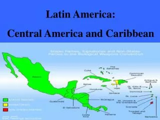
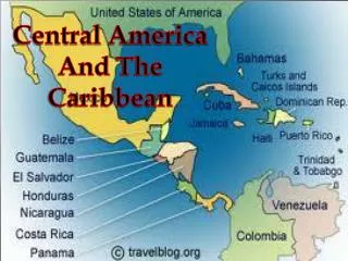
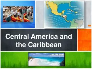
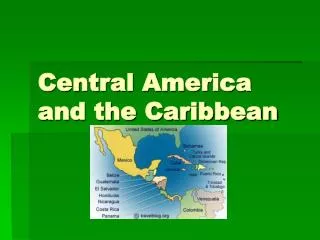
CENTRAL AMERICA AND CARIBBEAN. Natural Features. LOCATION. Central America: isthmus that connects North and South America West Indies contains Greater and Lesser Antilles Caribbean Sea and Pacific Ocean. GREATER ANTILLES Cuba Hispanola (Haiti and Dominican Republic Jamaica Puerto Rico

CENTRAL AMERICA AND CARIBBEAN
E N D
Presentation Transcript
CENTRAL AMERICA AND CARIBBEAN Natural Features
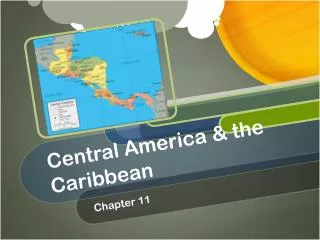
LOCATION • Central America: isthmus that connects North and South America • West Indies contains Greater and Lesser Antilles • Caribbean Sea and Pacific Ocean
GREATER ANTILLES Cuba Hispanola (Haiti and Dominican Republic Jamaica Puerto Rico Bahamas (around 700 islands) LESSER ANTILLES 20 small island countries including Barbados, Trinidad and Tobago, etc. CENTRAL AMERICA Guatemala El Salvador Honduras Nicaragua Costa Rica Panama COUNTRY GROUPINGS
What does it look like? • Coastal plains along coast (obviously) but rugged mountains along interior • Rivers fairly small • Caribbean and Cocos tectonic plate meet in Caribbean creating mountains (interior of Central America) and volcanoes (Lesser Antilles) • Some active volcanoes in region today
Climates and Biomes • Tropical wet and Tropical wet/dry climates in Caribbean • Central America has semi-arid along rain shadow, highland in mountains and tropical wet and wet/dry on east coast • Lesser Antilles have many islands made of limestone limiting availability of water • Famous for Mangrove trees
Natural Resources and Environmental Hazards • Resources: climate and tourism, fishing, bauxite (makes aluminum), nickel and limited oil • Hazards: earthquakes and volcanic eruptions common in Central America and Lesser Antilles, tropical storms and hurricanes all over
Central America History and Culture Political and Ethnic conflict
Central America History/Culture • Spanish arrived in 1500’s • Indigenous people originally farmers but later destroyed by Spanish (primarily disease) • Spanish converted region to Catholicism • Belize (British Honduras) only non-spanish speaking country in region • 1820’s beginning of independence for countries in region, but a few wealthy families continued to rule
Central America History/Culture cont. • 1900’s US built Panama canal that it controlled until 1999 when it was returned to Panama • Most people are “mestizo” European and Indigenous descendants but some are mulattoes (people of European and African descent) • Largest Indian population in Guatemala • Belize last to gain independence in 1981
Central America Political and Ethnic Conflict • Regions dependent on cacao and coffee exports which has brought in foreign influence and businesses • Great disparity between rich and poor, a few families control great deal of economy leaving many to live under subsistent conditions • El Salvador and Nicaragua experienced Civil wars during 1970’s and 1980’s
Central America More Conflict • Guatemala tried land reform (giving land to people who work on it) but seen limited improvements • Most people in region live as subsistent farmers • Panama has canal, but has part middle income and part developing economic activity • Highest standard of living is in Costa Rica due in large part to “eco-tourism”
Caribbean, History/Culture • Names West Indies by Columbus • Originally claimed by Spanish but when no gold was found, fought over by British, French and Dutch • Home to many Africans because of slave trade • European and African descent is most common • Many Creole languages (blend of European, African and Caribbean languages) • Protestantism, Catholicism and Voodoo (mix of African animist and Christian religions)
Caribbean Political and Ethnic Conflict • Population explosion (doubling since 1960) has created problems with land availability, immigration and unemployment • Economy mostly agriculture for Caricom (Caribbean Community and Common Market) was created to help promote industry and trade • Cuba does not belong to Caricom • Greatest natural resource is tourism but this also has some negative impacts on region like increased cost of living and land used for non-agricultural benefits
MEXICO NATURAL ENVIRONMENTS
LANDFORMS • Mexico is three times the size of Texas • Country is mostly central Plateau • Plateau surrounded by three mountain ranges • Sierra Madre Oriental in east • Sierra Madre Occidental in west • Sierra Madre del Sur along southern Pacific coast • At south end of Plateau is Valley of Mexico where Mexico city is located • City is about 7500 feet above sea level • Area tectonically active resulting in earthquakes and volcanoes
LANDFORMS, cont. Southern Mexico small mountain ranges, narrow valleys and volcanoes difficult travel overland Isthmus: narrow strip of land connecting two larger pieces of land Southern Mexico becomes Isthmus connecting North and South America Yucatan Peninsula is flattest region with few rivers because of waters desire to run through limestone instead of across it
NATURAL RESOURCES • Few rivers in Mexico • Mineral resources • Silver, gold, iron, mercury and lead • Petroleum • Most valuable natural resource • Along Gulf of Mexico have large fields of natural gas and oil • Most oil exported to US
MEXICO POLITICAL AND ETHNIC CONFLICT
GREATER MEXICO CITY • Cultural, economic and political center of Mexico • ¼ of Mexico’s population in this area • Bulk of GDP in this area • Very wealth and very poor, very few middle class people • Huge air pollution problem because city is surrounded by mountains that trap pollution
CENTRAL MEXICO • Northwest of Mexico City • Early Spanish settlements located here • Agricultural center of Mexico • Have small family farms and emerging agribusiness • Produce cash crops like fruits and vegetables that they sell to the US
GULF LOWLANDS AND SOUTHERN MEXICO • Hot humid climate has limited settlement • Today many forests have been cleared for farming and settlement is increasing • Have oil and natural gas deposits • Yucatan Peninsula in this area and is Mexico’s poorest region • Villages are small and maintain the greatest amount of traditional Mexican culture • Increasing in tourist popularity
NORTHERN MEXICO • Large, dry region • Has become very developed due to increased industrialization and improved infrastructure • Impact of US on region and this region on US is huge
FUTURE CHALLENGES • Politics becoming more democratic • NAFTA has increased economic growth but economic inequality still major concern • Huge poverty problem • Migration to the US is huge problem • Need to reduce crime • Country needs improved infrastructure to compete with neighboring US