Geoprocessing II
Geoprocessing II. Just what is Geoprocessing?. Geoprocessing is used by everyone that uses ArcGIS. Whether you're a new user or an old pro, geoprocessing will become an essential part of your day-to-day work with ArcGIS. (esri) So we have to emphasize it!. Two flavors of Geoprocessing.

Geoprocessing II
E N D
Presentation Transcript
Just what is Geoprocessing? • Geoprocessing is used by everyone that uses ArcGIS. Whether you're a new user or an old pro, geoprocessing will become an essential part of your day-to-day work with ArcGIS. (esri) • So we have to emphasize it! esf Laboratory for Applied GIS
Two flavors of Geoprocessing • Process modeling • What we have been talking about • Is a model of a physical process • Can be static or dynamic – iteration • Simulation • Explicitly model a process in time esf Laboratory for Applied GIS
Simulation • Model a phenomenon in time • Example: Forest fire growth • Create realizations of a phenomenon as it moves through space and time with changing variables (fuel load, weather) • Can be Deterministic or Stochastic esf Laboratory for Applied GIS
Simulations • Deterministic • Model with well understood rules • Stochastic • Have a component of randomness • Don’t fully understand the rules • Error in input data (very common) • Error in model parameters • Interactions between layers (propagation of error) esf Laboratory for Applied GIS
More? • This gets pretty complex and the online help system has some very good discussions on the subject. • Got to • bhelp.esri.com/arcgisdesktop/9.2/index.cfm?id=923&pid=921&topicname=General_concepts_of_modeling_through_simulations esf Laboratory for Applied GIS
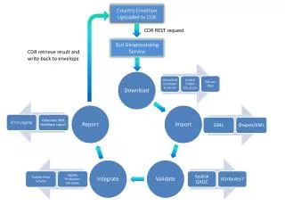
Its Purpose • Almost all uses of GIS involve repetition • The automation of geospatial tasks • Saves time • Provides documentation • Share methods • These methods are called Workflows esf Laboratory for Applied GIS
Workflows • A Workflow is a collection of Steps and data that define the paths that can be taken to complete a task. ... • So when presented with a problem with a set of criteria that must be met • You generate a workflow esf Laboratory for Applied GIS
A Problem • Task is to find tax parcels that could possibly be used for a nature center • Are at least 20 acres in size • Have both forest and Agricultural lands • Are within 6 miles of each of the town’s schools • Contain a stream or river (or be on a river bank) • Preferable the parcel should be owned by the town or the state esf Laboratory for Applied GIS
And the derived workflow is… • What tools would be used for each of the criteria? • In what order would these sub-tasks be undertaken? • Graphically… esf Laboratory for Applied GIS
Schematically Process Data Data Process Data Or by text list esf Laboratory for Applied GIS
A Problem • Task is to find tax parcels that could possibly be used for a nature center • Are at least 20 acres in size • Have both forest and Agricultural lands • Are within 6 miles of each of the town’s schools • Contain a stream or river (or be on a river bank) • Preferable the parcel should be owned by the town or the state esf Laboratory for Applied GIS