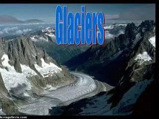
Glaciers
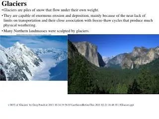
Glaciers. Dr. R. B. Schultz. Glaciers Glacier -- mass of ice formed by the recrystallization of snow under its own weight (compacted snow becomes “ firn ”). Ice and snow in layers is necessary for development.

Glaciers
E N D
Presentation Transcript
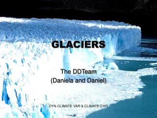
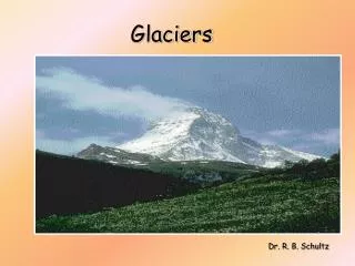
Glaciers Dr. R. B. Schultz
Glaciers Glacier -- mass of ice formed by the recrystallization of snow under its own weight (compacted snow becomes “firn”). Ice and snow in layers is necessary for development. One last requirement: more snow has to be present than melted in the previous year's worth of snowfall so that it can accumulate in layers (annual bands). Where do glaciers form? • In areas where precipitation falls as snow; snow must accumulate. • In high (polar) latitudes or at High elevations (in mountains) even at the equator Development of the Glacial Theory 1. 1829 - Swiss engineer named J. Venetz first proposed that glaciers had once been more extensive than at present. His observations inspired Jean de Charpentier to begin a field study of active glaciers. 2. 1837 - de Charpentier presented his results to the Swiss naturalist, Louis Agassiz (considered to be the "Father of Glaciation"), who developed the first comprehensive theory of glaciation. Based on Uniformitarianism concepts. We now know there were several ice ages in Earth history.
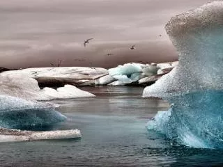
Current Glaciers on Earth Greenland Ice Sheet Antarctic Ice Sheet
Types of glaciers 1. Ice sheets (continental glaciers) -- cover large areas of land 2. Valley (alpine) glaciers -- form at mountain tops and flow down valleys How do glaciers move? Glaciers must be thick enough so that they flow downslope. Flow is by basal slip or plastic flow. Basal slip -- ice moves over a thin layer of meltwater Plastic flow -- ice deforms internally and flows like plastic Valley (Alpine) Glaciation Glacial Erosion Valley (alpine) glaciers erode material at the surface by breaking off pieces of rock and/or by abrasion of underlying rock. Landforms produced by valley (alpine) glacier erosion U-shaped valleys Horns Cirques Arêtes Hanging valleys Glacial lakes (Tarns) Groups of glacial lakes: Paternoster lakes
Important Stages of Alpine Glaciation • Unglaciated v-shaped stream valley • Glaciation Stage • a. Horn • b. Cirque • c. Arête • d. Medial moraine • 3. Post-Glaciation • a. Hanging valley • b. Pater noster lake • c. Tarn • d. Glacial trough
Continental Glaciation Glacial Deposits Drift -- general term applied to any deposit associated with glaciers Till -- sediment deposited directly from melting ice; till is unsorted and unstratified Stratified drift -- deposits from glacial meltwater streams Outwash -- another term for sediment deposited by meltwater streams These deposits are stratified and sorted. Landforms made of till Moraines -- ridges made of till that form at margins of a glacier End (or Terminal) moraine -- forms at bottom end of glacier Lateral moraine -- forms at side of glacier Ground moraine -- forms by deposition of till at the base of a glacier; not a ridge, just a lumpy plain. Medial Moraine – when two glacial valleys merge Drumlins -- streamlined hills made of till; steeper on the side from which ice came The area (south of L. Ontario) is covered by classic drumlin fields. Landforms made of stratified drift: Kames Kames -- small, steep-sided hills or mounds. Kamedeltas -- form where sediments are deposited in meltwater lake Kame terraces -- form from stratified drift deposited in meltwater streams alongside valley glaciers. Eskers are sinuous ridges made of stratified drift. The stratified drift is deposited in sub glacial meltwater streams.
Continental Glaciation Landform Features Southernmost extent of continental glacier
Pleistocene Ice Ages Pleistocene – “Ice Age” period of geologic time between ~1.7 million and 10,700 years ago. There have been numerous ice ages during the past 2 million years. During the Pleistocene ice ages, continental ice sheets covered large areas of land on the North American continent. Between the ice ages were interglacial periods, warmer periods like we are experiencing now. Climates were wetter in the early parts of ice ages. Many large lakes formed in the interior of North America Effects of Pleistocene Ice Ages -- Sea Level Changes • During ice ages, sea level fell as water was frozen in Polar Regions. • Rivers eroded down to lowered base level. • Had many canyons along coastal areas. • When sea level rose, river valleys were flooded, forming estuaries like Chesapeake Bay Ice ages occurred during the Precambrian, Paleozoic, Mesozoic and Cenozoic.
Pleistocene Glacial Stages in North America: Recent (15,000 BP) interglacial Wisconsinan (180,000 BP) Sangamon (400,000 BP) interglacial Illinoisan (550,000 BP) Yarmouth (900,000 BP) interglacial Kansan (1,400,000 BP) Aftonian (1,700,000 BP) interglacial Nebraskan (2,000,000 BP) Note: State names are glacial advances…local terms are glacial retreats. Cooling of the Earth 1. Evidence of a decrease in global temperatures of about 8oC during the Cenozoic. 2. Mountain building/tectonics. Rising landmasses acted as wind/moisture barriers. 3. Volcanic dust as a reflector: evidence is weak 4. Decrease in solar radiation: evidence weak despite small variations such as the Little Ice Age between 1450 and 1850. 5. Latitudinal changes in continents: plate tectonics
Cyclic fluctuations in climate 1. Microplankton and 18O (oxygen isotope) record of foraminifer (microfossil) skeletons record temperatures change and thus changes in the ice mass. The data correlate with benthic foram data. 2. A total of 18 glacial expansions during the Pleistocene is known, with a periodicity of +/-100,000 yr. There are cycles that have been recognized: “Milankovitch Cycles” (named after Russian scientist, Milutin Milankovitch, who discovered it): a. 92,500 yr cycle of orbit change from circular to elliptical = deep sea 18O (oxygen isotope) data b.Precession of the equinoxes due to gravitational attraction by the sun and the moon = wobble in the Earth's spin axis = 22,000 yr c. Periodic change in the tilt of the Earths rotational axis from 21.8o to 24.4o over a cycle of 40,000 yr. 4. Ultimate cause is probably a combination of plate tectonics and Milankovitch cycles. Recently, other workers (based on periodic cycles in the rock record) have discovered more cycles.
Milankovitch' s Orbital Theory • Orbital eccentricities • Axis tilt • Precession (wobble)
Key Terminology Glacier Firn Louis Agassiz Ice sheet Continental glaciation Valley glacier Alpine glacier Basal slip Plastic flow U-shaped valley Horn Cirque Arête Hanging valley Tarn Pater noster lake Medial moraine Glacial trough Drift Till Outwash Drumlin Kame Esker Kettle lake Pleistocene Epoch Interglacial stage Milankovitch cycles Precession Axis tilt Orbital eccentricities Milutin Milankovitch
Pertinent Web Sites Arctic Research Consortium The Arctic Research Consortium of the United States (ARCUS) was formed in 1988 to identify and bring together the distributed human and facilities resources of the Arctic research community—to create a synergy for the Arctic in which each resource, when combined with others, can result in a strength that enables the community to rise to the many challenges facing the Arctic and the United States. Ask a Geologist If you have questions, a professional geologist is here to help. Alpine Glacial Landforms This site presents basic definitions and examples of common alpine glacial landforms discussed in introductory level university physical geography, geology and earth science courses. Examples are provided as photographs with accompanying topographic maps. Alpine Glaciation Features Photographs and explanations of features of alpine glaciation. Arctic Theme Page (NOAA) NOAA's Arctic Theme Page provides access to widely distributed Arctic data and information for scientists, students, teachers, academia, managers, decision makers and the general public. Extinctions, Inc. Fossils from the Extinctions Fossil Company, a commercial source. Glacial Links Several links to Web sites containing glacial information. Glacial Geology, Journal of Glacial Geology and Geomorphology is an electronic journal of The British Geomorphological Research Group (BGRG) developed by The Queen's University of Belfast and published by The BGRG. It is a refereed journal with a variety of facilities available to subscribers. Glacial Geology Photo Gallery Glacial geology images from the Maine Department of Conservation. Glacial Landforms Text and images about how glaciers shape the land from the Geological Survey of Canada.
GLACIER (Rice University) GLACIER is a Web site all about Antarctica and the part Antarctica plays in our global system of weather and climate and oceans and geology. The site is intended to introduce you to the Antarctic and the brave souls who are investigating that vast, frozen continent. Glacier Bay (NASA) An excellent NASA site featuring a multi-media tour of Glacier Bay, Alaska. Glacier National Park—A Virtual Field Trip This Web site addresses various aspects of alpine glacial landscape interpretation, including landform identification, geomorphic processes, and glacial history. Glacier National Park, Montana, USA, provides the backdrop for this virtual field trip. Glaciers and Climate Change Links (NAGT) An extensive listing of glacier and climate change links arranged by topic from the National Association of Geology Teachers (NAGT). Glaciers and Ice Ages Links (Houghton Mifflin) Links to several glacier and Ice Ages sites, including class lecture notes, arranged by topic. Glaciers Links This Central Michigan University site maintained by Dr. Mark Francek lists several good links to websites containing information relative to topics discussed in the chapter. Glaciers: Satellite Images The United States Geological survey (USGS) satellite image atlas of glaciers of the world. Ice Age Atlas An atlas of the Ice Age Earth. Ice Age Exhibit The Ice Age Exhibit from the Illinois State Museum is an excellent source for Ice Age information.
Ice Age—National Scenic Trail, Wisconsin A good introduction to Wisconsin's glacial landscape. Institute For Ice Age Studies The home page of The Institute for Ice Age Studies (IIAS), an anthropolgy site specializing in the Ice Age. Landform Atlas of the United States The color landform atlas of the United States includes shaded relief maps and satellite image maps of each state. Mendenhall Glacier—A Virtual Tour Midwestern U.S. 16,000 Years Ago An exhibit from the Illinois State Museum featuring the midwestern United States 16,000 years ago. National Geophysical Data Center The National Geophysical Data Center (NGDC) manages environmental data in the fields of marine geology and geophysics, paleoclimatology, solar-terrestrial physics, solid earth geophysics, and glaciology (snow and ice). National Parks: Alaska Links to national parks, national monuments, etc. National Parks: Washington Links to national parks, national monuments, etc. National Snow and Ice Data Center (NSIDC) The National Snow and Ice Data Center (NSIDC) is a data and information resource for those studying snow and ice, and their importance to the Earth system. Paleoclimatology Program (NOAA) Access to a wealth of paleoclimatic data from the National Oceanic and Atmospheric Administration (NOAA).