Download
1 / 28
310 likes | 969 Views
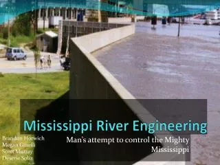
Mississippi River Engineering. Man’s attempt to control the Mighty Mississippi. Brandon Horwich Megan Ginelli Scott Murray Deserie Soliz. Quantifying the flood effects of river engineering on the Mississippi River system.

E N D
Mississippi River Engineering Man’s attempt to control the Mighty Mississippi Brandon Horwich Megan Ginelli Scott Murray DeserieSoliz
Quantifying the flood effects of river engineering on the Mississippi River system Have human activities caused, or worsened, large floods worldwide in recent years?
Models were used to quantify changes in flood levels at specific stations along the Mississippi and Missouri Rivers in response to construction of: • wing dikes • bendway weirs • meander cutoffs • navigational dams • bridges • other modifications.
Maximum annual stages respond to all climate- and land-use-driven changes in flow plusinstream conveyance changes. The good correlation in Figure (b) and the poor correlation in Figure (a) suggests that the instream changes had a greater effect upon net flood magnitudes over time on this river system.
Wing Dikes • Wing dikes constructed downstream of a location were associated with increases in stage, consistent with backwater effects upstream of these structures. • Stages increased 10.8 +/- 0.6 cm for each 1000 meters of wing dike built within 20 river miles downstream.
Levees Each 1% increase in leveed area downstream was associated with a 2.2 +/- 0.2 cm increase in stages. However, on other river reaches, the levees resulted in local decreases as well as increases in stage.
Case study conclusions • Discharge records from 66 stations on the Mississippi River system confirm a pattern of increasing flows. • Significant trends only detected on the upper Mississippi River • Total change in flood levels correlate strongly with instream river modifications (e.g. dikes and levees).
Floodplain Geomorphic Processes Human alteration along coastal plain rivers
Causes of increases erosion • Decreased sediment loads that enhance entrainment of banks and beds • Decrease amount of sediment delivered and stored on or near banks • Consistent wetting of lower bank due to diurnal flow fluctuation, due to energy generation. (this also promotes greater erodability • Channel degradation which allows for flow impingement low on the banks, removes stabilizing materials
Effects of channelization, channel incision and valley aggradations in West Tennessee
Case Study: The 1993 Flood Report of the Interagency Floodplain Management Review Committee To the Administration Floodplain Management Task Force
The Big One • 100 year flood • Surpassed all previous floods in US history • Record precipitation, flood stages, flood duration, area of flooding, economic losses • 500 yr floodLargest flood since 1543 • Flood observed during the DeSoto expedition
Factors • Extensive rains • Storm systems moving south, at roughly the same speed as flow • Early flood storms in north basin • Late flood storms south in basin • Heavy summer rains, saturated soils • Estimated SWHC 10in across floodplain • Summer rains exceeded 15in • Irrigated croplands
Influences of Levees • Upper Mississippi River • Levees limited destruction in large urban areas i.e. St. Louis • Estimated levees raised flood stage 2.4ft • Still 17ft above flood stage • Assuming floodplain SWHC was not saturated • Middle Mississippi River • 11ft lower if levees absent
SAST Conclusions • Levees or Reservoir Dams did not cause the 1993 flood. During large events such as occurred in 1993. levees have minor overall effects on floodstage, but may have significant localized effects • There are locations where levees should not be built. In many cases set-back levees might allow normal river functions while providing flood control. • Loss of wetlands significantly decreases floodplain water holing capacity, which results in higher flood stages downstream
Flood-control levees influence on the flood regime • When the levees are removed, the area that could be flooded increases. • Flood heights were increased on order of centimeters due to levees. • When looking at 100-yr flood, both shear stress and unit stream power was nonexistent outside of levees due to lack of flow. • Power inside the levees was lower than in completely unleveed areas. Levees, Floods and Floodplain Forests. Gergel et al. December 2002
Management implication for large-floodplain rivers • Some suggestions for levees is to have a system of setback levees that can maintain “natural” floodplain vegetation composition while also allowing some flood control. • Take advantage of the natural geomorphic processes within the area which will help rejuvenate the area. • A catchment-based approach could be used to preserve the dynamics of a geomorphologically active system Levees, Floods and Floodplain Forests. Gergel et al. December 2002
References • Executive Office of the President Interagency Floodplain Management Review Committee. 1994. Sharing the Challenge: Floodplain Management into the 21st Century. < http://eros.usgs.gov/sast/2P-00526.PDF> • Freeman, Gary E., S.K. Nanda, Maurice J. Mausback, Ronald E. Erickson, John A. Kelmelis, Byron D. Stone, William H. Kirby, James R. Reel. 1994. The Scientific Assessment and Strategy Team Contributions Assessing the 1993 Flood on the Mississippi and Missouri River Basins. Water International. Vol 19 pp. 177-185. • Gergel, Sarah E., Mark Dixon, Monica G. Turner. 2002. Consequences of Human-Altered Floods: Levees, Floods, and Floodplain Forests along the Wisconsin River. Ecological Applications. vol 12:6 1755-1770. • Hupp. Cliff R., Aaron R. Pierce, Gregory B. Noe. 2009. Floodplain Geomorphic Processes and Environmental Impacts of Human Alteration along Coastal Plain Rivers, USA. Wetlands. Vol 29 no 2 pp. 413-429. • Pinter, Nicholas, Abebe A. Jemberie, Jonathan W. F. Remo, Reuben A. Heine, Brian S. Ickes. 2008. Flood Trends and River Engineering on the Mississippi River System. Geophysical Research Letters. Vol 35. L23404.