Download

1 / 29
310 likes | 654 Views
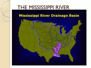
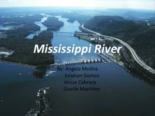
Mississippi River. Names. Great One Father of Waters Derived from the Ojibwe word misi-ziibi ("Great River") or gichi-ziibi ("Big River") at its headwaters. Importance. 2,350 miles from Minnesota to the Gulf of Mexico Transports a half-billion tons of sediment each year.

E N D
Names Great One Father of Waters Derived from the Ojibwe word misi-ziibi ("Great River") or gichi-ziibi ("Big River") at its headwaters.
Importance 2,350 miles from Minnesota to the Gulf of Mexico Transports a half-billion tons of sediment each year. Food and water Fertile land: provides alluvial soil which is deposited by a river on its banks, beds, and mouth Jobs Money Transportation Makes new land
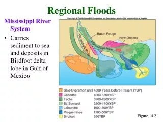
Course of the Mississippi River changes courses every 1000-1500 years occurs because the deposits of silt and sediment begin to clog river’s channel River takes the shortest route to the Gulf of Mexico
Mississippi River Delta area of land built up by alluvium deposited by the Mississippi River as it slows down and enters the Gulf of Mexico. Alluvium: fertile soil deposited by a river along banks, beds, and mouth
Location of Deltas 6200-7250 years ago: Maringouin 3900-5700 years ago: Teche 1800-4600 years ago: St. Bernard 400-3500 years ago: Lafourche Today: Plaquemines Future: Atchafalaya?
Future of Miss. River Delta In the last 100 years, the river has been diverting more of its flow to the Atchafalaya River which branches off some 60 miles northwest of New Orleans. In the mid-20th century, engineers observed the Mississippi was trying to change courses to the Atchafalaya Basin.
**Do NOT copy… for discussion onlyThe Great Flood: 1927 • Spring 1927 • Heavy rains, melting snow filled the Mississippi River with rushing water • Breaks in levees> sent water roaring all over the land • Carried roofs of houses, dead cows, snake filled tree branches and almost anything else • More than 70 levee breaks sent flood water over 16 million acres of land • 200 or more killed 700,000 homeless
Saving the City • The worst natural disaster in the nation’s history • Left one million homeless • Floodwaters covered the entire lower Mississippi Valley for several months • Dynamite was used to blow up the levee at Poydras (in St. Bernard)to relieve pressure on the New Orleans’ levee system, which made it worse. • ·Plaquemines and St. Bernard were flooded
Modern Levee System Flood led Congress to pass the Mississippi Valley Flood Control Act: a massive levee system that was designed to prevent such disasters from ever happening again. Provided more than $300 million for flood control
River Control Systems River Control System Activity
Old River Control Structure ·1960’s: This huge dam was built at the head of the Atchafalaya River ·Allows ¼ of the Mississippi’s water and all of the Red River’s water to flow into the Atchafalaya. ·Keeps the Miss. from changing course down the Atchafalaya
Bonnet Carré • Constructed upstream from New Orleans on river’s east bank • During floods, ¼ of the Miss. can be diverted through spillway into Lake Ponchartrain • Relieves pressure from New Orleans’ levee system
Morganza Spillway • Located on the west bank of the Miss. River upstream from Baton Rouge • During floods, protects the levee system by diverting water out of the Miss. River into the Atchafalaya Basin.
Coastal Erosion • Erosion: gradual wearing away of the land by the action of wind or water • Louisiana> 25 to 35 sq. miles a year lost (two football fields disappears every hour); • Hurricane Katrina destroyed 64,000 acres in one day
Reasons for Coastal Erosion • Flood Control: Levees, locks, dams, and floodgates prevent the river from overflowing its banks to rebuild the land • Global warming is also impacting our coastal marshes • Salt water intrusion: Oil pipelines and canals • Hurricanes
How to prevent Coastal Erosion? • Stricter regulations on the use of the wetlands • Restoration projects: marsh grass seedlings planted and annual beach sweep • Sand is pumped onto barrier islands to keep them from eroding away • Diversion Projects: diverts sediment from Mississippi River through the levees