Download
1 / 19
190 likes | 233 Views
This presentation deals with the various growth of ports and the fundamentals of the port

E N D
COASTAL AND OFFSHORE STRUCTURES – CEE 02 UNIT – I Growth of Ports History of Port – Classification of Harbours - Factors affecting the growth of Port. Requirement of a Harbour - General Planning - Site investigation. Description of selected Indian ports. UNIT – II Harbour Planning (Technical): Harbour entrance - Navigational Channel – Depth of harbour – Turning basin – berthing area – Shipping terminal facilities – Essentials of passenger terminal, dry bulk cargo terminal, Liquid bulk cargo terminals and container terminals. Navigational aids – Light house. UNIT – III Harbour Structures Break waters: Types – Selection – Forces and – Design principles of break waters. Berthing structures: Types – Loads – Selection and design principles of berthing structures –Selection and Design principles of Dock fenders and Mooring accessories. Types of dock structures, Dredging. UNIT – IV Offshore Structure Types of offshore structures – selection – function - Physical, environmental and geotechnical aspects of marine and offshore construction – Loads and responses of offshore structures. UNIT – V Construction of Offshore Structures Foundations for offshore structures – Introduction to design and installation of offshore piled platforms, concrete offshore platforms, Moored floating structures and Submarine pipelines
UNIT -1 GROWTH OF PORTS History of Port – Classification of Harbours - Factors affecting the growth of Port. Requirement of a Harbour - General Planning - Site investigation. Description of selected Indian ports. PORTS Port is defined as the place situated at the shore of the sea which connects land with the water body. They work as junction points for trading internationally, as in the exchange of modes of transport, goods, etc. Ports provide a number of facilities that help ships to handle cargo, which includes cranes and forklifts to load or discharge goods, warehouses for storage and docks for ships to attach to. Moreover, various amenities are also available at the port like hotels, restaurants, shipbuilding and repair companies, customs facilities, etc. Right from economy to strategy, ports have a great role to play in every country, as they are used for shipping out consumer goods and also to load troop ship for sailing to war. Port is nothing but a place for docking, traffic and storage HARBOUR Harbour is defined as a parking or storage space along the coastline, where boats, barges and ships can take shelter from bad weather or are kept for future. It is the area alongside the coast, which consists of a thick wall providing protection from the waves and currents to the ships, vessels, and cargo container loaders. A harbour is a place for storing boats.
Harbours are used for taking safe anchorage, if the weather is not fit for sailing. Harbours may or may not have onshore facilities. Difference between Port and harbour Basis for Sl.No. PORT HARBOUR Comparison 1 Meaning Port referes to an arrangement Harbour referes to an area next where boats and ships moor to the shore, where water crafts and transfer passengers and are anchored for getting safety cargo to and from land from stormy weather 2 What is it? It is a place for docking, traffic It is a place for storing boats and storage of boats 3 Construction Man Made Natural or man made 4 Used for Trading of goods and cargo Seeking shelter from bad between countries weather 5 Vessels It is a safe place for vessels It is a haven for vessels 6 Onshore Available May or may not be avai;lable facilities Harbour Components 1. Entrance Channel Water area from which ships enter in the harbour and it should have sufficient width , 100 m for small harbour, 100 to 160 m for medium and 160 m to 260 m for large harbours. 2. Break Water A protective barrier made up of concrete or course rubble masonry constructed from shore towards the sea to enclose the harbour
3. Turning Basin It is water areas which is required for maneuvering the ship after entering to the harbour and it is large enough to permit free turning 4. Shelter Basin It is are protected by shore and break water 5. Pier It is a solid platform at which berthing of ships on both the sides are possible 6. Wharf It is a docking platform constructed parallel to the shore which is solid structure providing berthing facility on one side only 7. Quay It ia also dock parallel to the shore which is solid structure providing berthing on oe side and retaining the earth on the other. 8. Dry Dock It is a chamber provided for maintenance, repairs and construction of ships. It includes walls, floor and gate Classification of harbours (A) Protection needed (B) Depending upon utility (C) Based on location (A) Classification of harbours based on protection needed (i) Natural Harbour (ii) Semi natural Harbour (iii) Artificial Harbour
(i) Natural Harbour Natural harbour is an inlet protected from storms and waves by natural configuration of land. The size and draft of present day vessels have necessitated the works of extension and improvement for natural harbours The factors such as local geographical features, growth of population, area etc., have made the natural harbour big and attractive. (ii) Semi-natural Harbour Protected on sides by headlands and requires man-made protection only at the entrance. Eg: Vishakapatanam
(iii) Artificial Harbours Or Artificial Roadsteads No natural facilities are available for the harbour It is an area protected from the effect of waves either by break water or by dredging These may be created suitably by constructing a breakwater or wall parallel to the coast or curvilinear from the coast A turning basin which is water space for moving the ships after they enter the harbour for going to or leaving a berth is also provided. It should be large enough tp permit free turning. (B) Classification depending upon utility (i) Harbour of Refuge (ii) Commercial harbour (ii) Fishery Harbour (iv) Military Harbour (v) Marine Harbour
(i) Harbour of Refuge On dangerous coast lines disabled or damaged ships under stress of weather conditions will need quick shelter and immediate repairs. In such situations these harbours are used (ii) Commercial harbour Commercial harbours could be situated on coasts or estuaries of big rivers or even on inland river coasts. (iii) Fishery Harbour These harbours are constantly open for departure and arrival of ships which houses loading , unloading facilities along with refrigeration storage stores. (iv) Military Harbours These are meant to accommodate the naval vessels (v) Marina Harbours Harbours providing facilities of fuel, food, washing machines, showers, telephone etc., for small boat owners having temporary or permanent berths. (C) Classification of harbours based upon the location (i) Canal Harbour (ii) Lake Harbour (iii) River or Estuary Harbour (iv) Sea or Ocean Harbour (i) Canal Harbour Harbours located along the canal for sea navigations and inland is known as canal harbour (ii) Lake Harbour The harbour constructed along the close of lake is known as lake harbour (iii) River or Estuary Harbour The harbour constructed along the banks of river is known as river or estuary harbour (iv) Sea or Ocean Harbour The harbour located on coast of sea or ocean is known as sea or ocean harbour
Requirements of a good harbour Following are the requirements of a good harbor i. The ship channels whether natural or artificial should have sufficient depth for the draft of the visiting vessels to the harbor. ii. The bottom of the harbour should provide secured anchorage to hold the ships against the force of high winds iii. To protect against the destructive wave action, the land masses or breakwater must be provided. iv. The entrance of the harbour should be wide enough to provide the ready passage for shipping and at the same time it should be narrow enough to restrict the transmission of excessive amounts of wave energy in time of storms. v. Facilities of obtaining repairs and supplies vi. Safe and convenient anchorage against the sea. vii. Storage sheds for cargo to avoid delay, god and quick repair facilities viii. Ample quay space that is ample space for unloading and loading cargo and facilities for transporting loading and unloading cargo. ix. The harbour should be constantly open for arrival and departure of fishing ships x. Refrigerator stores with sufficient storing space for preserving the fish Planning of harbours The following important facts need to be studied Site selection: 1.The guiding factors which play a great role in choice of site for a harbour are as follows Availability of cheap land and construction materials 2.Transport and communication facilities 3.Natural protection from winds and waves 4.Industrial development of the locality 5.Sea-bed subsoil and foundation conditions 6.Traffic potentiality of harbour
7.Availability of electrical energy and fresh water 8.Favorable marine conditions 9.Defence and strategic aspects 10.Traffic potentiality of harbour Topographical Study 1.To carry out a thorough survey of the neighbourhood including the fore shore and depths of water in the vicinity is necessary. 2.To obtain ground contours at intervals of 0.5 to 1.5 m 3.To know the probable surface conditions on land, borings on land should also be made. It will be helpful in locating the harbour works correctly 4.To ascertain the character of the ground, borings and surroundings should be taken Hydrographical Study 1.To determine the depth of water 2.The depth is obtained by use of Fathometer or echo sounder. 3.The soundings are taken at 7.5m intervals along the range lines 15m to 30 m apart depending upon the nature of the bed. 4.The problem of silting or erosion of coast line should be studied carefully Shape of the harbour 1.Size and number of ships to be accommodated in the harbour at a time. 2.Length and width needed for movement of ships to and from berths 3.Study on the type of cargo carried to make the harbour useful for operating and dispatching ships. 4.Study on the various positioning of various elements is very important that is location of entrance, turning basin, breakwater, wharves etc., General Considerations 1.The nature of the harbour, whether sheltered or not should be studied 2.The existence of sea insects which undermine the foundation should be studied 3.The natural metrological conditions should be studied at site with respect to frequency of storms, rainfall, range of tides, maximum and minimum
temperatures, directions and intensity of winds, humidity, direction and velocity of currents etc., Site Investigation to be carried out during harbour planning The information required for site investigation is grouped under the following headings: 1.Survey 2.Metrological data 3.Oceanographic data 4.Geological data 5.Soil Investigation 6.Seismic Data 7.Local Resources 1. SURVEY Topographical survey of sufficient area covered by the project is the first requirement and should be obtained at the earliest survey maps of scale 1: 50,000 and contour interval of 20 m are required for general planning. Hydrographic survey charts for the coastal region extending to depth of 200 m is required. These charts required for detailed planning to be drawn as large as possible. Data to be collected should cover the following (i) Wind, (ii) Cyclone, (iii) Rainfall, (iv) Humidity, (v) Temperature, (vi) Pressure (i) Wind Recording of velocity and direction of wind at the proposed site can be obtained by installing and recording the anemometers. From the data collected wind rose should be prepared for each month. (ii) Cyclone A design cyclone is adopted and waves at a place is computed.
(iii) Rainfall Data on rainfall available should be collected from Indian metrological department for a minimum period of 3 years. (iv) Humidity Data on the minimum mean and minimum humidity for every month shall be btained for a period of 5 years. (v) Temperature The temperatures on daily and seasonal variation to be noted (vi) Pressure Data on the average pressure for the project site to be obtained from Indian metrological Department (IMD) 2. OCEANOGRAPHIC DATA (i) Tides, (ii) Waves, (iii) Storm, (iv) Currents, (v) Salinity, (vi) Sea water temperature, (vii) Suspended load, (viii) Sea Bed. (i) Tides Record of tidal information and any local information specific to the site should be obtained from the port authorities (ii) Waves Wave data collected by ships moving in the area can be obtained from IMD. (iii) Storm Storms are calculated from tidal gauges (iv) Currents Current pattern at the specific location to be evaluated for atleast 1 year (v) Salinity It will be measured using direct meters (vi) Sea water temperature These are measured during site investigation
(vii) Suspended Load It is measured below the water level at every hour or during the tidal cycle. (viii) Sea Bed Studies done where the depth of water is 12m more than the designed depth. 3. GEOLOGICAL DATA It includes the study of the type of bed rock, faults, folds and their crushing properties 4. SOIL INVESTIGATION This study helps the numbers and location of trial pits and boring. The sub soil investigation should be carried out as per IS 1892- 1962. 5. SEISMIC DATA Past data regarding the seismic activity in the study area need to be collected 6. LOCAL RESOURCES It includes materials and man power resources. Materials such as brick, stone and the presence of quarries data need to be collected. Man power includes skilled and unskilled labour. FACTORS AFFECTING GROWTH OF PORTS 1. Population Growth and Industrialization 2. Growth in Petroleum Industry 3. Specialized Terminals 4. Port Operations 5. Port Management 6. Advances in Design and Construction Techniques 1. POPULATION GROWTH AND INDUSTRIALISATION (a) Demands: There has been an increase in population all over the world. India is the home for 16% of the world‟s population estimated at about 4000 million.
The increase in population over the decades from 1961 to 1991 is roughly 2.5% per annum though a slight decrease has occurred in the last and present decade. The population crossed 1000 million in the first decade of the 21st century. Agricultural and industrial production has increased to meet the demands of the population. Exports have increased to balance at least a major portion of the import costs. (b) Exports: Exports have been increasing at the average rate of 20% annually. The main exported commodities are agricultural products (7MT), iron ore (27MT) along with other items such as textiles, fishery products, leather etc. 2.GROWTH IN PETROLEUM INDUSTRY Crude petroleum production has increased steadily over the year and in 1979, the sea borne oil trade was about 1538 MT India imported 69 MT in 1991-92 and it may increase to 90MT by the turn of the century. By-products of petroleum industry such as plastics, synthetic fibres, synthetic rubber, paints etc have become essential commodities in everyday life. 3. SPECIALISED TERMINALS: Large bulk carriers have been found to be economical especially over long haul distances and they now cater to special dry bulk cargo like mineral ores, coal, fertilizer, food grains, cement. These require longer berths with deeper drafts and also require special handling equipment and large storage areas. Maximum utilization of these large container vessels with minimum operating costs can be achieved by proper planning of port facilities, such as special
handling equipment, storage spaces and optimized container movement from the ship to the delivery point. These new concepts in cargo shipping and its landside movement have brought in modernization of ports, expansion of port activities, establishment of new berths and terminals, in addition to changes in port organization and management as a whole. 4. ADVANCES IN HARBOUR ENGG. & PORT OPERATIONS There have been rapid technological advances in water transport system such as modern concepts in harbour and port planning. There are special ships built for container and dry bulk cargo etc So large ships required large draught but move at greater speeds cutting down the travel time at berth per tonne of cargo loaded or unloaded. Allotment of special terminals for different types of cargo has also avoided congestion. Ship cost and demurrage are minimized. As technology improves, one must not only keep abreast of time but also plan for future to keep port management dynamic. 5. PORT MANAGEMENT It is indeed whether ports should be managed by organizations controlled directly by or indirectly by national Govt. Large scale investment required for establishment of a new port or modernization of an existing port. In most countries public sector seems to control the viable solution and has a distinct disadvantage of technical delays, lack of time, besides loss of revenue. Port cost is comparatively less in a port privately owned or managed. The port costs may be high as 40% to 50% of the landed value of goods in a nationally owned port
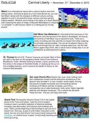
Port facilities such as a jetty or wharf are leased or auctioned to private users, keeping the overall management under a central organization. 6. ADVANCES IN DESIGN & CONSTRUCTION TECHNIQUES: Scientific and technological advances in several areas of harbour engineering have also been responsible for greater confidence in the design and construction of harbour. Some of them are: Greater understanding of wave mechanics, determination of transformation of waves near shore etc Movement of sediment under the action of waves, tides, littoral drift, beach process. Design & construction of breakwater, piled jetties, dolphins and diaphragm walls. Corrosion protection Dredging - equipment and methodology etc. Important Seaports In India Kandla port, Gujarat – The Bustling One Nhava Sheva, Maharashtra – The King Port Mumbai Port, Maharashtra – Largest Indian Sea Port Visakhapatnam Port, Andhra Pradesh – Port With A History Marmagao Port, Goa – Witness Serenity New Mangalore Port, Karnataka – At The North Of Gurpur Chennai Port, Tamil Nadu – Third Oldest In Country Cochin Port, Kerala – One Of The Largest Haldia Port, Kolkata – Biggest In The State Port Blair Port, Andaman And Nicobar Islands – The 13th Best In India Tuticorin Port, Tamil Nadu – Built On Artificial Sea Paradip, Orissa – Famous In The East
Ennore Port, Chennai – One Of The Most Easily Accessible Vizag Port, Visakhapatnam – Counted Amongst The Oldest Kandla Port, Gujarat The busiest and the richest Sea Port in India, Kandla port is situated90 kms from the Gulf of Kutch, Gujarat in a place called the Kandla creek. It was constructed in the 1950s after the India Pakistan partition at the loss of Port of Karachi. It is the largest port in India according to how much of cargo is handled. Kandla port is the first Export processing port in India. The significant imports that enter Kandla port are Petroleum, Steel and iron machinery, chemicals and also salt, textiles and grains. Mumbai Port, Maharashtra – Largest Indian Sea Port The availability of the 10-12 mtr sea surrounding the port does make it a lot easier for the ships to enter the port with ease. It is believed that this port is responsible for taking care of around 1/5th of India’s total foreign exports. It is mainly responsible for handling trade along with the western countries along with the east African countries. The port is undergoing development as the demands arise. Some of the common goods that are transported via this port include dry cargo and mineral oil from the Gulf countries. Visakhapatnam Port, Andhra Pradesh Located in East of India in Andhra Pradesh between Chennai and Kolkata port, the Visakhapatnam port is situated in a beautiful creek. It is one of the significant 12 seaports in India. It is India's second largest port by volume of cargo handled. It is located on the east coast of India and is located midway between the Chennai and Kolkata Ports
Visakhapatnam Port has three harbours - the outer harbour, inner harbour and the fishing harbour. The outer harbour has 6 berths capable of handling vessels with a draft up to 17 meters while the smaller inner harbour has 18 berths Inner Harbour 100 Hectares with 18 berths Outer Harbour 200 Hectares with 6 Berths This port handles around 1.2 lakh tonnes of cargo every year. The Visakhapatnam port has three principal harbours: the outer dock, the inner harbour and the fishing harbour. Chennai Port (Second Largest Sea Port in India) The Chennai port, also known as the Madras port is the second-largest port in the whole of India. It is the third oldest port in India. It lies on the Coromandel Coast in the Bay of Bengal and is Tamilnadu's principal port and is the primary reason for its stability. Chennai port area is divided into north, central and south zones and fishing harbours The berths can handle containers as well as liquid and dry bulk and breakbulk cargoes. The approach channel to the port is 6,700 m long, and the turning basin is 560 m in length A total of 9 well-lit channels marks buoys for the approach channel. The total area of Chennai Port is divided into Inner Harbour Area and Outer Harbour Area. The water Spread area is 220 acres and Land area is 458.01 acres in the Inner Harbour and 200 acres and 247.13 acres respectively in the Outer Harbour. Chennai Port has 24 berths located in three docks and draft varying between 7.50 and 18.50 metres.
The port handles a variety of cargo including iron ore, coal, granite, fertilisers, petroleum products, containers, automobiles and several other types of general cargo items. The port has a current depth of 17 m (56 ft) and is capable of handling fourth- generation vessels Tuticorin Port, Tamil Nadu Tuticorin Port is a new port that was recently constructed in Tamil Nadu and is one of the 13 major ports of India. It is an artificial harbour developed 8kms south of the old Tuticorin port. V. O. Chidambaranar Port Trust in Thoothukudi is located strategically close to the East-West International sea route on Coromandel Coast Artificial deep sea harbour formed with rubble mound type parallel break waters projecting into the sea for about 4 Kms. The port mainly trades with Sri Lanka and is correctly connected by railways and roads. It is also the second-largest port in Tamil Nadu. It is best for pearl fishery in the Bay of Bengal and is also known as the pearl city. It mainly deals with trade of coal, salt, food grains, edible oil, sugar, and petroleum products. Shortly, its depth is to be increased to 12.8 metres from the current 10.7 metres and also to build an outer harbour. The harbour basin extends to about 400 hectares of protected water area and is served by an approach channel of 2400 metres length and 183 metres width. The inner harbour consist of 14 berths At present in outer harbour there are 14 berths with capacity of 33.34 million tonnes per annum (MTPA), all situated within two breakwaters
Cochin Port, Kochi (Kerala) A major port on the Arabian Sea, the Cochin port is one of the largest seaports in India and also the fastest-growing one situated in Kerala. The Cochin port lies in between two islands, namely Willingdon and Vallarpadam. Its export mainly consists of tea, coffee and spices while its exports consist of mineral oil and chemical fertilisers. It is also a centre for shipbuilding. In this port, the imports always exceed exports.