Download
1 / 31
310 likes | 436 Views
SATELLITE - DERIVED INFORMATION ON SNOW COVER FOR ENVIRONMENTAL APPLICATIONS Peter Romanov Cooperative Institute for Climate Studies, University of Maryland Center for Satellite Applications and Research, NOAA/NESDIS. Advanced Research Workshop, Kiev, June 9-12, 2009. OVERVIEW.

E N D
SATELLITE - DERIVED INFORMATION ON SNOW COVER FOR ENVIRONMENTAL APPLICATIONS Peter Romanov Cooperative Institute for Climate Studies, University of Maryland Center for Satellite Applications and Research, NOAA/NESDIS Advanced Research Workshop, Kiev, June 9-12, 2009
OVERVIEW • Needs for snow data • Snow remote sensing techniques • Snow products • Examples of application of snow products Advanced Research Workshop, Kiev, June 9-12, 2009
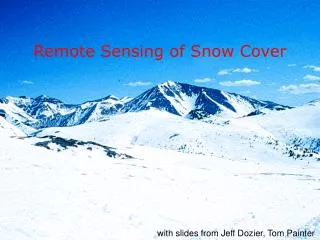
Snow cover: Facts • Seasonal and perennial • Affects • Land surface albedo • Land-atmosphere energy exchange • Hydrological balance • Wildlife • Seasonal snow extent • NH: over 40 mln km2 (70% of the land area) • 100% boreal zone • SH: about 1mln km2, (mostly South America) Surface melt on the Greenland ice sheet Advanced Research Workshop, Kiev, June 9-12, 2009
GUATEMALA CITY (Reuters) - President Vladimir Putin promised rich natural snow (….) as he presented the case on Wednesday for Russia's Black Sea resort of Sochi to stage the 2014 Winter Olympics . • Politics (?) SNOW COVER: APPLICATIONS • NOAA • Numerical weather prediction • Climate studies (modeling, monitoring) • Hydrology • Outside NOAA • Transportation • Hydro-power generation • Water management • Agriculture • Wildlife • Recreation • Other Advanced Research Workshop, Kiev, June 9-12, 2009
SNOW COVER: NOAA MODEL NEEDS • Continental to global scale coverage • Continuous coverage (no gaps) • Daily update • Spatial resolution higher than model grid cell • - NWP: < 8 km (ideally 1 km) Surface observations are insufficient to satisfy the needs Satellite data should be used Advanced Research Workshop, Kiev, June 9-12, 2009
NESDIS* MISSION • NESDIS tasks with respect to snow monitoring: • Develop techniques to monitor snow from satellites • Provide operational data on snow cover for users (NWP et al.) • Evaluate the accuracy of derived products • Establish long-term snow datasets for climate applications * NESDIS: National Environmental Satellite, Data, and Information Service Advanced Research Workshop, Kiev, June 9-12, 2009
SATELLITE SNOW MONITORING TECHNIQUES • Interactive • Visible imagery • Automated • Microwave • Visible/middle-infrared/infrared • Combined Vis/IR and Microwave All these techniques are actively used at NESDIS Snow products are generated daily and provide continental to global coverage Advanced Research Workshop, Kiev, June 9-12, 2009
NOAA INTERACTIVE MULTISENSOR SNOW AND ICE MAPPING SYSTEM (IMS) 35+ years of hand-drawn snow and ice maps for Northern Hemisphere • Interactive analysis • Visible imagery from satellites • Gradual improvement of temporal and • spatial resolution: • - 1972-1999: weekly at 180 km • - 1999-2004: daily at 24 km • - 2004-current: daily at 4 km Advanced Research Workshop, Kiev, June 9-12, 2009
IMS SNOW MAP: 4 KM SINCE 2004 Higher spatial resolution allows for better reproduction of snow cover distribution in the mountains 24 km resolution (old) 4 km resolution (new) Advanced Research Workshop, Kiev, June 9-12, 2009
WHY AUTOMATED SNOW MAPPING? • Reduces human workload • Provides objective assessment, consistency in time and space • Allows to objectively reprocess historical data • Maximize the use of instrument/satellite capabilities • - Temporal and spatial resolution, spectral coverage • Other snow properties besides snow extent can be estimated Advanced Research Workshop, Kiev, June 9-12, 2009
SNOW DETECTION IN VIS/IR: BASICS Primary spectral feature used to identify snow: Difference or ratio of snow reflectance in the visible (0.6 µm) and in the shortwave infrared (1.6µm) Advanced Research Workshop, Kiev, June 9-12, 2009
AUTOMATED SNOW MAPPING IN VIS/IR - High spatial resolution (5 km and better) - Snow detection accuracy of 92% - 97% • Discontinuity in the area coverage due to clouds • ~40% of the area in mid-latitudes is cloud-covered at a given time • Requires daylight Advanced Research Workshop, Kiev, June 9-12, 2009
SNOW FROM GEOSTATIONARY SATELLITES • Multiple (30 min) daily observations • - Provide more clear sky observations • - Help to better identify clouds RGB image Snow map over Europe derived from Meteosat-8/SEVIRI data Advanced Research Workshop, Kiev, June 9-12, 2009
SNOW FRACTION • Derived from observations in the visible spectral band • Characterizes the portion of snow in the instrument field of view • Used to determine albedo of snow covered land surface Snow cover fraction from combined GOES-East and GOES-West dataCloud clear compositing applied Advanced Research Workshop, Kiev, June 9-12, 2009
SNOW DEPTH • Technique uses relationship between land surface visible reflectance and snow depth • Relationship is most pronounced over plain grassy areas • Retrieval accuracy is ~ 30% • Max snow depth ~30 cm • Applied over US Great Plains and Canadian Prairies Advanced Research Workshop, Kiev, June 9-12, 2009
SNOW DETECTION IN THE MICROWAVE - Identified by decreasing brightness temperature within 10GHz – 100GHz - All-weather capability - Spatial resolution 25 km - 50 km - Snow detection accuracy: ~ 80% - Problems: melting snow, shallow snow, frozen ground Snow cover map from NOAA AMSU Advanced Research Workshop, Kiev, June 9-12, 2009
SNOW DEPTH & SWE ESTIMATES IN MICROWAVE • Most algorithms assume snow depth or SWE proportional to the temperature spectral gradient • Factors affecting retrievals: variable snow grain size, vegetation • 30%-100% accuracy • SD, SWE products are available from NOAA AMSU, DMSP SSMI, AMSR-E Aqua Snow water equivalent NOAA AMSU Advanced Research Workshop, Kiev, June 9-12, 2009
COMBINING SNOW RETRIEVALS IN VIS/IR AND MICROWAVE (DATA FUSION) Objective: Compensate for limitations of the two techniques Generate continuous (no gaps) snow map on a daily basis Approach: Use snow map derived from vis/IR at high spatial resolution Complement it with low resolution microwave data when cloudy or dark Microwave Vis/IR Combined snow map
NESDIS MULTISENSOR AUTOMATED SNOW/ICE MAPPING SYSTEM • Automated algorithm • Combines data from polar and geo satellites • Synergy of VIS/IR and microwave snow retrievals • Daily global maps • 4 km nominal resolution • ~90%-95% accuracy • Operational since 2006 System processes data from the following satellite instruments Imager/GOES-10 and -12 (geo) SSMI/DMSP-15,16,17 (polar, microwave) SEVIRI/MSG (geo) AVHRR/NOAA-17, 18 (polar, vis/IR) Advanced Research Workshop, Kiev, June 9-12, 2009
AUTOMATED SNOW MAPS AT NESDIS • sensor coverage resolution available since • Vis/IR • NOAA AVHRR global 4 km 2006 • GOES Imager N&S America 4 km 1999 • MGS SEVIRI Europe 4 km 2005 • MODIS EOS (NASA) global 0.5 km 2000 • Microwave • DMSP/SSMI global 30 km 1987 • AMSU/NOAA global 50 km 2000 • AMSR-E Aqua (NASA) global 25 km 2002 • Combined • NOAA/AVHRR+MSG • + all GOES + all SSMI global 4 km 2006 • MODIS+ AMSR-E global 5 km 2002 All maps are generated daily and are available both as images and as binary files. Maps are produced within a day after data acquisition. Advanced Research Workshop, Kiev, June 9-12, 2009
APPLICATIONS • Examples that involve only satellite data and do not require modeling Advanced Research Workshop, Kiev, June 9-12, 2009
TRENDS IN SNOW EXTENT • Snow extent derived from NOAA interactive snow charts • Comprise 37-year time series of data • Inhomogenous past 1999 Advanced Research Workshop, Kiev, June 9-12, 2009
SNOW AND FOREST FIRE ACTIVITY Alberta, Canada FOREST FIRES SNOW EXTENT Earlier start of fire season Earlier snow melt in spring
Mar, 15 Mar, 19 Mar, 22 ADVANCE OF SNOW MELT FROM GOES Snow maps combined with surface temperature estimates help to identify areas of melting snow Temperature of snow-covered land surface from GOES-East Red: melting snow Snow free land Clouds
■ SATELLITE SNOW DEPTH & STREAMFLOW Streamflow for Sheyenne river at Cooperstown, ND 47.42N, 98.02W Snow depth estimated from GOES Imager data 2003-2004 Streamflow Snow depth ■ ■ 2004-2005 Advanced Research Workshop, Kiev, June 9-12, 2009
WINTER FROST DAMAGE 2002-2003 Min surface temperature with no snow cover, December 2002 Snow cover: IMS data Surface temperature: MODIS Aqua data Green: No damage Yellow and red: Potential damage Percent of winter wheat frost damage, estimate on May 8, 2003 (USDA data) Advanced Research Workshop, Kiev, June 9-12, 2009
LENGTH OF SNOW SEASON AND DROUGHT Snow season 60-80 days 2005-2006 Snow season 20-30 days Shorter length of snow season in 2006-2007 may have contributed to drought in 2007 2006-2007 Advanced Research Workshop, Kiev, June 9-12, 2009
SOIL MOISTURE OVER UKRAINE 2007 March April May June Black sea 2006 March April May June AMSR-E Aqua data Advanced Research Workshop, Kiev, June 9-12, 2009
SUMMARY • No perfect technique for snow mapping • - Data fusion helps to generate a better quality product that satisfies model needs • No consistent snow cover climatology • - Reprocessing historical AVHRR data may help • Very limited potentials to estimate snow depth/SWE • - Potential solution: satellite retrievals blended with surface obs • All algorithms/products are global or continental • - They may need tuning to perform well over specific smaller areas Advanced Research Workshop, Kiev, June 9-12, 2009
LINKS NESDIS Automated snow remote sensing page: http://www.star.nesdis.noaa.gov/smcd/emb/snow/HTML/snow.htm NOAA Interactive snow charts: http://www.natice.noaa.gov/ims/ NESDIS Microwave remote sensing page: http://www.star.nesdis.noaa.gov/corp/scsb/mspps/ Peter Romanov peter.romanov@noaa.gov Advanced Research Workshop, Kiev, June 9-12, 2009
THANK YOU Advanced Research Workshop, Kiev, June 9-12, 2009