Download
1 / 12
120 likes | 238 Views
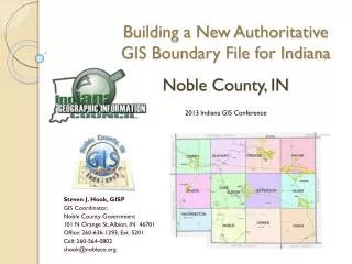
Building a New Authoritative GIS Boundary File for Indiana. Wayne County, IN. 2013 Indiana GIS Conference. Shaun N. Scholer, GISP GIS Manager, Wayne County/City of Richmond GIS Interlocal 401 E Main St. Richmond , IN 47374 Office: 765-973-9385 Cell: 317-414-0889 sscholer@co.wayne.in.us.

E N D
Building a New Authoritative GIS Boundary File for Indiana Wayne County, IN 2013 Indiana GIS Conference Shaun N. Scholer, GISP GIS Manager, Wayne County/City of Richmond GIS Interlocal 401 E Main St. Richmond , IN 47374 Office: 765-973-9385 Cell: 317-414-0889 sscholer@co.wayne.in.us
2013 Indiana GIS Conference Slide 2 Factors Identifying the Boundary of Wayne County • Historic Legal Description • Indian Treaty Lines • State Line • Spanning Multiple Baselines.
2013 Indiana GIS Conference Slide 2 History of the Wayne County Boundary
2013 Indiana GIS Conference Slide 4 Interpreting the Legal Description • Indiana Revised Statute of 1852 • Generalized the county boundary • Vague descriptions of some corners • Call/bearing missing
2013 Indiana GIS Conference Slide 2 Defining Corners from Legal Description
2013 Indiana GIS Conference Slide 6 Indian Treaty Lines • Greenville Treaty Line - The Treaty was signed at Fort Greenville on August 3, 1795 following the Native American loss at the Battle of Fallen Timbers the previous year. • Harrison or 12 mile Treaty Line - In 1809 Governor Harrison signed a treaty with the Indians which opened for settlement a 12-mile strip, paralleling the Greenville boundary line.
2013 Indiana GIS Conference Slide 2 Treaty Lines 12 Mile Treaty Line Greenville Treaty Line
2013 Indiana GIS Conference Slide 8 Impact to the County Boundary Randolph County Greenville Treaty Line Wayne County Randolph County Harrison Treaty Line Wayne County
2013 Indiana GIS Conference Slide 9
2013 Indiana GIS Conference Slide 5 Section Corner Accuracy Point Quality # 0 High Quality Field Location (125) # 0 Calculated - interpreted between points (0) # 0 Ortho-photo interpretation (48) # 0 Location plotted to unknown accuracy (0)
2013 Indiana GIS Conference Slide 11 Local GPS Base Station vs. InCORS Network
2013 Indiana GIS Conference Slide 12 Future GIS Work related to Updated County Boundary • Create new County Boundary polygon • Share with the State our updated County Boundary • Update various GIS layers affected by new section corner locations • Continue to work with neighboring counties to update our closing corners between their closing corners.