Download
1 / 12
120 likes | 202 Views
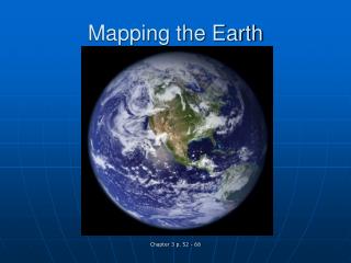
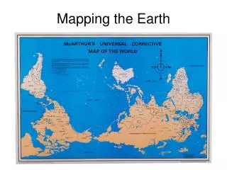
Mapping Earth. Physical maps. Different colors, lines, tints, shading and spot elevations are used to show the elevation and to differentiate lowlands from the mountains Colors are used to distinguish landforms and elevations

E N D
Physical maps • Different colors, lines, tints, shading and spot elevations are used to show the elevation and to differentiate lowlands from the mountains • Colors are used to distinguish landforms and elevations • The features that make up earth`s surface are called landforms • some examples of landforms are plains, plateaus, and plateaus • Some physical maps show elevation
globes • A globe is aspherical representation of the earth • When you look at a globe you can see the way the world looks • Globe categories: terrestrial and celestial
Contour/topographical maps • A topographic map is a type of map characterized by large-scale detail and quantitative representation of relief • usually using contour lines • detailed and accurate graphic representation of cultural and natural features on the ground
Political maps • Designed to show governmental boundaries of countries, states, and counties, the location of major cities • Usually include significant bodies of water • Bright colors are usually used to help you find the borders
Physical features • Plateaus • Seas • Mountains • Oceans • Islands • Rivers • Plains • Lakes • In the earth sciences and geology sub-fields, a landform or physical feature comprises a geomorphological unit, and is largely defined
Deserts • Arid or dry regions that receive less than ten inches of rain per year • Large areas with a lot of bare soil and low vegetation • The world`s deserts cover almost one quarter of the earth`s land surface • Receive little rainfall but when rain does fall the desert experiences a short period of great abundances
Bodies of water • any significant accumulation of water, usually covering the Earth • Some bodies of water are man-made • Include: reservoirs, harbors, oceans, lakes, rivers, ponds, etc. • Some bodies of water collect and move water
Mountains • A mountain is a large landform that stretches above the surrounding land in a limited area usually in the form of a peak. • A mountain is generally steeper than a hill • Mountains are formed through tectonic forces or volcanism • Types: Volcanic mountains, dome mountains, Plateau mountains, etc. • Mountains often serve as geographic features that define natural borders of countries
Physical map Political map Topographical map
sources • http://www.mapsofworld.com/physical-map/ • http://mapas.owje.com/maps/6877_world-physical-map-2003.html • https://en.wikipedia.org/wiki/Topographic_map • http://www.vectortemplates.com/raster-globes.php • http://www.jrank.org/history/pages/8346/What-Are-Different-Types-Maps-Graphs.html • http://www.1worldglobes.com/earthglobe.htm • http://www.encyclopedia.com/topic/globe.aspx • http://en.wikipedia.org/wiki/Mountain • http://science.nationalgeographic.com/science/earth/surface-of-the-earth/mountains-article/ • www.worldatlas.com/atlas/infopage/political.htm • www.defenders.org/deserts/basic-facts
sources • https://en.wikipedia.org/wiki/Topographic_map • http://en.wikipedia.org/wiki/Body_of_water