Download
1 / 47
950 likes | 1.85k Views
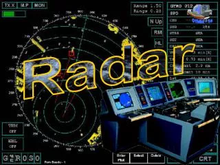
MARITIME NAVIGATION Radar. Vladimir LEBEDEV Senior Technical Officer MARITIME SAFETY DIVISION. History…. New technologies of Radar become available to Merchant Shipping with the end of hostilities in 1945 Radar on Merchant Ships was initially installed for commercial purposes

E N D
MARITIME NAVIGATIONRadar Vladimir LEBEDEV Senior Technical Officer MARITIME SAFETY DIVISION
History… • New technologies of Radar become available to Merchant Shipping with the end of hostilities in 1945 • Radar on Merchant Ships was initially installed for commercial purposes • on ferries to maintain better schedules in fog; and • large fishing vessels • Radar was treated with great suspicion by the mariners…
History… • With improving technology and after some time the use of Radar for safety purposes was recognized • Misinterpretation of Radar information had not resulted in any reduction of the number of serious collisions at sea
History… • International Conference on Safety of Life at Sea in 1960 revised the International Regulations for Preventing Collisions at Sea by adding rules to take account of the use of Radar and recommendations on the use of Radar information as an aid to avoiding collisions at sea
History… • The International Conference on Safety of Life at Sea in 1974 adopted provisions to the SOLAS Convention making Radar a mandatory carriage requirement for Merchant Ships in a phased programme starting in 1980, which finally completed in 2002
SOLAS requirements… All Merchant Ships of 300 gross tonnage and over now shall carry a Radar and many carry two IMO adopted performance standards for marine Radars, which are used in connection/integration with other navigational equipment required to carry on board ships such as,
SOLAS requirements… - an automated target tracking aid - ARPA - AIS - ECDIS - GNSS - others
NON-SOLAS ships • Many small craft (millions?) also carry Radar voluntary as manufacturers have produced cost effective designs for their needs
The Shipmaster’s Point of View • The Key Facts are: • That Radar remains (and will remain) the primary system for Collision Avoidance; and • Radar is a very important tool for Navigation
Why is Radar such a valuable tool? • The Master and watch-keepers have Confidence in information Radar provides because: • It’s operation is Ship based • It’s not reliant on third party sources • It has a proven track record • Radar is useful with SARTs when engaged in search and rescue
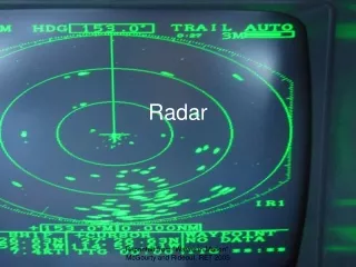
In Short… • In its display, Radar offers the watch-keepers the basic reality of all targets relative to the ship • It therefore aids the watch-keepers and helps in decision making for both • Navigation; and • Collision Avoidance
COLLISION AVOIDANCE • Early action is required to avoid a close quarters situation, therefore early identification of closing targets is essential • Watch-keeping officers need to be competent in the use of Radar and are trained in its use and the application of ARPA
Some IMO requirements… • Maximum emergency stopping distance from full speed of the ship should not be more that 15 ships lengths • Emergency turn radius of the ship should not be more that 2.5 ships length
Ship parameters… • Speed – up to 25 knots • Length • Largest container ship 335 m • Capesize bulker 300 m • Panamax 220-230 m
Ship parameters… • Emergency stopping distance 3.3 km – 5 km (1.8 nm – 2.7 nm) • Emergency turning radius 550 m – 840 m (0.3 nm – 0.45 nm) • Displacement weights 100 000 – 250 000 tonnes
Practical requirements • To start plotting targets and determining their course and speed when the target is between 8 and 10 nautical miles off
NAVIGATION • Radar gives accurate information on distance from charted features and assists in maintaining the ship’s course • Radar will normally show a 60 metre high land mass at a range of 20 miles. This is considered by seafarers as a minimum requirement
Target Description Target Feature Detection Range in NM6 Target description5 Height above sea level in metres X-Band NM S-Band NM Shorelines Rising to 60 20 20 Shorelines Rising to 6 8 8 Shorelines Rising to 3 6 6 SOLAS ships (>5,000 gross tonnage) 10 11 11 SOLAS ships (>500 gross tonnage) 5.0 8 8 Small vessel with radar reflector meeting IMO Performance Standards1 4.0 5.0 3.7 Navigation buoy with corner reflector2 3.5 4.9 3.6 Typical Navigation buoy3 3.5 4.6 3.0 Small vessel of length10 m with no radar reflector4 2.0 3.4 3.0 Res. MSC. 192(79)
Discrimination of targets from a watch-keepers perspective • To be able to distinguish a tug from its tow at sea at 12 miles range • Approaching a rig on a supply vessel: • To clearly identify the standby boat from the rig at 6 miles range • To be able to distinguish the anchor pennant buoys of a semi submersible rig at 3 miles range
Res. MSC.192(79) • 5.5.1 Range • The radar system should be capable of displaying two point targets on the same bearing, separated by 40 m in range, as to distinct objects. • 5.5.2 Bearing • The radar system should be capable of displaying two point targets on the same range, separated by 2.5° in bearing, as to distinct objects.
NAVIGATION • Radar greatly assists navigation during poor visibility • Pilots rely on Radar at close range in reduced visibility to pass buoys and beacons.
Res.MSC.192(79) • 5.4 Minimum Range 5.4.1 With own ship at zero speed, an antenna height of 15 m above the sea level and in calm conditions, the navigational buoy in Table 2 should be detected at a minimum horizontal range of 40 m from the antenna position and up to a range of 1 NM, without changing the setting of control functions other than the range scale selector.
In engineering terms • Res. ITU-R M.1313 • Power 30-70 kW • Horizontal Beamwidth 0.75 – 4 degrees • Pulse width 0.03 – 1.2 microsec • PRF 4000 – 375 Hz • Noise figure 3 – 8 dB
Antennae • Pitch 3 degrees • Roll 25 degrees • Yaw 5 degrees • So vertical beamwidth 20 – 30 degrees