Download
1 / 52
520 likes | 650 Views
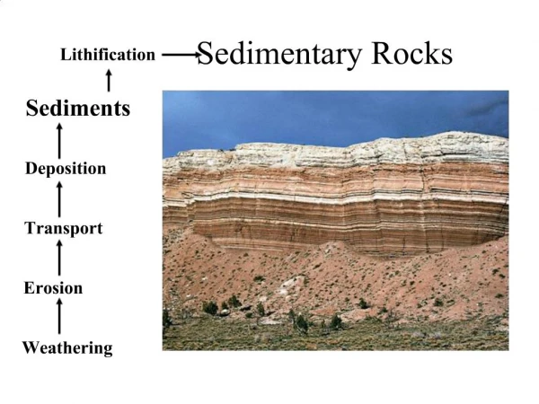
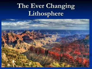
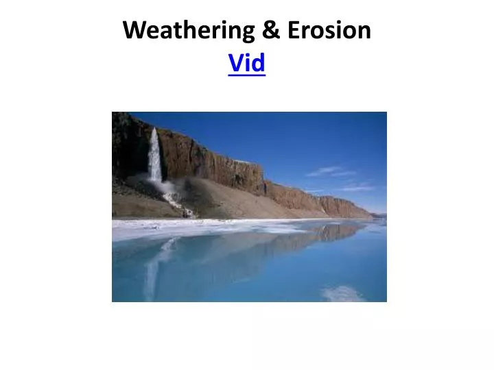
Weathering & Erosion Vid. I. Weathering. …is the breakdown of rock due to exposure to the atmosphere. Physical Weathering : any process that causes rocks to break down to smaller pieces of the same material. Frost Action

E N D
I. Weathering …is the breakdown of rock due to exposure to the atmosphere. • Physical Weathering: any process that causes rocks to break down to smaller pieces of the same material. • Frost Action a) Frost Wedging: water that’s found in cracks of bedrock freezes & expands causing the crack to get larger.
b) exfoliation: the outer layer of a rock expands & contracts as it’s heated by the sun…this causes the outer layer to weaken & crumble.
b) Biological:Plant Action … the roots of plants exert enough pressure to crack a rock. Eg: grass growing in the cracks in the road will expand as the roots grow. • moss: looks green carpet • lichens: looks like green scales Both grow on smooth surfaces & causes cracks to form
3. Abrasion: Rocks rub against each other during transport. B. Chemical Weathering: breakdown of rock resulting in a change in composition
1. Three substances responsible for chem’l weathering: a) Oxygen: 21% of the atmosphere is O2; oxidation is the addition of O2 . Eg: (4) Fe + (3) O2 2 (Fe2O3) iron + oxygen iron oxide (rust) Copper (cu) will turn green when oxidized. b) water: H2O hydration: • speeds up the process of rusting • may also cause minerals to dissolve; this is how caves are formed.
c) Carbon Dioxide: CO2 from burning of fossil fuels. It combines w/ H2O to form carbonic acid…this is what puts the “fizz” in carbonated drinks. d) Pollutants: substances emitted into the atmosphere by humans. Eg: Sulfur (S) combines w/ H2O to form sulfuric acid+ acid rain. • Rain is naturally acidic but this increase causes an increases in the rate of weathering. • VID
II. Rate of Weathering • Factors that affect weathering • Particle size: smaller particles will dissolve faster b/c there’s more surface area. Eg: sugar granules v. sugar cube 2. Mineral composition: the harder the mineral, the more resistant to abrasion. Some minerals are soluble in H2O & even more soluble when H2O is acidic.
3. Climate: average conditions of temperature & humidity. • Physical weathering: requires moisture & a temperature that fluctuates. • Chemical Weathering: more prevalent in warm, moist climates; may also be affected by local conditions such as pollution
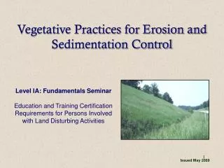
III. Soil: accumulation of loose, weathered material that covers much of the earth's surface. It contains weathered rock, water, air, bacteria, & decayed plant material. • Types of Soil 1. Residual: formed in place- the soil has the same characteristics as the rock below it. 2. Transported soil: formed from sediments that were deposited ******
Quiz Break!
Summary & Questions Sum up the last section in a short paragraph. • What is weathering? • Describe the 2 types of weathering. • How does biology affect erosion? Frost? • What three substances responsible for chem’l weathering? • What is chemical weathering? • What factors affect weathering? • What is soil? • What are the 2 types of soil?
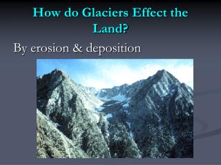
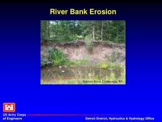
I. Erosion:transporting of sediments A. Agents of erosion: VID • water: rain, streams, waves, & currents • Wind • Gravity • Glaciers B. Streams: movement of H2O downhill thru channels by gravity
1. 4 ways sediments are transported in a stream a) Solution: smallest particles are dissolved & carried downstream. b) Traction: or bed-load- rolling, sliding, or bouncing. c) Floatation: particles< dense than H2Owill be carried @ the surface. d) Suspension: particles: particles w/the same density will remain suspended as they move.
2. Velocity: as the velocity increases, the erosion increases. • Velocity is affected by: • Gradient: steepness: as the gradient increases, the velocity increases. • Discharge: amount of H2O; as the discharge increases, the velocity increases, Flooding = > erosion. • Location w/in a stream channel
C. Formation of a Stream VID • Watershed or Drainage Basin: all the land drains into a body of H2O directly or thru tributaries. • Tributaries: are small streams that empty into bigger ones. • Divide: high point that separates one H2Oshed from another.
2. New Streams: young streams • Starts as water flowing down a hill moving sediments • Water will seek out the lowest elevation & create a channel • ***new stream will generally have a V-shaped valley w/STEEP sides. • VID,
3. Mature Streams • Overtime the stream valley widens & the slopes become < steep. • The velocity of the H2O will slow down & deposition occurs.
4. Formation of a Meander (curve) • As the velocity decreases due to the widening of the stream channel the water begins to flow around obstacles • As water flows around the obstacle, erosion occurs on the outside of the curve & deposition will occur on the inside. • Cutoff- when the flooding occurs in a mature stream, the water flows over the land instead of flowing around the meander. • Oxbow lake- when a cutoff becomes the main channel flow the meander is eliminated forming an oxbow lake. VID
How meanders grow laterally through erosion (outside bend) and sediment deposition (inside bend, point bar). When the loops get too large and consume too much energy (friction), the river will eventually find a less energetically "taxing" shortcut, and a part of the old channel will be abandoned and becomes an oxbow lake.
D. Erosion by Wind • Only moves smaller particles- sand, silt, & clay • Occurs in dry areas w/little vegetation to hold sediment in place • Results in abrasion of larger particles. Ventifacts: angular rocks eroded by wind.
E. Erosion by Gravity: also called mass wasting • Any size sediments will roll, slide, or fall down hill b/c of gravity. Eg: rock slide, mud slide, slump, & creep. Slumps
Summary & questions Sum up the last section in a short paragraph. • What is erosion? • What are the 4 agents of erosion? • What is a stream? • What is velocity & affects it? • How does a new stream form? • What happens to the velocity in a mature stream? • Describe an meandering stream. • What is a ventifact? • Describe erosion by wind. • Describe erosion by gravity.
Glaciers Glaciers results in mostly unsorted deposits w/melt H2Os sorting some of the deposits. Two types of glaciers: 1. Alpine Glaciers: also called valley glaciers, form @ hi elevations; the carve out “U” shaped valleys.
2. Continental Glaciers: cover large areas of land during Ice Ages. • Responsible for shaping much of NY • N. America was covered w/ice about 20,000 yrs. ago • There have been 4 Ice Ages over the past 2 million yrs. As the ice melts, the sediments are deposited.
3. Feature formed by glaciers: • Moraine: line of sediment; terminal moraine-deposit @ the southern end of a glacier.
b) Kettle Lake: large chunks of ice left behind eventually melt, leaving behind an impression that fills w/H2O.
c) Drumlines: tear shaped deposits that were pushed by glaciers d) Erratics: large boulders dropped by the glacier
e) Eskers: long narrow deposits that are formed by melt H2Os flowing under the glacier. An esker remnant
f. Outwash: the material deposited by the debris-laden meltwater
4. Glacial Polish: shiny surface left behind as the glacier scrapes any loose sediment from bedrock. 5. Glacial Striations: or Grooves- scratches that formed as a result of large boulder frozen to the bottom of the glacier being dragged across the bedrock.
F. Erosion by Glaciers • Formation of a glacier- more snow accumulates in the winter than melts in the summer • As the wt. of the ice builds up the glacier will start to flow 2. All size sediments are transported by a glacier. • All the particles are frozen to the bottom of the glacier & scrape along the bedrock leaving deep scratches called striations or grooves • Smaller particles are also carried by the glacier as it scrapes & pushes the loose sediments
Summary & Questions Sum up the last section in a short paragraph. • What is a glacier? • What’s the difference between an Alpine & Continental glacier? • What type of glacier formed most of NY? • Define the following: • Moraine • Kettle lake • Drumlines • Erratics • Eskers • Outwash *****
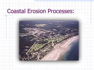
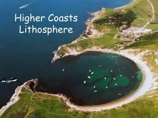
II. Oceans & Costal Processes • Ocean Facts: • Cover 71% of the earth’ surface • Average depth of 4Km • The deepest trench could submerge Mt. Everest w/another mile of ocean above it • 1L of H2O contains dissolved solids B. Coastlines are shaped by waves & long shore currents
Waves-water does not actually flow w/the wave it actually circulates in circles or ellipses • The wave is trasnferring energy that’s released on the shore when the wave breaks
3. The wave break when the depth of the water decreases & the bottom of the circulating orbit is slowed & the top continues @ the same speed. 4. Long shore currents are responsible for the characteristics features of ocean shorelines such as barrier sands. VID
Barrier Islands: a deposit of sand will migrate w/the long shore currents. VID • Jetties: man’s attempt stop cont’d erosion of beaches: • Long pile of large rocks extended out into the long shore current • Results in deposition on the side from which the current is approaching but also causes an increase in erosion on the opposite side.
III. Landscapes: the topography of the land (ESRT p.2) • Three Classifications: • Mountain Landscapes: greatest relief between the highest peaks & lowest valleys • Plateau Landscapes: relatively flat or rolling hills w/< relief that mountains & deep cut river valleys • Plain Landscapes: generally flat & @ low elevations.
Mountain Landscape 2. Plateau Landscape 3. Plains Landscape