Download
1 / 20
200 likes | 326 Views
Prof. Ali Agoumi Morocco (Algeria, Morocco, and Tunisia). To date, negotiations have largely focused on mitigating.

E N D
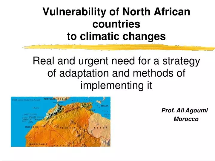
Prof. Ali Agoumi Morocco (Algeria, Morocco, and Tunisia)
To date, negotiations have largely focused on mitigating • Little focus during these negotiations: the vulnerability of some regions of the world and their need to adapt to the effects of climatic changes
In North Africa, three countries (Algeria, Morocco, and Tunisia) are particularly vulnerable: The main results of studies and research conducted on this aspect have been summarized in the initial national communications presented at COP7, held in Marrakech in 2001 with the support of UNDP/GEF Projects RAB,TUN,MOR And ALG
The objective of this article • to show how three key sectors in the region (water, agriculture and coastline) might fare over the coming decades and with what consequences to the populations if : True adaptive policies are not devised and implemented in those countries in the years to come
I Climate of the region • The three countries are located in a territory with a surface area of more than 3.3 million square kilometres;more than two-thirds of which are located in desert zones. • The region is predominantly semiarid to arid, • A wide spacial and inter-annual variability in precipitation, with less precipitation in the south, and periodic, frequent episodes of drought, which can last more than three successive years. • High mean annual temperatures, exceeding 20°C in the south, and milder temperatures along the coastline..
A marked increase in the frequency of droughts and floods. Climate during the 20th century
Prospects in the event of climatic changes • The general circulation models converge to estimate probable warming in the region on the order of 2 to 4 degrees in the 21st century, • A little convergence among assessments of the different models concerning future precipitation However, these indicate • Probable interference with rainfall (spatiotemporal distribution) • A slight downward trend (this remains to be confirmed)
II Socio- economic context • Population (Algeria, Morocco, and Tunisia) ; went from less than 60 million in 1994 to nearly 65 million in the year 2000, and should reach more than 72 million in 2010 • This population growth was accompanied by rapid and sometimes anarchic urbanization, an extensive rural exodus particularly linked to the climatic changes in those years • The socio-economic development of the countries in the region took place in the past century based on different economic choices and production sectors: • In Algeria, the industrial sector is the largest • In Morocco, the largest is the agricultural and fishing sector • In Tunisia, the largest is the service industry
III Fragile natural resources • - Water resources • 53 billion cubic meters of mobilisable water in the three countries: primarily surface water with a mobilization rate of approximately 60%; • Primarily used for agriculture (80%), drinking water (13%), and industry (7%); • Three water-stress countries (less than 1000 m3/inhabitant/year), Algeria and Tunisia being closer to a shortage (less than 500 m3/inhabitant/year); • Rapid and sometimes violent flows and significant sediment transport of 500 to 2000 metric tons/km2/year; • Water quality sometimes at the lower limit of the standards; • A strongly decreasing water table in recent years, with salinization of some coastal groundwater.
Soil, vegetation, and agriculture • Fertile, well watered zones in the north, sometimes with small forests; • Steppe-type vegetation with primarily alfa grass in the arid regions in the centre and south; • Oases planted with date palms in the south; • A strong potential for land dedicated to agriculture (cultivable land, forests, alfa grass coverage, range land), particularly in Algeria and Morocco; • Primarily rain-based agriculture, subject to climatic hazards; • Strong erosion with extensive soil degradation; • Decreasing rain-based agricultural yields: grain yields reduced by up to 50% in periods of drought; • Increased water needs for irrigation and decreased agricultural production due to lack of water in recent years; • Accelerated desertification, particularly in the south of the region; • Limited forestland, undergoing ill-advised development with depletion of forest reserves as a consequence.
Coastal zones • Fronting both the Atlantic and Mediterranean for thousands of kilometres; • Extensive, under-exploited fishing resources, particularly offshore; • 2/3 of the population lives along the coastline, in municipalities whose waste is often dumped into the sea with no prior treatment; • A concentration of industrial activities along the coasts with dumping of various waste products into coastal waters without the slightest treatment; • Important tourist activity, particularly along the Mediterranean coast, in turn degrading the quality of the coastal waters, with noticeable consequences for bathing and marine life.
IV Vulnerability and need for adaptation • Studies conducted on the coastline have especially been developed for the case of Tunisia :60% of the population, 70% of its economic activity, and 90% of its tourist attractions • Altered coastal dynamics, • Loss of land to sea water, particularly on some islands (KerKenna Islands) and swamps (Maritime swamps and Sebkhas) • Intrusion of sea water onto land and salification of coastal ground water • Changes in agricultural and aquatic production along the coastline, linked to these events • Socio-economic endangerment of these coastal zones, linked to the greater frequency of flooding and land erosion. Seaside tourism and its infrastructures would be greatly threatened.
Golfe de Hammamet : risques liés à une EANM de 50 cm à l’horizon 2100 Progression de la salinité Plages menacées de disparition définitive Plages subissant un recul du fait de l’EANM, mais peuvent s’y adapter Parties de sebkha (marécage salé) susceptibles de se transformer en lagunes Phénomène amplifié en considérant les surcôtes
Studies on agriculture • Greater erosion, leading to widespread soil degradation • Deficient yields from rain-based agriculture of up to 50% during the 2000-2020 period • Reduced crop growth period • Risk of non-dormancy of some arboreal species • Reduced agricultural activity in coastal zones due to anticipated salification of ground water • Reduced agricultural production linked to higher water demand in this sector, combined with an anticipated decrease in that resource in the region. Recommendations to adapt this sector to climatic changes, • - incorporating better use of water for agriculture (new techniques), • -adoption of drought-resistant varieties, • -better selection of planting dates, • -supplemental irrigation in zones that lend themselves to that practice.
Water sector • Probable decrease in water flow • Change in seasonal water recharging, with impact on the effectiveness of certain hydraulic and agricultural systems • Increased evapotranspiration and, consequently, water salinity • Drop in water tables and increased salinity of coastal ground water • Warmer, less aerated surface water, with less flow and, therefore, less able to dilute and biodegrade certain pollutants Cas Study: Al Wahda Dam
Al Wahda Dam : Ouergha Watershed • A hydrologic model simulating runoff to the mouth of the watershed, taking into account precipitation and air temperature, was developed, calibrated, and validated for the watershed. • In a second phase of the research, this tool was used to assess the future of the runoff in the event of climatic changes, by incorporating into it the new temperatures anticipated by the general circulation models.
Different air temperature and precipitation scenarios were tested: from 1 to 4°C of warming and 0 to 10% decrease in precipitation Percentage of annual water deficit in the Al Wahda Dam (Oz) as a function of warming in °C (Ox) and the percentage of anticipated precipitation deficit (Oy)
Adaptive policies and actions are already imperative! what seems important for these countries in order to succeed in adapting is : the implementation of water policies structurally focusing on the scarcity of the resource and on its progressive future decrease due to climatic changes
V Adaptive actions and strategies to be implemented • More accurate monitoring and, therefore, better qualitative and quantitative knowledge of climate changes in the region. • Better forecasting of medium and long-term behaviour of climate in the region relative to anticipated climatic changes. • Better developed, more complete, and, insofar as possible, quantitative assessment of the vulnerability of the region to climatic changes, and adaptive actions required as a consequence. Additionally, creation of an observatory to monitor changes in vulnerability in the various affected sectors. • Immediate integration, into socio-economic and policy decision-making processes in these countries, of the high vulnerability of the region to climatic changes and the need for ongoing adaptation strategies and actions to deal with it.
THANKS agoumi@mtds.com • www.ccmaghreb.com • www.ccmaroc.ma