Download
1 / 42
460 likes | 936 Views
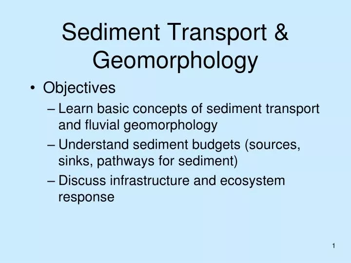
Sediment Transport & Geomorphology. Objectives Learn basic concepts of sediment transport and fluvial geomorphology Understand sediment budgets (sources, sinks, pathways for sediment) Discuss infrastructure and ecosystem response. Sediment Transport and Geomorphology in Planning Steps.

E N D
Sediment Transport & Geomorphology • Objectives • Learn basic concepts of sediment transport and fluvial geomorphology • Understand sediment budgets (sources, sinks, pathways for sediment) • Discuss infrastructure and ecosystem response
Sediment Transport and Geomorphology in Planning Steps • Characterize Physical Attributes of • Existing conditions • Reference conditions • Future w/o project conditions • Alternatives • 70% of ecosystem restoration efforts are linked to sediment and geomorphology
Sediment Transport & Geomorphology • Sediment Transport • mechanics of sediment erosion, transport, and deposition by water • Geomorphology • geologic science of landscape formation • H&H is the big driver affecting sediment transport and geomorphology
Too Much/Too Little Sediment • Problems with too much sediment • Raised flood profiles • Reduced underwater light • Decreased capacity of hydraulic structures • Problems with too little sediment • Incision (channel lowering) • Delta loss • Scour at hydraulic structures
Sediment Size • Clay < 0.004 mm • Silt 0.004 - 0.0625 mm • Sand 0.0625 - 2 mm • Gravel > 2mm • The larger the sediment particle, the less readily it is picked up by flow at a given speed, and if picked up, the shorter the distance it is likely to travel before re-settling • Clay and silt are considered fine sediments • Sand and gravel are considered coarse sediment • Note: Protocols for cobble bed mountain streams may differ, where fines may be considered anything less than 5.6 mm.
Descriptions of Sediment Load Ability to Measure Mode of Transport Location in River Measured Load-Sediment that can be measured with a sampler Suspended Load-Sediment that can be found at any depth. Includes fine and coarse sediment Wash Load – sediment that passes over bed without deposition. exchanges with banks/floodplain Un-Measured Load-Sediment in the lowest portion of the water column that cannot be measured with most samplers Bed Load-Sediment that creeps or hops along bed (coarse material) Bed Material Load – sediment that exchanges with and is found in measureable quantities in bed
Suspended Load Curves (based on measured SS) Suspended sediment can be measured using samplers A plot of suspended sediment load versus water discharge. Note order of magnitude variation. Suspended Sediment Load (tons/day) = Sediment Concentration (mg/L) * Water Discharge (cfs) * .0027
Bed Load Sketch & Bathymetry from Dvd Abraham and Thad Pratt, ERDC Bed load moves in waves at a certain speed (or celerity). The celerity (c) is given by dividing the distance ∆x by time ∆t. Problem is that measuring c is difficult and expensive, and calculating it is uncertain even with good models and data. Often we just assume that bed load is 5% to 15% of the total sediment load.
Calculating Sediment Transport • There are dozens of sediment transport functions that predict sediment transport based on: • sediment size, weight, and fall velocity • water velocity and depth • channel width • channel slope and roughness • water temperature • Many assumptions are made • Choose functions appropriate for your conditions
Lane’s Balance says that sediment discharge and sediment grain size tend to balance against water discharge and slope
Sources, Sinks, Pathways Rio Puerco, NM • Sources • Bed • Banks (Bluffs) • Ravines & Gullys • Watershed • Watershed Sources depend on: • geology and topography of the watershed • magnitude, intensity, duration, and distribution of rainfall • vegetative cover; and the extent of cultivation and grazing. • Regression methods are used to develop soil loss relationships Source Sink
Sources, Sinks, Pathways • Sinks • Floodplains • Valley side slopes • Deltas • Off - channel areas • USACE Dredges • Most rivers cannot transport all of the sediment that is eroded within its channels and watersheds, so every river system has sinks for sediment.
Sources, Sinks, Pathways • The capacity of a stream to transport sediment depends on • hydraulic properties of the stream channel and sediment properties • Sediment Transport = F (hydraulic properties & sediment properties) • slope • velocity grain size distribution • channel geometry cohesiveness • roughness pathway sink
Sediment Budgets, Watershed Scale Whitewater River Sediment Budget, NRCS, 1965 to 1994 Sources of sediment estimated by AGNPs model Sinks determined by historic survey comparison Sources (1000’s tons/year) Sheet & Rill Erosion 555 Ephemeral & Classic Gully Erosion 72 Streambank Erosion 86 Headwaters Sediment Load To Mississippi River 24 Colluvium 553 Sandbars & Streambank Deposits 17 Tributary Valley Deposits 36 Main Valley Deposits 63 Whitewater Delta Deposits 20 Sinks (1000’s tons/year) Only 24,000 tons/year of the total 713,000 tons/year from sheet and rill erosion, ephemeral & classic gully erosion, and streambank erosion is transported to the mouth of the river.
Sediment Effects on Water Quality • The majority of sediment transport in a given year occurs during seasonal high water events • Sediment transport during other times can have a significant effect on underwater light, nutrient loads, substrate.
Suspended Sediment Concentration (SSC) is Different than Total Suspended Solids (TSS) SSC sampling: Iso-kinetic sampling where the velocity and concentration in the sampler intake is equal to the velocity and concentration in the surrounding water is required to ensure sediment samples that represent the true sediment load. See USGS protocols by Edwards and Glyssen (1999) and Davis (2005) TSS sampling (e.g. automatic water samplers (or pump samples) Often are not iso-kinetic, however this is not a problem for fine sediments. The SSC analytical method uses the entire water-sediment mixture in the analysis. (ASTM D-3977) A TSS analysis entails withdrawal of an aliquot (or part) of the original sample for subsequent analysis. (SM 2540-D). It is OK to use if the sediments are fine sediments, but don’t use if coarse sediments are in the sample. For more information see http://water.usgs.gov/osw/techniques/sediment.html
Geomorphology High Energy Channel • Geologic science of landscape formation • Fluvial Geomorphology • landscape formation by streams Low Energy Backwater
Watershed and Channel Alteration will change H&H Causing Geomorphic Responses Including: • Channel incision • Channel plugging • Land loss along channels • Gullying • Floodplain deposition
Geomorphic Responses may Affect: • Infrastructure: Bridges, FRM • Human uses: Drinking water, recreation, agriculture • Aquatic Habitat • Commercial Navigation • Water Quality: Underwater light, nutrients, contaminants
Spatial Scales • Changes in: • Channel geometry • Slope • Roughness • Cause changes in • Sediment transport • Geomorphic processes • Channel Capacity
Time-Scales • Annual geomorphic changes like sand bar migration, bank erosion, point bar building occur due to seasonal high flows • Long-Term geomorphic change like incision or delta building or loss might be natural or anthropogenic. • Climate variation, watershed development, channelization, dams, urbanization affect geomorphic change at both scales.
Use Multiple Tools for Sediment Transport and Geomorphological Analysis • Field Investigations • Existing conditions substrate, bankfull conditions, vegetation, discussion with local experts • Surveys: • Cross sections, profiles, sediment cores • Analytical Techniques • Numerical Models: • Watershed models • River models • Aerial photo comparisons • Change from Historic conditions • Sediment Budgets • Specific Stage Discharge Analysis
Erosion of aRiver Bend Sink Source Sink Geotechnical Failure From Bend Migration And Toe Erosion Low Flow Cross Section High Flow Cross Section
River Meandering and Effects of 0.2 % Chance Flood
Geomorphic Response to Watershed Development • Floodplain Deposition, Channel Incision
Highway 61 Bridge Canadian Pacific RR Bridge Whitewater River Avulsion August 2007 New Mouth of Whitewater River Whitewater River shortened By about 6,000’ Old Mouth of Whitewater River
Channelization Sediment Deposition, Loss of Capacity Agricultural Levee Break
1938 1954 1991 Geomorphic Response to Raised Water Levels In Lower Pool 8 • Island Loss And Erosion • Increased Connectivity • Sediment Deposition
Bridges • Usually footings are deep enough to handle a certain amount of scour. • Changed hydrological conditions (climate variation, land use change) or changed hydraulic conditions (dam removal, debris) can create greater scour levels
Bridge 87015TH 212 over Minnesota River Overflow Abutment Fill and Approach Panel LostQ500 = 7,300 cfsQ1997 = 10,000 cfs Excerpts from Inspectors Notes: 4/4 108” below NW, channel has shifted to east 4/5 69” from SE wingwall, deck vibrating, riprap eroded, looking down through water. 4/6 2:00 PM Panel undermined, water flowing under it. 4/6 5:00 PM Panel fell in.
Bridge 54002Bridge is still structurally stable, but from the travelers perspective it failed.