Download
1 / 81
810 likes | 1.08k Views
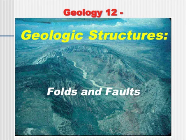
Geology 12. Presents. Unit 3 Chp 10 Earth’s Interior Chp 11 Ocean Floor Chp 12 Plate Tectonics Chp 9 Seismic (EQ) Chp 13 Structure. Chp 12 Plate Tectonics.

E N D
Geology 12 Presents
Unit 3 • Chp 10 Earth’s Interior • Chp 11 Ocean Floor • Chp 12 Plate Tectonics • Chp 9 Seismic (EQ) • Chp 13 Structure
Chp 12 Plate Tectonics • Theory is that Earth consists of about 18-20 rigid lithospheric plates that move about the Earth’s surface on a plastic asthenosphere and mantle. • Lithosphere = crust + upper mantle (UM) • Lithospheric plates: • Cont’l: up to 250 km thick (crust 90 + UM 160) • Oceanic: up to 100 km thick (crust 10 + UM 90) • Move 2 – 20 cm/yr but average is 2-3 cm/yr
Lithospheric Plates = crust + upper Mantle Up to 100 km thick Up to 250 km thick
Evidence of Plate Tectonics • 1. Continental fit/jig-saw puzzle pieces
3. Glacial Evidence: Glacial striations indicate movement of ice away from the pole
4. Fossil Evidence: same fresh water land fossils found on different continents
5. Paleomagnetism and Polar Wandering: plates moved N/S as given by magnetic inclination.
volcanic mountain chain (ridge) in the oceans are where the sea floor splits and spreads apart. • 6. Seafloor Spreading: a 65,000 km long 5 pieces of evidence to support seafloor spreading to come
lithosphere mantle • As oceanic plates are driven apart by thermal convection cells/currents in the mantle, new oceanic crust forms in the rift. • New oceanic crust is created at the ridge; old oceanic crust is destroyed as it plunges down the trenches.
6. Evidence of Seafloor Spreading • a) GPS = Global Positioning Satellites in space give exact positions of continents; they tells us exactly how the plates are moving.
b. Reversal of Earth’s Magnetic Field is recorded on the seafloor as iron-rich magma cools below the Curie Point to form pillow lavas and gabbro recording the Earth’s present magnetic field. animation
b. Reversal of Earth’s Magnetic Field is recorded on the seafloor as iron-rich magma cools below the Curie Point to form pillow lavas and gabbro recording the Earth’s present magnetic field.
To find the middle of oceanic ridge, use the “dirty diaper” model Lab 12.1 is next…it covers magnetic striping
young old old • c. Radiometric Dating of Oceanic Plate: youngest at ridge; older as you move away Oldest oceanic crust is 180 ma Oldest continental crust is 4,000 ma (4 ba)
d. Thickness of Sediments on Oceanic plates • Thinnest near the ridge; thicker as you move away Abyssal hill Seamount Abyssal plain
e. Heat Flow Highest at Ridge: b/c • Oceanic crust is thinnest at ridge = less insulation from hot interior • Oceanic crust is newly formed from molten rock = hot 4 Oceanic ridge Island arc (volcanoes) 3 2 World average 1 new crust old crust trench 0
Plate Boundaries • A. Passive Margins: where oceanic and cont’l plates are fused and larges amount of sediment is deposited. Cont’l Margin Cont’l Shelf Cont’l Slope Abyssal Plain Cont’l Rise Oceanic Plate Cont’l Plate fused
Cont’l Margin • As oceanic plate becomes thicker, it becomes heavier, plus it gets pushed down with sediment. If/when this boundary becomes active, the sediment will be pushed into mtn’s. Oceanic Plate Cont’l Plate fused i.e. like the Rockies
Plate Boundaries • A. Passive Margins
Plate Boundaries • B. Active Margins: where plates are moving away (#1: plate is being created), towards (#2: plate is being destroyed), or past each other (#3)
Crust is pulled apart by convecting mantle, thins, breaks open, and magma (lower pressure lower melting temp’) wells up to form sheeted dikes of gabbro, basalt and pillow lava. • Divergent Boundaries/Spreading Ridge rift basalt mantle gabbro
Also: • High heat flow • Basaltic/mafic lava • Shallow (& mild) EQs (<30 km) • Rugged topography (seamounts, basalt floods, pillow lava) • Starts off as • i) doming/crustal unwrap • ii) rift valley & basalt floods • iii) narrow sea (i.e. Red, Dead) as continents split up • iv) spreading ocean (i.e. Atlantic)
Plate Boundaries • B. Active Margins • 1. Divergent Boundaries
c crust u.m. Upper mantle asthenosphere over • 2. Convergent Boundaries = where 2 plates collide a) oceanic-oceanic under Accretionary wedge Volcanic isld’ arc Fore arc basin trench Back arc basin
Magma melting temperature lowered by water • Deepest trenches (11 km) because both plates are heavy (3.0 gm/cm3) • Andestic magma
Fore arc basin Back arc basin • 2. Convergent Boundaries • a) Oceanic-oceanic Accretionary Complex Volcanic arc
Driving Force on oceanic plate is: i) pushed/dragged by convecting mantle = “ridge push”: ii) Pulled by sinking oceanic slab in mantle = “slab-pull”: • Deep EQs (100 - 700 km) • Ex: Aleutian Islds, Japan, Taiwan, Philippines, New Zealand, Caribbean Islds.