Download
1 / 12
130 likes | 153 Views
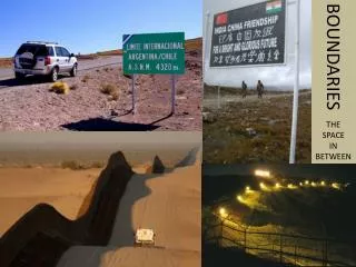
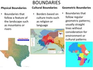
Borders and Boundaries. Borders are boundaries between states or countries Borders can be physical features such as mountains, rivers, oceans. These are natural borders. Borders can also be political agreements.

E N D
Borders are boundaries between states or countries Borders can be physical features such as mountains, rivers, oceans. These are natural borders. Borders can also be political agreements. Borders can change. For example, after a war, a country may lose land or a country may gain land, and the borders will change.
State BordersIdentify the borders of California.Identify the borders of Texas.Identify the borders of Minnesota.
Other borders within a state –States are divided into counties and cities. Do you know how many counties there are in Texas?
Functions of Government US Security Governor is the leader Public libraries President is the leader Collects taxes Collects taxes Mayor is the leader Provides fire dept. Prints money Collects taxes School districts Builds highways Provides an army
Boundaries change-How many countries were former Soviet Republics?
Ukraine has been in the news this week. Why is Ukraine and its borders significant to Russia?
America’s borders were set by purchase, conquest and geography.
Governments generally set up clear boundaries and exercise power within these boundaries, creating political units. • Political maps show political units, such as countries and their borders or states and their counties. • Political power is distributed spatially within a political region or unit. • A nation's power affects its international trade. Important Ideas