Download
1 / 35
360 likes | 552 Views
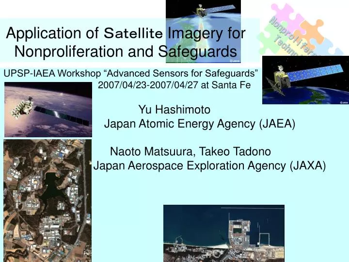
Nonproliferation Technology. Application of Satellite Imagery for Nonproliferation and Safeguards. UPSP-IAEA Workshop “Advanced Sensors for Safeguards” 2007/04/23-2007/04/27 at Santa Fe Yu Hashimoto Japan Atomic Energy Agency (JAEA) Naoto Matsuura, Takeo Tadono

E N D
Nonproliferation Technology Application of Satellite Imagery for Nonproliferation and Safeguards UPSP-IAEA Workshop “Advanced Sensors for Safeguards” 2007/04/23-2007/04/27 at Santa Fe Yu Hashimoto Japan Atomic Energy Agency (JAEA) Naoto Matsuura, Takeo Tadono Japan Aerospace Exploration Agency (JAXA)
Nonproliferation Technology Research Plan JAXA and JAEA are proceeding on joint research to improve verification methods by satellite imagery using JAEA sites, information about buildings, and their operation and construction declared to the IAEA and comparing data acquired by ALOS “DAICHI” (1) Investigation of domestic and foreign trends regarding satellite imagery utilization for nonproliferation/safeguards (2) Comparison between information of buildings on-site and satellite imagery data (3) Research for verification of nuclear facilities’ operation and construction, combined with operational information, remote monitoring data, etc., and imagery data (4) Application of satellite imagery to nonproliferation, e.g., application to CTBT verification
Objectives 1. To Evaluate Satellite Imagery’s abilities for Verification of Information about Nuclear Sites 2. To improve the correctness and completeness of declared information 3. To improve verification technology for safeguards, especially detection of undeclared activities and facilities Nonproliferation Technology
Nonproliferation Technology Improvement of the IAEA’s verification abilities Development of Verification Technology for Nonproliferation/Safeguards Acquisition of information about the sites, investigation of methods for analysis and evaluation Acquisition of satellite imagery data, data processing, analysis (JAXA)
Nonproliferation Technology JAXA/JAEA Joint Research Japan Aerospace Exploration Agency (JAXA) • Earth Observation & Research Center (EORC) • Tsukuba Space Center, Tsukuba city Japan Atomic Energy Agency (JAEA) • Nuclear Nonproliferation Science & Technology Center (NPSTC) • Tokai-mura
Research of Nonproliferation Information Analysis/Evaluation Nonproliferation Technology Information Acquisition/Data base Nonproliferation Information Analysis/Evaluation • New research started in 2006 • Concept: Information Evaluation acquired by satellite imagery, environmental monitoring, and remote monitoring of nuclear facilities with comparison between facilities’ characteristics and operational information Satellite Information Environmental Radiation Monitoring Information about Facilities, Operation, etc. Facilities’ Characteristics Monitoring Post Remote Monitoring
Nonproliferation Technology R&D Centers of JAEA Tono High-level rad-waste research Tsuruga Prototype fast breeder Monju, Decommissioning of Advanced Thermal Reactor Fugen Horonobe High-level rad-waste research Mutsu Decommissioning of nuclear ship Tokai Basic research, Safety studies, Neutron Science, Nuclear fuel-cycle technologies, Rad-waste management and disposal, etc. Ningyotoge Decommissioning of uranium enrichment plants Kansai Photon & Synchrotron Radiation Science Oarai Experimental reactors Joyo, HTTR and JMTR; Advanced reactor R&D including FBR cycle commercialization Naka Fusion R&D, ITER support Takasaki Radiation application
Confirmation of declaration regarding buildings, • Confirmation of facilities’ operation, • Verification of undeclared activities, etc. Nonproliferation Technology Information Analysis for Additional Protocol Expanded Declaration Pursuant to Additional Protocol ・ Nuclear Fuel Cycle-related R&D activities, ・ A general description of each building on each site (Site Map, Size, Activity) ・ Information regarding Uranium mines, concentration plants, and source material, etc. Information from open sources
Nonproliferation Technology The Advanced Land Observing Satellite (ALOS) “Daichi” Overview • ALOS used for cartography, regional observation, disaster monitoring, and resource surveying. • Panchromatic Remote-sensing Instrument for Stereo Mapping (PRISM) for digital elevation mapping, • Advanced Visible and Near Infrared Radiometer type 2 (AVNIR-2) for precise land coverage observation • Phased Array type L-band Synthetic Aperture Radar (PALSAR) for day-and-night and all-weather land observation
Nonproliferation Technology The Advanced Land Observing Satellite (ALOS) “Daichi” Objectives • Provide maps for Japan and other countries including those in the Asian-Pacific region (Cartography) • Perform regional observation for "sustainable development", harmonization between Earth environment and development (Regional Observation) • Conduct disaster monitoring around the world • (Disaster Monitoring) • Survey natural resources (Resources Surveying) • Develop technology necessary for future Earth observing satellite (Technology Development)
Nonproliferation Technology PRISMPanchromatic Remote-sensing Instrument for Stereo Mapping A panchromatic radiometer with 2.5m spatial resolution at nadir --- provide a highly accurate digital surface model (DSM) Three independent optical systems for viewing nadir, forward and backward --- produce a stereoscopic image along the satellite's track PRISM's wide field of view (FOV) provides three, fully-overlapped stereo (triplet) images of a 35km width without mechanical scanning or yaw steering of the satellite
Nonproliferation Technology AVNIR-2Advanced Visible and Near Infrared Radiometer type 2 A visible and near-infrared radiometer for observing land and coastal zones --- provides better spatial land-coverage maps and land-use classification maps for monitoring regional environments --- provides 10m spatial resolution images (7,000 pixels per CCD and electronics enable this higher resolution ) A cross-track pointing function for prompt observation of disaster areas is another improvement
Nonproliferation Technology PALSARPhased Array type L-band Synthetic Aperture Radar An active microwave sensor using L-band frequency to achieve cloud-free and day-and-night land observation --- provides higher performance than SAR --- ScanSAR, which will enable us to acquire a 250 to 350km width of SAR images at the expense of spatial resolution --- three to five times wider than conventional SAR images (a joint project between JAXA and the Japan Resources Observation System Organization (JAROS))
Nonproliferation Technology Land Changes Due to Earthquake (March 25, 2007) [Figure 1] Diastrophism around the Noto PeninsulaColor changes are more obvious near the epicenter. Measured a maximum of 45 centimeters in the rise of the land. One cycle of colors indicates 11.8 centimeters of change. [Figure 2] The Noto Peninsula Observed by the PALSAR on April 10 http://www.jaxa.jp/press/2007/04/20070412_daichi_e.html
Nonproliferation Technology Horonobe Area Acquisition date: 2006/07/02 Horonobe, Hokkaido AVNIR-2/PRISM Pan-sharpened image • Underground Research Center • Research for the deep geological environment • Engineering technology for safe and practical construction, and operation of a deep repository • The long-term stability of the geological environment • Activities/Works • Boring, excavation for shafts/drifts/underground laboratory, research of geosciences • Expected Information from satellite imagery • Construction/Installation of facilities/equipment on the ground, progress of underground excavation supposed by amount of earth dug out of a construction site
Nonproliferation Technology Tokai Area (North) Acquisition date: 2007/02/12 Tokai-mura, Ibaraki AVNIR-2/PRISM Pan-sharpened image Activities/Works Research Reactors J-PARC: Japan Proton Accelerator Research Complex - Linac, 3GeV/50GeV synchrotron - Accelerator-driven transmutation, Muon/Neutron utilization for materials and life science experiments R&D related nuclear fuel cycle - reprocessing, MOX conversion, MOX fuel fabrication, waste management Expected Information from satellite imagery Construction/Operation of facilities, Verification of design Information, declaration on buildings of the site QuickBird
Nonproliferation Technology Pan-sharpened image by PRISM and AVNIR-2 (2.5m resolution, 2006/11/12) Pan-sharpened image by PRISM and AVNIR-2 (2.5m resolution, 2007/02/12) J-PARC: Japan Proton Accelerator Research Complex - Linac, 3GeV/50GeV synchrotron - Accelerator-driven transmutation, Muon/Neutron utilization for materials and life science experiments Expected Information from satellite imagery Construction/Operation of facilities, Verification of design Information, declaration on buildings of the site
Nonproliferation Technology Oarai Area Ortho rectified image Oarai-machi, Ibaraki PALSAR 2006/9/30 Reactors for Irradiation/Experiment JMTR, HHTR, JOYO PIE of Fuel/Material JMTR-Labo, AGF, MMF Hydrogen production by nuclear process heat Feasibility Study of FBR Cycle Expected Information from satellite imageryConstruction/Operation of facilities, Verification of design Information, declaration on buildings of the site QuickBird
Nonproliferation Technology Oarai Area Oarai-machi, Ibaraki QuickBird
Nonproliferation Technology Potential Abilities of Analysis of Satellite Imagery Panchromatic imageLocation, Size,and Height of Buildings 3D imageRough Change of Ground Height Multi-spectrum, Pan Sharpen Image Change of Vegetation, Ground (Soil) PALSARDetection of Ground/Building covered Vegetation Structure buried under Ground Cloud-free and Day-and-Night Land Observation Detection of precise change of Ground Height (Interferometric SAR) Thermal IR Image Detection of Dump Heat/Water – Operational Conditions of Facility Difference of Temperature between Summer and Winter - Change of Ground, Detection of Building
Nonproliferation Technology Summary of Planned Research for Nonproliferation and Safeguards using Satellite Imagery ・ Comparison between actual activities at facilities/sites and satellite imagery data analysis ・ Data Acquisition by “DAICHI” ・ Investigation/Demonstration of techniques to accomplish analysis purposes ・ Utilization of Commercial Satellite Images ・ High Resolution Image:QuickBird, IKONOS ・ Higher Resolution Image: Next Generation commercial satellite ・ Support Programme for the IAEA ・ 06/IIS-002 Signatures of Nuclear Fuel Cycle Related Processes (Satellite Imagery/Space-Born Remote Sensing Data)
Nonproliferation Technology Thank you !
Nonproliferation Technology JNC-1(Tokai) • TRP (Tokai Reprocessing Plant) • PCDF (Plutonium Conversion Development Facility) • PPFF (Plutonium Center Plutonium Fuel Facility) • PFPF (Plutonium Fuel Fabrication Facility) • JNC Tokai R&D
Nonproliferation Technology JAER1(Tokai) • NSRR (Nuclear Safety Research Reactor) • VHTRC (closed) (Very High Temperature Reactor Critical Assembly) • JAERI Tokai R&D • JRR-2 (closed) • JRR-3 • JRR-4 • SCF (NUCEF) • TCA (Tank-type Critical Assembly) • FCA (Fast Critical Assembly)
Nonproliferation Technology JAER3, JNC-2(Oarai) • Joyo • DCA (closed) (Deuterium Criticality Assembly) • IRAF (Irradiation Rig Assembling Facility) • FMF (Fuels Monitoring Facility) • JNC Oarai R&D • JMTR (Japan Material Testing Reactor) • JMTRC (closed) (Japan Material Testing Reactor Critical Assembly) • HTTR (High Temperature Engineering Test Reactor) • JAERI Oarai R&D
Site location, point of contact, working hour and holidays Site Map Description of each building Size Activities Nonproliferation Contents of Expanded Declaration Site Map Initial Declaration Full list Annual Declaration Comparison table
Nonproliferation Technology Expanded Declaration Description of Buildings • MAIN PLANT (Six-story building with three basements, 21793m2)To develop technology for receipt, storage, shearing and dissolution of spent fuel, separation, purification, uranium denitration, plutonium product storage, treatments of off-gas, high and medium active liquid wastes, high active liquid waste storage, and remote maintenance of enriched uranium dissolver. • 2ND ANNEX STACK (Hight:90m, Outside diameter of top:2.8m, Outside diameter of bottom:6.4m)To ventilate from TOKAI VITRIFICATION FACILITY. • ADMINISTRATION BUILDING (PCDF) (Five-story, 1341m2)Offices for research and development, and security room for entering control to PCDF.Managed access should be implemented at the security room on the fourth floor to meet physical protection requirements. Sample
Complementary AccessOpening Meeting • Explanation of the purpose of the activity by IAEA and identification of the building • Explanation of the building by operator • Preparation of papers (Pamphlets, layout, etc.) • Explanation (Activities, history, etc.) • Questions & Answers Usually 30 minutes to 1 hour
Nonproliferation Technology Complementary AccessAccess • Explanation of Safety Rules • Explanation of building, instruments and equipments • Questions & Answers • IAEA Activities • Use of Global Positioning System • Taking Photographs • Measurement of Radiation • Environmental Sampling