Download
1 / 12
120 likes | 245 Views
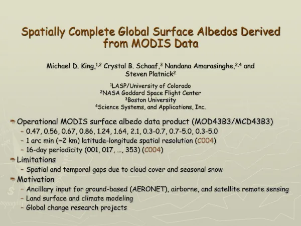
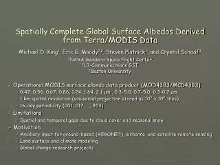
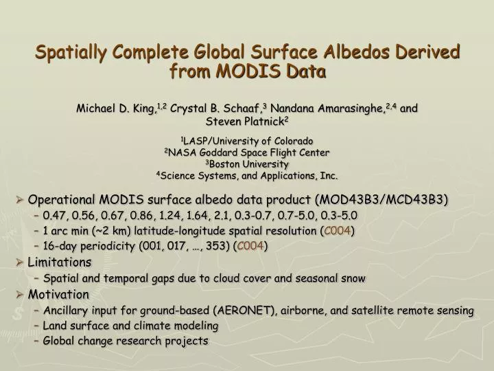
Spatially Complete Global Surface Albedos Derived from MODIS Data. Operational MODIS surface albedo data product (MOD43B3/MCD43B3) 0.47, 0.56, 0.67, 0.86, 1.24, 1.64, 2.1, 0.3-0.7, 0.7 - 5.0, 0.3-5.0 1 arc min (~2 km) latitude-longitude spatial resolution ( C004 )

E N D
Spatially Complete Global Surface Albedos Derived from MODIS Data • Operational MODIS surface albedo data product (MOD43B3/MCD43B3) • 0.47, 0.56, 0.67, 0.86, 1.24, 1.64, 2.1, 0.3-0.7, 0.7-5.0, 0.3-5.0 • 1 arc min (~2 km) latitude-longitude spatial resolution (C004) • 16-day periodicity (001, 017, …, 353) (C004) • Limitations • Spatial and temporal gaps due to cloud cover and seasonal snow • Motivation • Ancillary input for ground-based (AERONET), airborne, and satellite remote sensing • Land surface and climate modeling • Global change research projects Michael D. King,1,2 Crystal B. Schaaf,3 Nandana Amarasinghe,2,4 and Steven Platnick2 1LASP/University of Colorado 2NASA Goddard Space Flight Center 3Boston University 4Science Systems, and Applications, Inc.
Conditioned MOD43B3 Albedo Mapsl = 0.858 µm Moody et al. (2005) 1 arc min (~2 km)
Spatially Complete Albedo Mapsl = 0.858 µm Moody et al. (2008) 1 arc min (~2 km)
New Improvements to Land Surface Albedo(Collection 5) • Enhanced spatial resolution • 30 arc sec (~1 km) latitude-longitude spatial resolution • Based on reprojected averages of the underlying 500 m data • Increased resolution of time sampling • 8-day periodicity (001, 009, 017, …, 361), based on 16-days of observations • Utilizes both Terra & Aqua data for increased number of angular samples • Performed phenological gap-filling on BRDF model parameters • RossThickLiSparse Reciprocal model • Kernel-driven linear model that relies on the weighted sum of an isotropic parameter and two functions (or kernels) of viewing and illumination geometry • Phenology established on a per pixel basis (using 20 months of data – 4 months before and 4 months after a year)
New Improvements to Land Surface Albedo(Collection 5) • Data use high quality results primarily • If there are large stretches of missing data the poorer quality results are considered (but weighted very low) • High quality data are used primarily (replacing temporal data) • Temporal fits are used secondarily • If missing data remains, use regional curves per latitude band and continent • Spatial smoothing fills in remaining gaps • Temporal fits are used secondarily • Data available for 2001,…,2009 completed
Spatially Complete White-sky Albedo Mapsl = 0.858 µm July 12-27, 2004 July 12-27, 2004 0.0 0.2 0.4 0.6 0.8 1.0 Surface Albedo (0.86 µm) Crystal Schaaf 30 arc sec (~1 km)
Spatially Complete Albedo QA Maps July 12-27, 2004 High quality data Spatially smoothed pixels Temporally fitted pixels Spatially fitted pixels between 80°N-90°N Spatially fitted pixels Solar zenith angle between 70° and 82° Two part spatial fitting with temporal averages Crystal Schaaf 30 arc sec (~1 km)
Spatially Complete White-sky Albedo Mapsl = 0.858 µm Moody 16-day – Schaaf 8-day July 12-27, 2004 -0.10 -0.05 0.0 0.05 0.10 Surface Albedo Difference (0.86 µm)
Plans for Cloud Optical Properties(Collection 6) • 1 arc min (~2 km) latitude-longitude spatial resolution • Average 30 arc sec files to reduce file size • Use 8-day periodicity (production rules) • Direct broadcast needs yet to be evaluated • May want to use every other 8-day file (since they are based on 16-days) to reduce the number of files to be served • Extension of gap-filled albedo dataset to solar zenith angle of 81.4° necessary for cloud team, but is beyond angles preferred by Boston University • If we make these files available on the MODIS atmosphere web site (as currently for Moody et al.’s data), we may ’redact’ this extended range • May use a representative year (subject to discussion) • Enables one set of files to be used for both forward processing and reprocessing • Effect of this new gap-filled dataset on cloud optical properties not yet evaluated
Spectral Albedo of Snow • Used near real-time ice and snow extent (NISE) dataset • Distinguishes land snow and sea ice (away from coastal regions) • Identifies snow • Projected onto an equal-area 1’ angle grid • Aggregate snow albedo from MOD43B3 product • Surface albedo flagged as snow • Aggregate only snow pixels whose composite NISE snow type is >90% and flagged as snow in any 16-day period • Hemispherical multiyear statistics • Separate spectral albedo by ecosystem (MOD12Q1) • Results represent ‘average’ snow conditions • Additional sources of variability include snow depth, snow age, grain size, contamination (soot), and, in the case of black-sky albedo, solar zenith angle
Snow Albedo by IGBP EcosystemNorthern Hemisphere Multiyear Average (2000-2004)
Spatially Complete White-Sky AlbedoJanuary 1-16, 2002 Snow-free 0.8 0.6 Surface Albedo (0.86 µm) Snow-covered 0.4 0.2 0.0