Download
1 / 52
610 likes | 914 Views
VERTICAL DATUMS. APRIL 08, 2008 By Ronnie L. Taylor Chief, Geodetic Advisor Branch NOAA, National Geodetic Survey. VERTICAL DATUMS. Local/Regional Assumed City, County International Great Lakes Datum 1955 (IGLD55) International Great Lakes Datum 1985 (IGLD85) National

E N D
VERTICAL DATUMS APRIL 08, 2008 By Ronnie L. Taylor Chief, Geodetic Advisor Branch NOAA, National Geodetic Survey
VERTICAL DATUMS • Local/Regional • Assumed • City, County • International Great Lakes Datum 1955 (IGLD55) • International Great Lakes Datum 1985 (IGLD85) • National • Sea Level Datum 1929 (SLD29) • National Geodetic Vertical Datum of 1929 (NGVD29) (As of July 2, 1973) • North American Vertical Datum of 1988 (NAVD88) (As of June 24, 1993) • Tidal Datums
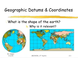
VERTICAL DATUMS What types of heights are there? • Orthometric heights • Ellipsoid heights • Geoid heights
NATIONAL SPATIAL REFERENCE SYSTEM(NSRS) • The National Spatial Reference System (NSRS) is the name given to all geodetic control contained in the National Geodetic Survey (NGS) Data Base. This includes: A, B, First, Second and Third-Order horizontal and vertical control, Geoid models such as GEOID 99, precise GPS orbits and Continuously Operating Reference Stations (CORS), observed by NGS as well as data submitted by other Federal, State, and local agencies, academic institutions and the private sector
NATIONAL SPATIAL REFERENCE SYSTEM(NSRS) • ACCURATE-- CM accuracy on a global scale • MULTIPURPOSE-- Supports Geodesy, Geophysics, Land Surveying, Navigation, Mapping, Charting and GIS activities and derived products • ACTIVE-- Accessible through Continuously Operating Reference Stations (CORS) • INTEGRATED-- Related to International services and standards (e.g. International Earth Rotation and Reference System Service, International GPS Service etc.)
WHAT IS A GEODETIC DATUM? • Geodetic Datum • “A set of constants specifying the coordinate system used for geodetic control, i.e., for calculating coordinates of points on the Earth”* • “[above] together with the coordinate system and the set of all points and lines whose coordinates, lengths, and directions have been determined by measurement or calculation.”* *Definitions from the Geodetic Glossary, September 1986 Characterized by: A set of physical monuments and Published coordinates (horizontal and/or vertical) on the monuments
GEODETIC DATUMS • Classical • Horizontal – 2 D (Latitude and Longitude, e.g. NAD 27, NAD 83(1986)) • Vertical – 1 D (Orthometric Height, e.g. NAVD 88) Contemporary Practical – 3 D (Latitude, Longitude and Ellipsoid Height) Fixed and Stable – Coordinates seldom change, e.g. NAD 83 (1991) Scientific 4 D (Latitude, Longitude, Ellipsoid Height, Velocities) – Coordinates change with time, e.g. ITRF00
VERTICAL CONTROL DATUMS • A set of fundamental elevations to which other elevations are referred. • Datum Types • Assumed – As the name implies • Geodetic – Either directly or loosely based on Mean Sea Level at one or more points at some epoch • (NGVD 29, NAVD 88, IGLD85 etc.) • Tidal – Defined by observation of tidal variations over some period of time • (MSL, MLLW, MLW, MHW, MHHW etc.)
VERTICAL DATUMS OF THE UNITED STATES First General Adjustment - 1899 Second General Adjustment - 1903 Third General Adjustment - 1907 Fourth General Adjustment - 1912 Mean Sea Level 1929 National Geodetic Vertical Datum of 1929 (NGVD 29) North American Vertical Datum of 1988 (NAVD 88)
METADATAData About Data • DATUMS • NAD 27, NAD 83(1986), NAD83 (199X), NGVD29, NAVD88, MLLW, MSL, MHW etc. • UNITS • Meters, U.S. Survey Feet, International Feet, Chains, Rods, Poles, Links, Varas (CA or TX), Smokes, Smoots. • ACCURACY • A, B, 1st, 2nd, 3rd, 3cm, Scaled etc.
METADATA?? Horizontal & Vertical Datums?? Plane Coordinate System ?? Units of Measure ?? How Accurate ??
How Accurate B-Order, 1st-Order, 2cm, 0.01 ft?? Horizontal and Vertical Datums ?? Units of Measure ?? Plane Coordinate Zone ?? METADATA??
NGVD 29 Versus NAVD 88 • Datum Considerations:NGVD 29NAVD 88 • Defining Height(s) 26 Local MSL 1 Local MSL • Tidal Epoch Various 1960-78 • (18.6 years) • Treatment of Leveling Data: • Gravity Correction Ortho Correction Geopotential Nos. • (normal gravity) (observed gravity) • Other Corrections Level, Rod, Temp. Level, Rod, Astro, • Temp, Magnetic, • and Refraction
NGVD 29 Versus NAVD 88 (continued) • Adjustments Considerations:NGVD 29NAVD 88 • Method Least-squares Least-squares • Technique Condition Eq. Observation Eq. • Units of Measure Meters Geopotential Units • Observation Type Links Between Height Differences • Junction Points Between Adjacent BMs
NGVD 29 Versus NAVD 88 (continued) • Adjustments Statistics :NGVD 29NAVD 88 • No. of Bench Marks 100,000 (est) 450,000 (US only) • Km of Leveling Data 75,159 (US) 1,001,500 • 31,565 (Canada) • Published Information: • Orthometric Height Type Normal Helmert • Orthometric Height Units Meters Meters • Gravity Value Normal “Actual”
PRESENT NETWORK FOR NAVD 88 • ORIGINAL LEVELING 700,000 KM • REPEAT LEVELING 200,000 KM • NEW BNA LEVELING 81,500 KM • NEW OUTSIDE LEVELING 20,000 KM • TOTAL FOR NAVD 88 1,001,500 KM • (620,000 MILES)
National Geodetic Vertical Datum 1929(NGVD 29) • Defined by heights of 26 tidal stations in U.S. and Canada • Tide gages were connected to the network by leveling from tide gage staffs to bench marks • Water-level transfers used to connect leveling across Great Lakes • Normal Orthometric Heights: • H* = C / • C = model (“normal”) geopotential number • = from normal gravity formula • H* = 0 level is NOT a level surface
NORTH AMERICAN VERTICAL DATUM 88 • WHAT IS A VERTICAL CONTROL NETWORK? • An Interconnected System of Bench Marks • Each Bench Mark Is Assigned A height Referenced To A Common Surface
VERTCON - Vertical Datum Transformations Published = 4.896 m Difference = 0.000 m / 0.00 ft
HEIGHT SYSTEMS DATUMS • INTERNATIONAL Great Lakes Datum (IGLD) 1985 • Same as NAVD 88, except published in Dynamic Heights • Dynamic Heights • Hdym = C/Go; Go = 980.6199 gals • (Normal gravity at 45 degrees latitude as defined in 1985)
NORTH AMERICA VERTICALDATUM 88 • WHY DO WE NEED A VERTICAL CONTROL NETWORK? • Reduces The Amount Of Future Leveling Required • Enables Surveyors To Check Their New Leveling • Provides Backups For Destroyed Or Disturbed Bench Marks • Assists In Monitoring Changes In Local Areas • Provides A Common Framework
Vertical Datums Vertical Datums • MSL elevation is roughly equivalent to orthometric height (H), the technical name for height above the geoid. • Geoid height (N) is the separation between the geoid and the ellipsoid. It can be plus or minus. • Ellipsoid height (h) is the distance above or below the ellipsoid (plus or minus). Ellipsoid height is also called geodetic height.
h N GEOID 03 Ellipsoid GRS80 Geoid Ellipsoid, Geoid, and Orthometric Heights H = Orthometric Height(NAVD 88) h = Ellipsoidal Height (NAD 83) H = h - N N = Geoid Height (GEOID 03) H TOPOGRAPHIC SURFACE
What is the GEOID? • “The equipotential surface of the Earth’s gravity field which best fits, in the least squares sense, mean sea level.”* • Can’t see the surface or measure it directly. • Modeled from gravity data. *Definition from the Geodetic Glossary, September 1986
High density rocks Low density rocks Level Surfaces and Orthometric Heights Earth’s Surface WP Level Surfaces P Plumb Line Mean Sea Level “Geoid” WO PO Level Surface = Equipotential Surface (W) Ocean Geopotential Number (CP) = WP -WO H (Orthometric Height) = Distance along plumb line (PO to P)
Orthometric Heights • Using Optical or Digital/Bar Code Leveling B Topography A C • Adjusted to Vertical Datum using existing control • Achieve 3-10 mm relative accuracy
NATIONAL TIDAL DATUM EPOCH • A specific 19 year period that includes the longest periodic tidal variations caused by the astronomic tide-producing forces. • Averages out long term seasonal meteorological, hydrologic, and oceanographic fluctuations. • Provides a nationally consistent tidal datum network (bench marks) by accounting for seasonal and apparent environmental trends in sea level that affects the accuracy of tidal datums. • The NWLON provides the data required to maintain the epoch and make primary and secondary determinations of tidal datums.
National Water Level Observation Network (NWLON) 175 Permanent Stations
Falling1-3mm Rising 1-3mm Rising 1-3mm Rising 3-5mm Falling 5+mm Rising 1-3mm Rising 5-10mm
GENERALIZED ACCURACY OF TIDAL DATUMS FOR SHORT SERIES (BASED ON ONE STD DEV) Series East Gulf West Length Coast Coast Coast # Mo FT FT FT 1 0.13 0.18 0.13 3 0.10 0.15 0.11 6 0.07 0.12 0.08 12 0.05 0.09 0.06
NAVD 88 minus LMSL (1960-1978) (units = cm)
MHHW = 10.27 feet (3.130 meters) MHW = 9.83 feet (2.996 meters) Boston Harbor, Massachusetts NAVD88 = 5.51 feet (1.679 meters) Feet MTL = 5.08 feet (1.548 meters) NGVD29 = 4.70 feet (1.433 meters) MLW = 0.34 feet (0.104 meters) MLLW = 0.00 feet (0.000 meters)
Importance of Shoreline AL, AK, CA, CT, FL, GA, LA, MD, MS, NJ, NY, NC, OR, RI, SC, WA Territorial Seas Privately Owned Uplands State Owned Tidelands Contiguous Zone Exclusive Economic Zone State Submerged Lands Federal Submerged Lands 3 n. mi. High Seas 12 n. mi. MHHW 200 n. mi. MHW MLLW Chart Datum Privately Owned State Owned Privately Owned State Owned TX DE, MA, ME, NH, PA, VA
WGS 84, NAD 83 (86) NAVD 88, NGVD 29 MHHW,MHW, MTL, DTL, MLW, MLLW Tidal Datums Vertical Datum Relationships 3-D Datums Orthometric Datums
National Spatial Reference System(NSRS) Consistent National Coordinate System Latitude Longitude Height Scale Gravity Orientation and how these values change with time.