Download
1 / 62
661 likes | 891 Views
Tidal and Geodetic Vertical Datums. Marti.Ikehara@noaa.gov State Geodetic Advisor, NGS National Ocean Service, NOAA Sacramento, CA October, 2005 Workshop. Vertical Control Datums. A set of fundamental elevations to which other elevations are referred. Vertical Datum Types

E N D
Tidal and Geodetic Vertical Datums Marti.Ikehara@noaa.gov State Geodetic Advisor, NGS National Ocean Service, NOAA Sacramento, CA October, 2005 Workshop
Vertical Control Datums • A set of fundamental elevations to which other elevations are referred. • Vertical Datum Types • Assumed – Self-explanatory • Tidal – Defined by observation of tidal variations over some period of time • (MSL, MLLW, MLW, MHW, MHHW, etc.) GeodeticOrthometric– Either directly or loosely based on Mean Sea Level at one or more points at some tidal epoch • (NGVD 29, NAVD 88, IGLD85, etc.)
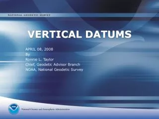
Types of Tides Semidiurnal Tide Mixed Tide Diurnal Tide
IDEALIZED CHANGE OF TIDAL EPOCH 1983-01 EPOCH
NAVD 88 PROGRAM DEFINITION NAVD 88 was an initiative which combined 1.1 million kilometers of leveling surveys in the NGS National Spatial Reference System (NSRS) database into a single least squares adjustment, to provide users with improved heights for over 500,000 vertical control points distributed throughout the United States, on a common datum.
RATIONALE FOR BASIS OF NAVD 88 • IN ORDER TO MINIMIZE THE EFFECTS ON USGS NATIONAL MAPPING PRODUCTS (NMP), AS REQUESTED BY USERS, NGS SELECTED THE NEW INTERNATIONAL GREAT LAKES DATUM OF 1985 (IGLD 85) LOCAL MEAN SEA LEVEL HEIGHT VALUE AS the MINIMUM-CONSTRAINT CONTROL POINT FOR NAVD 88. THE DATUM POINT IS LOCATED AT THE MOUTH OF THE ST. LAWRENCE RIVER IN QUEBEC, CANADA. • USING FATHER POINT/RIMOUSKI AS THE DATUM POINT FOR BOTH IGLD 85 AND NAVD 88 MINIMIZES THE IMPACT ON NMP, AND ALLOWS NAVD 88 TO REPLACE BOTH NGVD 29 AND IGLD 55.
LEVELED NETWORK FOR NAVD 88 • ORIGINAL LEVELING 700,000 KM • REPEAT LEVELING 200,000 KM • NEW NGS LEVELING 81,500 KM • NEW OUTSIDE LEVELING 20,000 KM • TOTAL FOR NAVD 88 1,001,500 KM • (620,000 MI)
NAVD 88 DATUM DEFINITION • Vertical datum based upon an equipotential surface • Minimally constrained adjustment held fixed at Father Point (Point-au-Pere), in Rimouski • 1.1 million km of leveling data used • Heights of 585,000 permanent bench marks estimated • Both orthometric heights and geopotential numbers published
COMPARISON OF VERTICAL DATUM ELEMENTS NGVD 29NAVD88 • DATUM DEFINITION26 TIDE GAGES FATHER POINT IN THE U.S. & CANADA QUEBEC, CANADA • BENCH MARKS100,000 450,000 • LEVELING (Km)102,7241,001,500 • GEOID FITTINGDistorted to Fit Best ContinentalMSL Gauges Model
What is the GEOID? • “The equipotential surface of the Earth’s gravity field which best fits, in the least squares sense, mean sea level.”* • Its surface can’t be seen or measured directly • It is modeled from gravity data *Definition from the Geodetic Glossary, September 1986
Ellipsoid,Geoid,and Orthometric Heights H = Orthometric Height(NAVD 88) h = Ellipsoidal Height (NAD 83) H = h - N N = Geoid Height (GEOID 03) h H TOPOGRAPHIC SURFACE N GEOID 03 Geoid Ellipsoid GRS80
Geodetic Control Networks Northern California CaltransObservations Leveling Hwy 20
NATIONAL TIDAL DATUM EPOCH • A specific 19 year period that includes the longest periodic tidal variations caused by the astronomic tide-producing forces. • Averages out long term seasonal meteorological, hydrologic, and oceanographic fluctuations. • Provides a nationally consistent tidal datum network (bench marks) by accounting for seasonal and apparent environmental trends in sea level that affects the accuracy of tidal datums. • The NWLON provides the data required to maintain the epoch and make primary and secondary determinations of tidal datums.