Download
1 / 27
270 likes | 293 Views
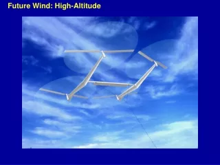
High Altitude Redesign (HAR) CRWG Meeting. April 29, 2004. Content. HAR Phase 1 Functions Expansion Plans Propagation of HAR Functionality Airspace – Traffic Management Cooperation Customer Outreach. Phase 1 “Roll out”. May 15, 2003.

E N D
High Altitude Redesign(HAR)CRWG Meeting April 29, 2004
Content • HAR Phase 1 Functions • Expansion Plans • Propagation of HAR Functionality • Airspace – Traffic Management Cooperation • Customer Outreach
Phase 1 “Roll out” May 15, 2003 - Web access to ATCAA locations and SUA/ATCAA schedules - Waypoints published for ATCAA/SUA Avoidance Charting Waypoints July 10, 2003 Chart “Q” Routes • Initial 11 Q routes published Sept 4, 2003 • “Improved Web site – additional future upgrades Sept. 23, 2003 • Initiate use of Q Routes • Initiate NRR (PTP) June 10, 2004 Chart NRS Waypoints • Full HAR with NRR • PTP for database limited A/C August 5, 2004 • Q Routes – Adv. RNAV A/C
Phase 1 -Mitigating Impact of SUA/ATCAA • Waypoints near SUA/ATCAA • Available for flight planning • Being used to tactically reroute aircraft • SUA/ATCAA Website (http://sua.faa.gov) • Redesigned website operational • Improvements being routinely made • Data accuracy issues being addressed • National look at local data surfacing inconsistencies • Verifying data in comparison to NFDC baseline • Reporting of schedule data being worked with “MILOPS” organization
SUA/ATCAA Website: Graphic Depiction All Areas, including Restricted / Prohibited and not scheduled Altitude Filtered FL-290 – 600 Scheduled Active within 8hrs
SUA/ATCAA Website: Avoidance Waypoints Salt Lake Center area w/waypoints
SUA/ATCAA Website: Area information Cursor “click” Readout Cursor “roll over”
“Q” Routes • Routes not being flight planned by customers • Lifting of GNSS restriction linked to “FMS base line” efforts that is expected for August 5, 2004 chart • Enabled by DME-DME use and limited FMS “coasting” • Expect most routes to be useable at FL290 and above • Considering FL240 capability for Q1-5 • Use below “HAR Airspace” are “local facility” decisions • Equipage standards expected soon identifying who can use Q Routes • Changes to coincide with GNSS restriction being lifted • Work continues on route design standards - how close to other routes or airspace? • Currently using 4 miles either side of center-line width and from adjacent airspace • Radar procedures to ensure aircraft separation
“Q” Routes (con’t) • Widespread customer use of Q routes is key to realizing system benefits, especially in “high density” airspace, such as in expansion areas • May not implement all designed routes if space needed to accommodate non-conforming traffic flows • RNP separation standards work to start in FY-05
Non-Restrictive Routing (NRR) • Issues: • Limited use • Dispatcher familiarity • Perceptions and attitudes • Flight planning flexibility vs. NRP • HAR workshop at CDM CR meeting - PHX • Good opportunity to interact with customers • Initial discussions provided insight into customer concerns • Airspace design teams eager to address concerns • Meeting held at ATCSCC, 2/25-26 concerning aircraft entering HAR airspace from the east • Agreement among attendees • Further work needed to refine pitch line in ZMP area • Follow-up needed with non-participants
NRR (con’t) • Follow-up activities: • ZME wanted pitch line for 36 degrees latitude farther north • ZMP pitch boundary variance from HAR norm under discussion • Developed proposed AFD changes • Awaiting resolution of above • Continued analysis of pitch/catch points • Flight planning proximity • Hours of need • Considering time dependent pitch/catch applications • Advised customers that Increased flexibility may reduce predictability that route filed is route flown • Proposed to RTCA AWG process for routine interaction with flight planner / dispatcher community
Navigation Reference System (NRS) • NRS charting is 6/10/2004 • Initial 7 Center area • NFDD issued – 470 waypoints • Controller training underway • Informational video to all ATC facilities • Supplemental information for facilities with NRS waypoints or adjacent to them • Operational phase-in planned • Planning tactical application initially to only those aircraft that flight plan NRS waypoints • Waypoint use below HAR altitudes is at controller option
Waypoint Naming Convention KD5 4U Longitude Increment FIR FIR Subset e.g., Center ID Latitude Increment
Phase 1 Expansion • Expansion activities planned around RVSM • RVSM airspace analysis progressing well • Provided opportunity to restart expansion work earlier than last presented • Implementation targeted -post RVSM • Targeting first geographic expansion (5/12/05): • Airspace: • West of Mississippi: ZLA, ZAB, ZFW, ZHU, ZME • Florida departures/arrivals - to/from the west: ZJX, ZMA • Initial design complete (FL350 floor altitude) • Reviewing design based on RNAV and Q Route capabilities • Planning flight planner / dispatcher forums following design review and after modeling
Phase 1 Expansion (con’t) • Lowering HAR airspace floor • Governing principle - Common floor across HAR airspace • Eventual goal – FL290 and above • May not be realizable until later phases • Expansion to Great Lakes Corridor and Northeast linked to NY redesign • Pursuing early implementation of SUA/ATCAA waypoints and NRS
Propagation of HAR Functionality • Exploring early propagation of some HAR functions to additional airspace: • “Mitigating impacts of SUA/ATCAA on civil aviation”: • Place existing “avoidance” waypoints on: • Low (L) IFR Charts • VFR Sectional Charts • Establish waypoints near other SUA/ATCAAs which “top” below initial HAR airspace • Early implementation throughout rest of country • Website already designed for “all altitudes” • Navigation Reference System (NRS) • Use of waypoints in all altitude environments • Early implementation throughout rest of country • Rethinking “first source” when creating new waypoints • Consistency during initial implementation
Airspace - Traffic Management Cooperation • Strong support from senior management to improve organizational relationships • Need to ensure customers hear a consistent message from airspace and TFM communities • DRVSM Airspace Analysis “model” is effective • Facility traffic management and ATCSCC participation in major inter-facility meetings • Increased NAR involvement in customer traffic management forums • Commitment of MTO’s, ATCSCC and HAR to work closer together • Need to ensure involvement at all levels • Need good communications flow across and up/down organizations
Customer Interaction • Forum / process needed for customer review of: • SUA/ATCAA Website • NRR pitch / catch points • Expansion airspace designs • Information needed on timeline and method for pilot / dispatcher training • HAR - in general • Q Routes • NRR • NRS
SUA/ATCAA (con’t) Website changes to date: • General and Home Page : • Cosmetic changes for consistency and clarity • Add “Site Best Viewed at 1024x768 Resolution” • Add “What’s New” link on this page • Add “Help” button & provide content (user guide) • Grayed out disabled functions • Map • Depict Center boundary as default setting • Improve consistency with TFR site • Filtering by Flight Level • Provide “area readout window” via mouse “click” • “Get Info” default to preclude unwanted resizing • Listing • Click the Column Heading to Sort by that Column” • List areas by Center vs. State • Filter out duplicate listings • Data • Improve correlation of MILOPS and NFDCC databases • Include restricted and prohibited airspace • Indicate data “age”
SUA/ATCAA (con’t) Website changes planned: • General and Home page • Additional “Help” content • Performance enhancements • Capability to download active area data • Other? – user suggestions? • Map • Depict waypoints only when associated areas active • Change waypoint symbol (Match Charts). • Implement cache buffer for initial (default) map • Data • Additional database accuracy correlation • Provide ‘MILOPS’ with exception log.
NRR (con’t) • Fundamental agreement with affected Centers for flights entering HAR from east: • “Westbound traffic originating outside of HAR airspace may begin NRR after meeting one of the following conditions: -At 86 West Longitude when north of 36 North Latitude and south of 44 North Latitude (except no westbound traffic between PMM and GSH); or -At 36 north Latitude when west of 86 west Longitude and East of 95 West Longitude; or -Over any of the following pitch points, listed from north to south: DLH or CESNA or GEP or BAE or MKG or GRR or PMM or GSH or CADIZ or FWA or VHP or FLM or IIU or SGF or RZC or BNA or VUZ” Expect same procedures at FL350 • Subject to modeling during vertical expansion efforts