Download
1 / 30
330 likes | 463 Views
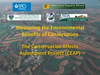
Conservation Effects Assessment Project (CEAP). Measuring the Environmental Benefits of Conservation Managing the Agricultural Landscape for Environmental Quality. Why CEAP?. OMB requests for outcome-based reporting

E N D
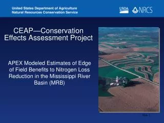
Conservation Effects Assessment Project(CEAP) Measuring the Environmental Benefits of Conservation Managing the Agricultural Landscape for Environmental Quality
Why CEAP? • OMB requests for outcome-based reporting • 2002 Farm Bill significantly increased conservation funding call from both inside and outside government for better accountability • Assessment is needed to guide development and implementation of future conservation programs
Overview of CEAP • Watershed case studies (43) • National Assessment • Cropland • Wildlife • Wetlands • Grazing Land
CEAP Highlights… • Blue Ribbon Panel review • National Agricultural Library bibliographies • Cropland (set of 5) • Wetlands • Grazing Lands • Wildlife • Literature Syntheses on Practice Effects—What is Known and Not Known • International Workshop on Managing Agricultural Landscapes For Environmental Quality—Strengthening the Science Base (Oct 2006)
Cropland National Assessment-- Goals • Estimate the benefits of conservation practices currently present on the landscape • Estimate the need for conservation practices and the benefits that could be realized under “full treatment” • Simulate alternative options for implementing conservation programs on cropland
Schematic for Construction of the National Assessment Onsite (field-level) Effects Field-level modeling APEX Farm survey data at NRI-CEAP sample points Off-Site Water Quality Effects Watershed modeling SWAT
Primary Sample Unit (PSU) Points Statistical Design
Activities for Construction of the CEAP Current Condition. Collect: 1. Farm survey (NASS) 2. NRI point attribute data 3. Field office records: NRCS/FSA 4. Historical weather data Select subset of NRI sample points 20,000 cropland 10,000 CRP Setup data for site specific simulations Soil Data NASIS Field-level modeling (APEX) CEAP Current Condition, onsite estimates Refine APEX model
NRI-CEAP Cropland Survey The survey obtains for each sample point: • Three years of crop and cropping practice information • Crops grown, seeding rates, etc. • Nutrient applications, including manure • Pesticide applications and pest management practices • Field operations, including tillage • Irrigation practices • Conservation practices • Conservation Program participation
NASS Farmer Survey • 44 pages • Covers all aspects of crop production for 3 years. • Tillage • Fertilizers and manures • Pesticides • Irrigation • Conservation
APEX Model • Daily weather—47-year simulation using actual weather for 1960-2006. • Hydrology • Erosion • Nutrient cycling • Carbon cycling • Pesticide fate • Soil characteristics (temperature, bulk density, etc.) • Crop growth • Tillage and management operations • Field-to-field routing used to simulate field borders, buffer strips
Hydrologic Balance Evaporation and Transpiration Precipitation Surface Runoff Root Zone Infiltration/plant uptake Lateral Flow Vadose (unsaturated) Zone Percolation to shallow aquifer Shallow (unconfined) Aquifer Return Flow Confining Layer Deep percolation
Modeling Strategy • Estimate a CEAP Baseline using farmer survey information at NRI sample points • Construct an alternative scenario assuming “no practices” Difference between these two scenarios represents the benefits of the accumulation of conservation practices currently in place.
Microsimulation Modeling Thus, the resulting simulation model … • Captures the diversity of land use, soils, climate, and topography as represented by the NRI, and diversity of human behavior as represented in the NRI-CEAP survey. • Estimates the loss of materials at the field scale where the process model performs the best, using site-specific information. • Provides a statistical basis for aggregating results to the national and regional levels.
SWAT : Off-Site Effects Point Sources Non-Cultivated Lands APEX Cultivated Fields Channel/Flood Plain Processes
Water • USLE • USLE modifications • MUSLE • Onstad-Foster • RUSLE • RUSLE 2 • Wind • Manhattan, KS with Bagnolds energy equation EROSION
Nitrogen • Surface runoff • soluble and adsorbed • Subsurface flow • lateral and vertical • Mineralization • Immobilization • Denitrification • Volatilization • Nitrification • Crop uptake NUTRIENTS
Phosphorus • Surface runoff • soluble and adsorbed • Leaching • Mineralization • Immobilization • Adsorption-desorption • Crop uptake NUTRIENTS
PESTICIDE FATE GLEAMS • Surface runoff • soluble and adsorbed • Leaching • Degradation • from foliage and soil • Washoff from plants • rainfall or irrigation
APEX • Management capabilities • Irrigation • Drainage • Furrow diking • Buffer strips • Terracing • Waterways • Fertilization • Manure management • Lagoons • Reservoirs • Crop rotation and selection • Pesticide application • Grazing • Tillage
Water • Overland flow • Channel • Floodplain • Sub-surface • Sediment • Modified Bagnolds stream power • Deposition – degradation • Overland flow • Channel • Floodplain ROUTING COMPONENT
Nutrients and pesticides • Soluble materials considered conservative • Adsorbed materials sediment transported • Enrichment ratio concept ROUTING COMPONENT
SUBAREA FILE • Management • Daily weather • Soil • Channel parameters • Depth • Width • Length • Slope • Reservoir parameters • Spillway elevation • Runoff volume • Release rate • Surface area
INPUT DATA • Data Files Residing with Model • Weather • Tillage • Fertilizer • Soil • Pesticide • Management • Crop Growth Parameters
RECENT APEX APPLICATIONS • CEAP – Conservation Effects Assessment Project • National assessment of the effects of conservation practices on cultivated cropland across the U.S. Distribution of APEX testing sites across the U.S. that were used in the CEAP sensitivity analysis