Download
1 / 35
350 likes | 462 Views
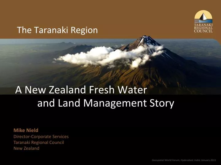
The Taranaki Region. A New Zealand Fresh Water and Land Management Story. Mike Nield Director-Corporate Services Taranaki Regional Council New Zealand. Geospatial World Forum, Hyderabad, India, January 2011. Introduction. New Zealand A world-leading agriculture-based economy

E N D
The Taranaki Region A New Zealand Fresh Water and Land Management Story Mike NieldDirector-Corporate ServicesTaranaki Regional CouncilNew Zealand Geospatial World Forum, Hyderabad, India, January 2011
Introduction New Zealand • A world-leading agriculture-based economy • One of the world’s biggest and most efficient dairy producers. Taranaki • A region of intensive agriculture, specifically dairy farming, on the West Coast of the North Island.
The Taranaki region • Mt Taranaki dominates the region’s landscape. • Temperate climate. • Volcanic ash soils. • Over 300 rivers emanate from the forested mountain and water these rich agricultural soils.
Our economy • Dairying makes a significant contribution to New Zealand’s economic and social well-being. • New Zealand produces about 2% of total world dairy production. • Taranaki is one of New Zealand’s leading dairying regions.
Our economy Dairy farming covers most of the ring plain around the mountain • 1,870 dairy herds with 480,000 dairy cows. • Dairying results in diffuse (widespread) source discharges to our waterways. • Need to avoid, remedy and mitigate impacts on water quality.
Voluntary riparian programme • Council promotes and supports landowners to plant and fence waterways. • Significant investment by the Council and the farming community. • Effective riparian management requires active management and ongoing commitment from landowners. • The largest community-planting scheme in NZ.
Regional council responsibilities • Council is responsible for the control of water and land and the control of discharges of contaminants into the environment. • Often no absolute answers to environmental problems – involves community value judgments. • Tailored solution for Taranaki’s issues.
The solution Riparian Management Programme • A long-running voluntary programme. • Council supports farmers to fence and replant riparian margins on the ring plain. • Property specific riparian plans are prepared. • Low-cost riparian plants supplied. • Ongoing advice and assistance provided.
Riparian plans • Prepared by Council at no cost and no obligation to landowner. • Tailored to the needs of the property. • Plan includes • aerial map with GIS layers highlighting recommended work • planning and budgeting tables.
Pre-GIS • Production of maps and plans was slow and labour intensive. • 279 plans produced up to 2001. • No way to monitor implementation of plans. • Needed to automate the process to cover all 1,800 farms in an acceptable timeframe. • 1,955 plans prepared since 2001.
The solution • Developed GIS application in partnership with Explorer Graphics Ltd, (EGL) who are part of the NorthSouth GIS Group. • Automated production of riparian plans and then monitoring implementation and reporting on achievement of riparian management. • GIS application was implemented using technology from Esri.
The GIS application • Riparian plan production and reporting is consolidated with a comprehensive farm land management application. • A complete solution for farm management. • Delivered as ArcGIS (ArcView) ArcMap extension • “Land Management Application” (LMA) GIS toolbar and LMA GIS menu items. • Council land management officers access necessary functions for operational use via LMA GIS Toolbar or LMA menu item in ArcMap.
Reporting • Status of farm plan production is available as a layer in the corporate Intranet GIS application. • Used for executive management reporting and strategic planning.
Results • 1995 to 2001 - 279 plans prepared. • Since 2001 - 1,955 plans prepared. • Farm management and riparian plan production now largely completed. • Focus is now on implementation and monitoring. At 30 June 2010 landholders had • fenced 1,383 kilometres of stream bank • planted 769 kilometres of stream banks • 68% of stream banks are fenced and 59% of stream banks are planted (includes existing).
Benefits • The riparian programme is a national leading-edge water quality and farm management programme for New Zealand. • Water quality is stable or improving on all significant watercourses in the region. • Continuing intensification of the dairy industry. • Move to larger farms for dairy production. • Higher stocking rates.
Progress • At 30 June 2010 - 2,334 plans prepared covering 95% of dairy farms. • Plan preparation largely completed and focus is on the implementation of plans. • Landowners are slowly but surely implementing the plans. • Since 1996 over 1.9 million plants have been supplied.
Progress since 2004/2005 • Council has monitored the implementation of riparian plans. • Over the last five years, plan holders have • fenced 1,014 kilometres of stream bank • planted 613 kilometres of stream bank. • 8,001 km of stream banks are now fenced • 68% of total covered by riparian plans. • 5,094 kilometres of stream banks are protected by vegetation (existing or newly planted) • 59% of total length relevant for planting.
The riparian programme personifies the good business practice model – the “should do, can do, people want” success formula. Good business practice model
Good business practice model First stage • Idea about what we should do. • Developed and tested the idea of the riparian management programme via policy Second stage • Gained support of others for the riparian management programme. Third stage • Provide the capacity for the Council to deliver • Professional staff • Appropriate systems and technological support
Conclusion Council’s riparian management programme leads the way in addressing an increasingly important issue for New Zealand. • How to ensure our agricultural industries, which are vital to our economic and social wellbeing, promote the sustainable management of our resources.
Conclusion • The riparian management programme is a large-scale voluntary programme that is transforming the Taranaki landscape. • It cannot be delivered by the Council on its own. • Riparian management requires active and ongoing management and commitment from landowners with support from industry and the wider community.
Conclusion • The Council’s approach has been proactive and innovative. • Council has applied critical success factors of successful organisational strategy to • obtain buy-in to the programme • gain agreement on roles and responsibilities • maintain capacity to deliver.
Questions Mike Nield Email: mike.nield@trc.govt.nz Phone: 0064 6 765 7127 Mobile: 0064 274 549 120 Geospatial World Forum, Hyderabad, India, January 2011