Download

1 / 7
70 likes | 264 Views
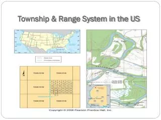
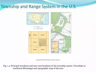
How to Find Township, Range and Section. Tool for investigating Public Land Survey Location. Purpose.

E N D
How to Find Township, Range and Section Tool for investigating Public Land Survey Location
Purpose • Many times air photos are listed by PLS designation (this is certainly the case for Bellingham). To discover the air photo that covers a certain location it is necessary to first find the Township Range and Section identifier. The internet program described below does just that,
Go to Web Site • http://www.geocommunicator.gov/blmMap/Map.jsp?MAP=OG • Zoom into location where PLS data desired using the aerial or road view (lower right corner to change between). • Then switch to the base view to determine the correct Township, Range and Section identity (see next pages for example)
Originator: p. buckley, 6/12/2012 contact: patrick.buckley@wwu.edu