Download
1 / 23
230 likes | 330 Views
Early Successes El Nino –Southern Oscillation and seasonal forecasting. David Anderson, With thanks to Magdalena Balmaseda, Tim Stockdale. Summary.

E N D
Early SuccessesEl Nino –Southern Oscillation and seasonal forecasting David Anderson, With thanks to Magdalena Balmaseda, Tim Stockdale.
Summary • Pre TOGA, the 1982/3 El Nino was not well predicted. In fact, the opposite a non El Nino was predicted, reflecting a lack of understanding and a shortage of observations. • Improvements in observation coverage as a result of TOGA and improvements in models have lead to better analyses and more reliable forecasts. • Improved meteorological reanalyses can lead to improved ocean analyses and forecasts. • There is a large scatter in ocean analyses, partly because of analysis deficiencies but partly because of lack of observations. • Future model developments will lead to greater extraction of information from past observations. But, if there are insufficient data, there will always remain uncertainty, perhaps of vital quantities. • There is skill in predicting the Indian ocean as well as the Pacific, but there is less skill in predicting the evolution of SST in the tropical Atlantic
SST, as analysed in Nov 1982.A major El Nino is clearly in progress Contour Interval 0.5C Would not have been available until Dec 82 or Jan 83
No El Nino • "To call this event an El Nino would be a case of child abuse.“ Klaus Wyrtki, October 1982 • Some SST observations were high but no build up of sea level in the west Pacific by stronger trade winds and no high SSTs along South American coast- thought to be necessary precursors. • Ship Observations that the thermocline was 50- 100m deeper than normal set the alarm bells ringing. Nov 1982 Toole and Borges 1984. • McPhaden et al J Geophys Res. TOGA volume 1998.
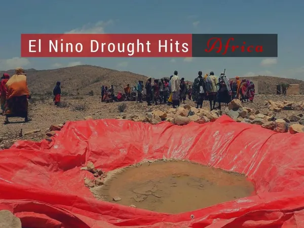
82-83 1982-83 El Niño: • Strongest of the 20th century up to that time • Not predicted (no forecast models) • Not detected until nearly at its peak--satellites biased cold by El Chicon • No real-time in situ data El Chichon, Mexico March 1982 From Mike McPhaden
SST as analysed May 82 Upper, Oct 82 lower A hint of El Nino is present even in May 82 but was not appreciated.
TOGA(Tropical Ocean Global Atmosphere) • The failure to alert the community to the 82/3 El Nino lead scientists, lead by Adrian Gill, to develop the TOGA programme. • A key component of the TOGA observing system was the development of first the XBT, and tide gauge network and then the TAO array. • TOGA brought a major change in the way oceanographers worked. Data was to be made freely available as quickly as possible, like in meteorology. • It is still amazing that from my office, I can see instantly what is happening in the subsurface tropical Pacific ocean, one of the remotest spots on earth.
Typical receipt and use of observations in the ECMWF monthly and seasonal forecast systems Coverage 2009
Coverage 1999 19990421 Note the TOGA TAO array. See McPhaden et al J Geophys Res TOGA review issue 1998
Coverage 1989, 1979 19890423 19790416
Global Sea Level Observing System (GLOSS) Tide gauges were part of the first observing system for TOGA. Klaus Wyrtki They were also used for validation but are less used now on monthly timescales as altimetric sea-level data are assimilated. They are useful for other purposes, however.
Nino regions Frequently used regions for studying El Nino
ECMWF forecasts (CLIVAR) Looks like success but not quite as good as it seems
Chaos in SST Two forecasts of the 97 El Nino, made from small perturbations in ocean initial conditions in Dec 96.
Forecast improvement over the last 16 years, from better models, better data, better analyses.From Balmaseda, Stockdale
Pre/post 1993Note the rms error is lower in the more recent period, even though the skill of persistence and ensemble spread are about the same, suggesting the improved skill results from better analyses as a result of better data coverage. From Stockdale et al 2009, ECMWF Seasonal Forecasting System 3 and its prediction of SST.From
Impact of ocean observations on forecast skill (ECMWF-S3) Reduction (%) in SST forecast errorRange 1-3 months NINO-W EQATL STIO WTIO EQ3 In Central/Western Pacific, up to 50% of forecast skill is due to atmos+ocean observations. Synergy: > Additive contribution Ocean~20% Atmos ~25% OC+ATM~55% From Balmaseda and Anderson GRL, Jan 2009 Wednesday talk by Balmseda
Ops 2002/3 Ops 1980 Ops 1980 Ops 1980 Ops 2001 Ops 2001 ERA 2001 ERA 2001 Anomaly correlations of 500hPa height forecasts Northern Hemisphere % ERA 40 (ECMWF Reanalysis) See Uppala et al QJRMS 2005
Progress also depends on the quality of the atmospheric analyses The quality of the initial conditions is not always the limiting factor on the skill ERA15/OPS S2 NOdataS2 Assim ERA40/OPS DEM NOdata DEM Assim Magdalena Balmaseda See also her talk on Wednesday
Temperature and salinity in the Nino3 region as analysed by several different models as part of ENACT. See Balmaseda, Clivar GSOP, Reading 2006 for more examples. GSOP- Stammer.
Summary • There has been substantial progress over the years in seasonal climate prediction, some of it coming from model development, some from better use of the data and some from greater observation coverage. • We should never again fail to detect EL Nino but it is not clear that key signals of impending decadal variability could not be missed. RAPID_WATCH in the N Atlantic and global ARGO should help but better understanding of key processes is still needed, supported by better observing systems, to identify key regions. • Meteorological experience suggests that, as models and data assimilation systems improve, greater information can be extracted from past observations. But if key observations are not made, we can not go back to recreate them. Better to have some redundancy than a deficit. • Ocean analyses are currently ‘all over the place’ with respect to some variables, at least in part because there are insufficient data to constrain the analysis sufficiently. If the region or variable isn’t key, then that is not necessarily a problem but if it is, then it is a big concern. Ignorance is still a major challenge. • Improvements in ocean analyses are linked to improvements in atmospheric analyses. There might be merit in coupled analyses, but this is very much in its infancy.
I think at operational centres such as ECMWF, Met Office, NCEP,…all forecasts should be made with a coupled system. The resolution should be high for shorter range, daily, weekly, monthly but could be lower for longer range. • Salinity sensors such as SMOS, AQUARIUS should help with salinity problems. • Progress is likely to come from model development, improved analysis as well as more data. Progress is likely to be incremental rather than dramatic. • Shorter range forecasts need higher resolution but less deep measurements. • Ocean reanalyses are likely to be valuable products in their own right, not just as initial conditions for forecasts. (The Uppala et al paper on ERA-40 (QJRMS 2005) is one of the most cited papers in Geosciences. )