Download

1 / 62
850 likes | 2.13k Views
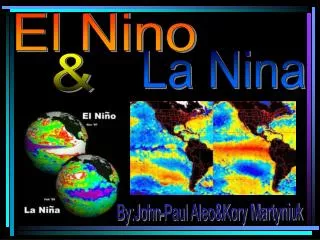
El Nino & La Nina. Contents. Introduction What is El Niño ? What is La Niña ? El Niño and La Niña Years Recent Event (1997-1998 Event) Today’s El Niño and La Niña information What are typical global climate effects? Various impacts of El Niño and La Niña

E N D
Contents Introduction • What is El Niño ? • What is La Niña? • El Niño and La NiñaYears • Recent Event (1997-1998 Event) • Today’s El Niño and La Niñainformation • What are typical global climate effects? • Various impacts of El Niño and La Niña • Forecasts, Detection and Prediction Conclusion
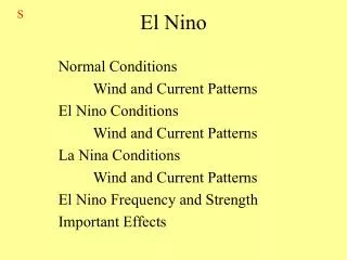
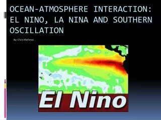
Introduction • El Niño refers to the large-scale ocean-atmosphere climate phenomenon linked to a periodic warming in sea-surface temperatures across the central and east-central equatorial Pacific. El Niño originally referred to an annual warming of sea-surface temperatures along the west coast of tropical South America. • La Niña refers to the periodic cooling of ocean surface temperatures in the central and east-central equatorial Pacific. La Niña originally referred to an annual cooling of ocean waters off the west coast of Peru and Ecuador.
What is El Niño? • El Niño is a disruption of the ocean-atmosphere system in the tropical Pacific having important consequences for weather around the globe. • Among these consequences are increased rainfall across the southern tier of the US and in Peru, which has caused destructive flooding, and drought in the West Pacific, sometimes associated with devastating brush fires in Australia. Observations of conditions in the tropical Pacific are considered essential for the prediction of short term (a few months to 1 year) climate variations.
Quick facts about El Niño • The phrase "El Niño" refers to the Christ Child and was coined by fishermen along the coasts of Ecuador and Peru to describe the warm ocean current that typically appeared around Christmas time and lasted for several months. • El Niño is the second largest driver of the world's weather, second only to normal seasonal warming and cooling, which also brings changes in precipitation patterns. • El Niños appear approximately every two to seven years. They typically last 12 to 18 months. In the early 1990s, a protracted El Niño persisted for four years.
El Niños have been documented since the early 1700s. More detailed observations from ships led to instrumental record keeping in the earlier half of this century. It is only since the 1970s, however, that scientists began linking El Niño to massive flooding and severe droughts around the world. • About every four to five years, a pool of cooler-than-normal water develops off South America. The effects of this cooler water are called La Niña. This usually brings colder winters to the Canadian west and Alaska and drier, warmer weather to the American southeast.
Brief history, and the origin of El Niño terms • For hundreds of years (the first available record dates 1567), South American fishermen have noticed the appearance of warm waters in the eastern Pacific Ocean along the coast of Ecuador and Peru. As the phenomenon typically becomes apparent around Christmas, the name "El Niño", or the Christ Child was eventually bestowed.
Noticing that as pressure rises in the east, there is typically an accompanying decrease in the west, with the reverse also true, he coined the term Southern Oscillation to categorize his find. • Further study led to the realization that Asian monsoon seasons under certain barometric conditions were often linked to drought in Australia, Indonesia, India, and parts of Africa and mild winters in western Canada.
Not until the late 1960s did a Norwegian meteorologist, Jacob Bjerknes, a professor at the University of California, establish the connection between the changes in sea surface temperatures and the weak winds from the east and heavy rainfall that accompany low pressure conditions. • Ultimately, Bjerknes' discovery led to the recognition that the warm waters of El Niño and the pressure variance of Walker's Southern Oscillation are interrelated, leading to the full naming of the phenomenon as : "El Niño Southern Oscillation(ENSO)".
Why El Niño occurs? • El Nino is thought to occur due to changes in the normal patterns of trade wind circulation. Normally, these winds move westward, carrying warm surface water to Indonesia and Australia and allowing cooler water to upwell along the South American coast. For reasons not yet fully understood, these trade winds can sometimes be reduced, or even reversed. This moves warmer waters toward the coast of South America and raises water temperatures. Warmer water causes heat and moisture to rise from the ocean off Ecuador and Peru, resulting in more frequent storms and torrential rainfall over these normally arid countries.
Normal conditions El Niño conditions Comparison of Normal and El NiñoConditions
What is La Niña? • La Niña is characterized by unusually cold ocean temperatures in the Equatorial Pacific, compared to El Niño, which is characterized by unusually warm ocean temperatures in the Equatorial Pacific.
Quick facts about La Niña • The phrase "La Niña" is spanish for "the girl" and sometimes called "El Viejo" (old man). It is characterized by unusually cold ocean temperatures in the equatorial Pacific. In comparison, El Niño is characterized by unusually warm ocean temperatures in the Equatorial Pacific. • La Niñas appear approximately every 4-5 years. They typically last 1-2 years. • Global climate abnormalities of La Niña are less pronounced and in some areas tend to be the opposite of those associated with El Niño. However, the effects of La Niña are not always opposite to that of El Niño.
After an El Niño, the climate does not always swing to a La Niña phase. There have been only 17 moderate to strong La Niñas compared to 25 moderate to strong El Niños since the turn of the century. • La Niña is a natural phenomenon in the climate system and have been occurring for centuries. Detailed observations from ships led to systematic instrumental record keeping in the earlier half of this century.
It is believed that La Niña's cooling of the equatorial Pacific tend to favour hurricane formation in the western Atlantic. In contrast, El Niño conditions tend to suppress the development of tropical storms and hurricanes in the Atlantic, but increase the number of tropical storms over the eastern and central Pacific Ocean. • La Niña usually brings colder winters to the Canadian west and Alaska, and drier, warmer weather to the American southeast.
Brief history of La Niña terms • La Niña, meaning the little girl, names the appearance of cooler than normal waters in the eastern and central Pacific Ocean. Sometimes called El Viejo, anti-El Niño, or simply "a cold event", it is the antithesis of El Niño. • At the turn of this century, a connection between La Niña, El Niño, and other weather patterns had yet to be established. During the 1920s, the head of the Indian Meteorological Service, Sir Gilbert Walker, recognized patterns to the rainfall in South America. His discovery led him to theorize additional associations with the change in the ocean temperatures, and with atmospheric pressure changes measured at stations at different parts of the Pacific (Darwin, Australia, and Tahiti).
Noticing that as pressure rises in the east, there is typically an accompanying decrease in the west, with the reverse also true, he coined the term Southern Oscillation to categorize his find. • Further study led to the realization that Asian monsoon seasons under certain barometric conditions were often linked to drought in Australia, Indonesia, India and parts of Africa, and to mild winters in western Canada.
Not until the late 1960s did a Norwegian meteorologist, Jacob Bjerknes, a professor at the University of California, establish the connection between the changes in sea surface temperatures and the weak winds from the east and heavy rainfall that accompany low pressure conditions. • Ultimately, Bjerknes' discovery led to the recognition that the warm waters of El Niño (with the often cool waters of La Niña) and the pressure variance of Walker's Southern Oscillation are interrelated, leading to the full naming of the phenomenon as : "El Niño Southern Oscillation (ENSO)".
Why La Niña Occurs? • La Niña is thought to occur due to increases in the strength of the normal patterns of trade wind circulation. Under normal conditions, these winds move westward, carrying warm surface water to Indonesia and Australia and allowing cooler water to upwell along the South American coast. For reasons not yet fully understood, periodically these trade winds are strengthened, increasing the amount of cooler water toward the coast of South America and reducing water temperatures.
Normal conditions La Niña conditions Comparison of Normal and La Niña Conditions
The increased amount of cooler water toward the coast of South America, causes increases in the deep cloud buildup towards southeast Asia, resulting in wetter than normal conditions over Indonesia during the northern hemisphere winter. • The changes in the tropical Pacific are accompanied by large modulations of the jet stream within the middle latitudes, shifting the point at which the stream normally crosses North America. The shifted jet stream contributes to large departures from the normal location and strength of storm paths. The overall changes in the atmosphere result in temperature and precipitation anomalies over North America which can persist for several months.
El Niño and La Niña Years • El Niño (Spanish name for the male child), initially referred to a weak, warm current appearing annually around Christmas time along the coast of Ecuador and Peru and lasting only a few weeks to a month or more. Every three to seven years, an El Niño event may last for many months, having significant economic and atmospheric consequences worldwide. During the past forty years, ten of these major El Niño events have been recorded, the worst of which occurred in1997-1998. Previous to this, the El Niño event in 1982-1983 was the strongest. Some of the El Niño events have persisted more than one year.
In the tropical Pacific, trade winds generally drive the surface waters westward. The surface water becomes progressively warmer going westward because of its longer exposure to solar heating. El Niño is observed when the easterly trade winds weaken, allowing warmer waters of the western Pacific to migrate eastward and eventually reach the South American Coast (shown in orange). The cool nutrient-rich sea water normally found along the coast of Peru is replaced by warmer water depleted of nutrients, resulting in a dramatic reduction in marine fish and plant life.
In contrast to El Niño, La Niña (female child) refers to an anomaly of unusually cold sea surface temperatures found in the eastern tropical Pacific. La Niña occurs roughly half as often as El Niño.
Recent Event(1997-1998 Event) • The most recent El Niño event began in the spring months of 1997. Instrumentation placed on Buoys in the Pacific Ocean after the 1982-1983 El Niño began recording abnormally high temperatures off the coast of Peru. Over the next couple of months, these strength of these anomalies grew. The anomalies grew so large by October 1997 that this El Niño had already become the strongest in the 50+ years of accurate data gathering.
The image below displays the Sea Surface Temperature (SST) Anomalies in degrees Celsius for the middle of September, 1997. By this time, the classic El Niño pattern has almost fully ripened, with maxima above +4 degrees Celsius.
Droughts in the Western Pacific Islands and Indonesia as well as in Mexico and Central America were the early (and sometimes constant) victims of this El Niño. These locations were consistent with early season El Niños in the past. A global view of the normal climatic effects of El Niño can be seen below.
The effects El Niño have on United States' weather is less obvious. Back in 1982-1983, the U.S. Gulf States and California received excessive rainfall. As the winter approached, forecasters expected excessive rainfall to occur again. Indeed, portions of central and southern California suffered record-breaking rainfall amounts. Damage consisted not only of flooding, but mudslides Some mudslides destroyed communities in a flash -- causing many casualties. Other problems could be found in the Gulf states, as severe weather was above average. Even though no one particular storm can be blamed on El Niño, many forecasters do believe the event did increase the chances for such severe weather to occur.
Upwelling • One oceanic process altered during an El Niño year is upwelling, which is the rising of deeper colder water to shallower depths. The diagram below shows how upwelling occurs along the coast of Peru. Because of the frictional stresses that exist between ocean layers, surface water is transported at a 90 degree angle to the left of the winds in the southern hemisphere, 90 degrees to the right of the winds in the northern hemisphere. This is why winds blowing northward parallel to the coastline of Peru "drag" surface water westward away from shore.
The Transport of Deeper Water to Shallow Levels • Nutrient-rich water rises from deeper levels to replace the surface water that has drifted away and these nutrients are responsible for supporting the large fish population commonly found in these areas. The effectiveness of upwelling and its ability to support abundant sea life is greatly dependent upon the depth of the thermocline.
The thermocline is the transition layer between the mixed layer at the surface and the deep water layer. The definitions of these layers are based on temperature. • The mixed layer is near the surface where the temperature is roughly that of surface water. In the thermocline, the temperature decreases rapidly from the mixed layer temperature to the much colder deep water temperature. • The mixed layer and the deep water layer are relatively uniform in temperature, while the thermocline represents the transition zone between the two. • A deeper thermocline (often observed during El Niño years) limits the amount of nutrients brought to shallower depths by upwelling processes, greatly impacting the year’s fish crop.
Non El Niño Years • The easterly trade winds of the tropics drag the surface waters of the eastern Pacific away from the coastlines of the Americas. As it moves away, the water is deflected northward (in the northern hemisphere) by the Coriolis forceand southward (in the southern hemisphere), causing water to move away from the equator in both directions. Upwelling in the eastern Pacific brings colder water up from deeper levels to replace the surface water that has been dragged away.
Sea surface temperature (SST) data reveals the presence of colder water in the eastern tropical Pacific. The following plot of average sea surface temperatures from 1949-1993 shows that the average December SSTs were much cooler in the eastern Pacific (less than 22 degrees Celsius) than in the western Pacific (greater than 25 degrees Celsius), gradually decreasing from west to east.
The trade winds accumulate warm surface water around Indonesia, raising the sea level roughly half a meter higher in the western Pacific. As upwelling persists, the level of the thermocline rises to shallower depths off the South American coast and is depressed in the western Pacific. The upwelled water is rich in nutrients and supports an abundance of fish and marine life.
As surface water propagates westward, it is heated by the atmosphere and the sun, allowing warmer waters to accumulate in the western Pacific. The cooler water in the eastern Pacific cools the air above it, and consequently the air becomes too dense to rise and produce clouds. In the western Pacific however, the overlying air is heated by the warmer waters below, destabilizing the lower atmosphere and increasing the likelihood of precipitation. • This is why during most non El Niño Years, heavy rainfall is found over the warmer waters of the western Pacific while the eastern Pacific is relatively dry.
Today’s El Niño and La Niña information • El Niño Events are the results from weakening easterly trade winds. The easterly trade winds are driven by a surface pressure pattern of higher pressure in the eastern Pacific and lower pressure in the west. When this pressure gradient weakens, so do the trade winds. The weakened trade winds allow warmer water from the western Pacific to surge eastward, so the sea level flattens out.
This leads to a build up of warm surface water and a sinking of the thermocline in the eastern Pacific. The deeper thermocline limits the amount of nutrient-rich deep water tapped by upwelling processes. These nutrients are vital for sustaining the large fish populations normally found in the region and any reduction in the supply of nutrients means a reduction in the fish population.
Convective clouds and heavy rains are fueled by increased buoyancy of the lower atmosphere resulting from heating by the warmer waters below. As the warmer water shifts eastward, so do the clouds and thunderstorms associated with it, resulting in dry conditions in Indonesia and Australia while more flood-like conditions exist in Peru and Ecuador.
El Niño causes all sorts of unusual weather, sometimes bringing rain to coastal deserts of South America which never see rain during non-El Niño years. The flooding results in swarming mosquitoes and the spread of disease.
The air-sea interaction that occur during an El Niño event feed off of each other. As the pressure falls in the east and rises in the west, the surface pressure gradient is reduced and the trade winds weaken. This allows more warm surface water to flow eastward, which brings with it more rain, which leads to a further decrease of pressure in the east because the latent heat of condensation warms the air...and the cycle continues.
What are typical global climate effects?Impacts on Precipitation and Temperature • While typical impacts of both El Niño and La Niña can be readily recognized, it should be noted that these impacts do not necessarily occur with any given El Niño or La Niña episode. For example, rainfall over southern Africa is often below normal concurrent with an El Niño, but during the 1997/98 event near-average or even above-average rainfall occurred over much of the region. Factors other than the state of tropical Pacific Ocean SSTs may influence regional climate variability (including internal atmospheric dynamics, SST in other ocean basins and land surface conditions). Therefore, impacts noted below may not necessarily be caused directly by La Niña but appear consistent with the event.
As La Niña conditions developed after mid-year, global rainfall patterns started to adjust, especially in the tropics. By October, global rainfall patterns consistent with the developing La Niña conditions were first observed in the far western Pacific and, as the cold episode developed, characteristic La Niña patterns were observed elsewhere. These included relatively wet conditions over much of Indonesia and parts of Australia and southern Africa, and relatively dry conditions in south-eastern South America, including parts of southern Brazil, Uruguay, Northern Argentina, and much of eastern Africa.
A classic feature of the transition from an El Niño pattern into a La Niña was seen in the global average surface temperature anomaly for 1998, which was the highest observed in the instrumental record despite maturing La Niña conditions during the latter half of the year. Although La Niña patterns are generally associated with colder than average surface land temperatures in the global tropics and subtropics over the full period of an event, these temperature conditions may not start to emerge until January, as was the case this year. This lag between the development of La Niña and the emergence of negative surface land temperature anomalies and teleconnections to higher latitudes is typical.
Various impacts of El Niño and La Niña Atmospheric Consequences of El Niño (influencing weather patterns worldwide) • During an El Niño year, tropical rains usually centered over Indonesia shift eastward, influencing atmospheric wind patterns world wide. Possible impacts include: a shifting of the jet stream, storm tracks and monsoons, producing unseasonable weather over many regions of the globe.
During the El Niño event of 1982-1983, some of the abnormal weather patterns observed included:
The 1982-83 El Niño strengthened the upper-level ridge that was present off the West coast of the United States. (This intensification is represented by the increased amplitude of the wave in the right panel below). Normal Winter El Niño Winter
The amplification led to a warming in the near-Pacific regions of North America, extending from Alaska to the northern Plains of the United States (orange shading).