Download
1 / 11
110 likes | 329 Views
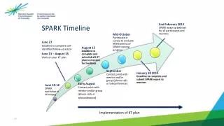
Leveraging Mapping for the Rural E conomy Spark Presentation – 25 th November 2013. “GDP study for Ariyalur and Pudukottai !!” – Shilpa tells Gayathri “Let’s digitize data!!” – Noble Joseph “ODK!!” – Amit Shah “ B ranch page, hub page, entity page!!” – Shilpa and Gayathri

E N D
Leveraging Mapping for the Rural EconomySpark Presentation – 25th November 2013
“GDP study for Ariyalur and Pudukottai!!” – Shilpa tells Gayathri “Let’s digitize data!!” – Noble Joseph “ODK!!” – Amit Shah “Branch page, hub page, entity page!!” – Shilpa and Gayathri “OK, let’s get cracking!!” – Shilpa and Gayathri • Genesis
Expansion mapping in the past • Villages being left out • Population numbers being collected at different levels • Natural congregation of people was not where branches were located • Mapping in Thenaaru and Vellaaru KGFSs • Optimal demarcation of service areas based on an algorithm • Household mapping in every branch service area • Setting the context
Mapping in Thenpennaiaaru KGFS • Remote rural criteria • Efficient branch network • Key infrastructure network • Expansion Criteria Mapping
How was the data collected? • Village • Population • Geocodes Panchayat approach – A panchayat is an administrative unit consisting of 6 to 7 villages. It is the unit to be approached to obtain population data for each village. • Primary Health Centre • Geocodes • School • Geocodes • Population check with school headmaster • Other Key Infrastructure • Geocodes
What tool was used to collect data? KGFS entity ODK server Data • Entity page • Hub page Data input
All mapping in the service area under one umbrella • Household mapping • Enterprises mapping • What you see • Other economic potential mapping • What you hear • Rules for whom to ask • How to ask • How to triangulate • Service Area Mapping
Benefits of using ODK • Real time data monitoring and improving data collection • All data on our server • Easy export to excel and kml • Benefits of spatial MIS • Strengthening the bottom up approach • Take a transect walk around the service area sitting here • Provide customized solutions and tailor made products that suit our end customers • Conclusion