Download
1 / 15
160 likes | 179 Views
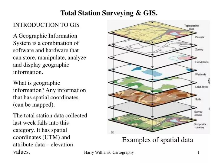
Total Station Surveying & GIS. INTRODUCTION TO GIS A Geographic Information System is a combination of software and hardware that can store, manipulate, analyze and display geographic information. What is geographic information? Any information that has spatial coordinates (can be mapped).

E N D
Total Station Surveying & GIS. INTRODUCTION TO GIS A Geographic Information System is a combination of software and hardware that can store, manipulate, analyze and display geographic information. What is geographic information? Any information that has spatial coordinates (can be mapped). The total station data collected last week falls into this category. It has spatial coordinates (UTM) and attribute data – elevation values. Examples of spatial data Harry Williams, Cartography
We could simply display the total station data in the GIS, but this would clearly be improved by having some frame of reference that we can recognize. Harry Williams, Cartography
The frame of reference could be a street map…. Harry Williams, Cartography
Or, something increasingly popular is to use an air photo as a back drop. This particular image is a raster image consisting of colored pixels (cells) – a jpeg. Harry Williams, Cartography
Raster image Harry Williams, Cartography
but what’s wrong with this picture? Harry Williams, Cartography
It’s oriented around the right way now (we are used to having north at the top of the page), but the pixels that make up the image still do not have spatial coordinates… N Harry Williams, Cartography
Giving spatial coordinates to an image is called image registration and it’s achieved by using Ground Control Points (GCP). A GCP is a point that can be seen on the image and for which we know the spatial coordinates. To demonstrate, I collected 4 GCPs with a GPS. 672343.7mE3676601.8mN 672155.6mE3676594.8mN 672154.3mE3676508.6mN 672340.0mE3676508.8mN Harry Williams, Cartography
These GPCs are added to the image within the GIS… Harry Williams, Cartography
The result is the image is now registered – every pixel has spatial coordinates…(note: for accuracy, a large number of GPCs is required). Harry Williams, Cartography
Digital Elevation Models (DEMs): a DEM is a raster coverage (a map made up of cells or pixels), wherein every cell has an elevation value. The elevation values are usually calculated by interpolation from a number of spot heights within the map area. For example Inverse Distance Weighting (IDW) Interpolation gives weights to spot heights based on the inverse of their distance from an unknown point…(in other words, the closer the spot height is to the unknown point, the more weight or influence it has on the calculated elevation for the unknown point)… Harry Williams, Cartography
The DEM is a continuous surface, so it can be used to: • Provide an elevation for any point on the map • Be used to construct topographic profiles The following example is from a Geography Masters thesis – it is a DEM of coastal wetlands in Trinity Bay, Texas, including some topographic profiles. Harry Williams, Cartography
In the lab today you will use MapInfo GIS* to map the total station survey points onto a registered air photo and then create a DEM from the survey points. *MapInfo GIS is the basis for GEOG 4060/5060 Applied GIS: MapInfo Professional offered in the spring. Harry Williams, Cartography