Download
1 / 5
50 likes | 57 Views
Sand dunes is one of desertification phenomenon that hinder land resources and human activities. It threaten to bury human settlement, roads, farms, water and other resources. Due to many environmental and climate conditions, there are many places around the world suffering from sand movement and mobile dune creep onto cultivated land and human settlements. Sand dunes have a fragile environment where, instability with a series of changes lead to a system not in equilibrium with its surroundings within an arid and hyper arid climates changes. These changes usually characterized by increase of evaporation and long periods of dryness, very low rainfall and vegetation. The aim of this research work is to apply remote sensing and GIS techniques to monitor and analyze sand dunes accumulation in the northern part of Sudan. Three successive satellite images acquired in different dates were used as the main source of data in this research work. A digital elevation model was also needed for topographic analysis. GIS was used to analyze output remote sensing data. Results, reflected that, sand dines accumulated during the last years and its accumulation in progress by 0.4 every year. Moreover, 50 of the study area is expected to be covered by sand dunes after less than 20 years. From topographic point of view, sand dune heights reached be 20m. These results present clear indicators of desertification that faces the study area. Dr. Abdelrahim Elhag | Dr. Nagi Zomrawi | Sahar Khidir "Analysis of Sand Dunes Accumulation using Remote Sensing and GIS" Published in International Journal of Trend in Scientific Research and Development (ijtsrd), ISSN: 2456-6470, Volume-4 | Issue-1 , December 2019, URL: https://www.ijtsrd.com/papers/ijtsrd29507.pdf Paper URL: https://www.ijtsrd.com/computer-science/computer-network/29507/analysis-of-sand-dunes-accumulation-using-remote-sensing-and-gis/dr-abdelrahim-elhag<br>

E N D
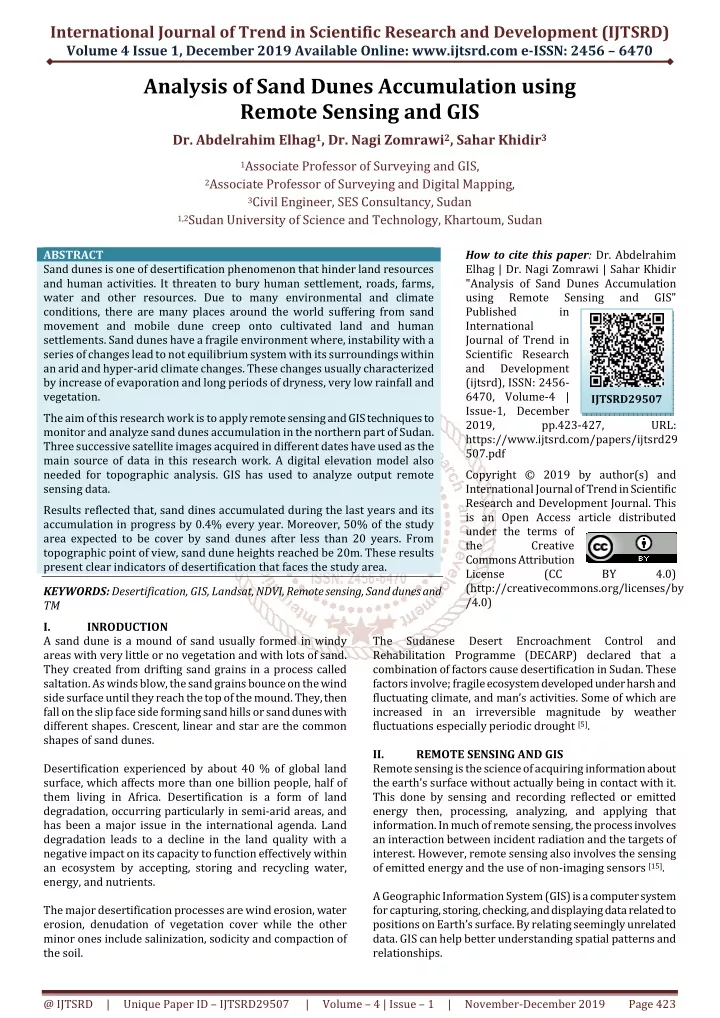
International Journal of Trend in Scientific Research and Development (IJTSRD) Volume 4 Issue 1, December 2019 Available Online: www.ijtsrd.com e-ISSN: 2456 – 6470 Analysis of Sand Dunes Accumulation using Remote Sensing and GIS Dr. Abdelrahim Elhag1, Dr. Nagi Zomrawi2, Sahar Khidir3 1Associate Professor of Surveying and GIS, 2Associate Professor of Surveying and Digital Mapping, 3Civil Engineer, SES Consultancy, Sudan 1,2Sudan University of Science and Technology, Khartoum, Sudan ABSTRACT Sand dunes is one of desertification phenomenon that hinder land resources and human activities. It threaten to bury human settlement, roads, farms, water and other resources. Due to many environmental and climate conditions, there are many places around the world suffering from sand movement and mobile dune creep onto cultivated land and human settlements. Sand dunes have a fragile environment where, instability with a series of changes lead to not equilibrium system with its surroundings within an arid and hyper-arid climate changes. These changes usually characterized by increase of evaporation and long periods of dryness, very low rainfall and vegetation. The aim of this research work is to apply remote sensing and GIS techniques to monitor and analyze sand dunes accumulation in the northern part of Sudan. Three successive satellite images acquired in different dates have used as the main source of data in this research work. A digital elevation model also needed for topographic analysis. GIS has used to analyze output remote sensing data. Results reflected that, sand dines accumulated during the last years and its accumulation in progress by 0.4% every year. Moreover, 50% of the study area expected to be cover by sand dunes after less than 20 years. From topographic point of view, sand dune heights reached be 20m. These results present clear indicators of desertification that faces the study area. KEYWORDS: Desertification, GIS, Landsat, NDVI, Remote sensing, Sand dunes and TM I. INRODUCTION A sand dune is a mound of sand usually formed in windy areas with very little or no vegetation and with lots of sand. They created from drifting sand grains in a process called saltation. As winds blow, the sand grains bounce on the wind side surface until they reach the top of the mound. They, then fall on the slip face side forming sand hills or sand dunes with different shapes. Crescent, linear and star are the common shapes of sand dunes. Desertification experienced by about 40 % of global land surface, which affects more than one billion people, half of them living in Africa. Desertification is a form of land degradation, occurring particularly in semi-arid areas, and has been a major issue in the international agenda. Land degradation leads to a decline in the land quality with a negative impact on its capacity to function effectively within an ecosystem by accepting, storing and recycling water, energy, and nutrients. The major desertification processes are wind erosion, water erosion, denudation of vegetation cover while the other minor ones include salinization, sodicity and compaction of the soil. How to cite this paper: Dr. Abdelrahim Elhag | Dr. Nagi Zomrawi | Sahar Khidir "Analysis of Sand Dunes Accumulation using Remote Sensing Published in International Journal of Trend in Scientific Research and Development (ijtsrd), ISSN: 2456- 6470, Volume-4 | Issue-1, December 2019, pp.423-427, https://www.ijtsrd.com/papers/ijtsrd29 507.pdf Copyright © 2019 by author(s) and International Journal of Trend in Scientific Research and Development Journal. This is an Open Access article distributed under the terms of the Creative Commons Attribution License (CC (http://creativecommons.org/licenses/by /4.0) and GIS" IJTSRD29507 URL: BY 4.0) The Rehabilitation Programme (DECARP) declared that a combination of factors cause desertification in Sudan. These factors involve; fragile ecosystem developed under harsh and fluctuating climate, and man’s activities. Some of which are increased in an irreversible magnitude by weather fluctuations especially periodic drought [5]. II. REMOTE SENSING AND GIS Remote sensing is the science of acquiring information about the earth's surface without actually being in contact with it. This done by sensing and recording reflected or emitted energy then, processing, analyzing, and applying that information. In much of remote sensing, the process involves an interaction between incident radiation and the targets of interest. However, remote sensing also involves the sensing of emitted energy and the use of non-imaging sensors [15]. A Geographic Information System (GIS) is a computer system for capturing, storing, checking, and displaying data related to positions on Earth’s surface. By relating seemingly unrelated data. GIS can help better understanding spatial patterns and relationships. Sudanese Desert Encroachment Control and @ IJTSRD | Unique Paper ID – IJTSRD29507 | Volume – 4 | Issue – 1 | November-December 2019 Page 423
International Journal of Trend in Scientific Research and Development (IJTSRD) @ www.ijtsrd.com eISSN: 2456-6470 Many different types of information can be compare and contrasted using GIS. The system can include data about people, landscape, and sites in both raster and vector forms. Now days GIS used in every field to to make maps, perform analysis, share information, and solve complex problems [13]. Remote sensing and GIS techniques can be use as a tool to study dynamic features such as sand dunes and give a synoptic view of the entire field as well as it sources. In addition, the ability to examine changes over time allows for the extrapolation of current climate regimes and the monitoring of marginal areas susceptible to future desertification. III. STUDY AREA AND DATA COLLECTION The Northern state is one of the eighteen states of Sudan. It has an area of 348,765 km². It is characterised by an arid environment with evapo-transpiration far exceeding the very low average of rainfall per year. Because of the harsh climatic conditions, the area becomes highly susceptible to wind erosion, which lifts and transports the fine particles of the dominant soils. Stronger winds remove the heavier particles to form dunes, which endanger agricultural lands and settlements. Over time, these processes lead to a pronounced loss of productivity [13]. The study area of this resarch work is located in the Northern State of Sudan between 18°35ʹN to 18°42ʹN latitudes and 30°32ʹE to 30°40ʹE longitudes as demonstrated in figure (1) below. IV. The raw Landsat satellite images files were first uncompressed and combined in one file using Erdas Imagine 8.5. These images were then, reduced to WGS84 datum and zone N 36 UTM projection. Subsets have also carried out in order to extract images of the study area. One of the powerful tools of Erdas package is that, the ability to use it to analyze successive images to detect changes and monitor the sand dune migration in the study area. Thus, the difference of satellite images acquired in dates 2000 and 2007 was carried out to detect changes occurred. Figure (2) illustrates the obtained result. DATA ANALYSIS Fig.2: Sand dunes change map 2000/2007 Again, changes have detected between image 2007 and image 2018. Result of this difference illustrated in figure (3) hereunder. Fig.1: The study area Data collected for this resarch work include three different Landsat satellite images (Path 175 rows 47) covering the study area with spatial resolution of 30 meters. The first was Landsat-7 TM image acquired in March, 2000; the second was Landsat-7 TM image acquired in January 2007 where, the third was Landsat-8 TM image acquired in March, 2018. A Digital Elevation Model (DEM) with 30 meters resolution was also obtained. Fig.3: Sand dunes change map 2007/2018 From figure (2) and figure (3) above, it can obviously noted how sand dines accumulated during the period. In order to estimate the rate of encroachment of the sand dunes within the study area, remote sensing analysis has extended to determine the area that covered by sand dunes in 2000 compared with 2007 and 2018. Figure (4) represents the resultant image. @ IJTSRD | Unique Paper ID – IJTSRD29507 | Volume – 4 | Issue – 1 | November-December 2019 Page 424
International Journal of Trend in Scientific Research and Development (IJTSRD) @ www.ijtsrd.com eISSN: 2456-6470 Figure (6) represented below, demonistrates the normalized difference vegetation index in year (2018). Fig.4: Successive changes in sand cover From figure (4) above, yellow colour indicates areas of sand cover in 2000. In 2007 sand, cover extended in larger areas as indicated in violet. It is obvious that in 2018 sand dunes much accumulated as shown in the red colour. Usually, Landsat satellite based indices images produced to portray the surface changes that happened during the study period. Changes in vegetation cover usually indicated by the Normalized Difference Vegetation Index (NDVI) that derived from the ratio of band 3; Red (R) and band 4; Near Infra-Red (NIR) of Landsat TM image data set. Where, NDVI= (NIR-R)/ (NIR+R). Here, in this research work, the geometrically corrected Landsat TM images band 3 and band 4 have used to derive the vegetation Index. NDVI has applied to that image acquired in year 2000 as shown in figure (5) below. Fig. 6: Normalized difference vegetation index (2018) A comparison between figure (5) and figure (6) reflects hwo sand dunes extended where bare soil backing down. Now, supervised classification has applied to the three images. The classified images then entered as input data in ArcGIS 10.1 software. Next, the extracted sand dunes zones converted from raster to vector polygons. Sand dunes areas have calculated from attribute tables and tabulated as listed in table (1) below. Table1: Increment of sand dunes areas Sand area (Km2) (Km2) 2000 3.7 2007 20.0 16.3 2018 55.5 35.5 From table (1) above, it can be seen that, sand dunes acuumulated by 16.3 km2 during the period 2000 to 2007 by rate of 2.3 km2 per year. On the other hand, accumulation rate was 3.2 km2 per year during the period from 2007 to 2018 i.e. sand dunes accumulation rate increase last years. Now, representing years against sand dunes areas, second order polynomial trend line equation has approximated as follows: y = 9.6x2 - 12.5x + 6.6 Where, x representing years y is the expected sand dunes areas This implies that after less than 20 years, 50% of the study area will be covered by sand dunes. Figure (7) below illustrates sand dunes areas and the trend line. Increment Increment /year (Km2) - 2.3 3.2 Date - … (1) Fig. 5: Normalized difference vegetation index (2000) @ IJTSRD | Unique Paper ID – IJTSRD29507 | Volume – 4 | Issue – 1 | November-December 2019 Page 425
International Journal of Trend in Scientific Research and Development (IJTSRD) @ www.ijtsrd.com eISSN: 2456-6470 Fig. 7: Sand dunes areas and trend line Study area covers about 250 km2. Comparing accumulation rate with the whole study area yields 0.9% during the period 2000 to 2007. This rate was increaed to be 1.3 during the period 2007 to 2018. This result idicate that accumulation rate increse by 0.4% every year. Table2: Rate of increment Incement Per year Increment /year (Km2) Rate of increment % Date Fig. 9: Profile graph of a sample area Since this sample randomly selected, it can expect to find dunes higher than 20m. V. CONCLUSION In those areas facing desertification, it is almost necessary to plan for comprehensive program for sand stabilization. Since the study area fall on such desertification progress, urgent percussions would be took into consideration. From the data collected about study area and analysis carried out it can be conclude with the following points: % - 0.9 1.3 2000 2007 2018 - 2.3 3.2 0.4 Sand dunes heights have also examined in this study. A topographic map was prepared for the study area using GIS by creating contour map from the data of the digital elevation model as appeared in figure (8). ?Sand dines accumulated on the study area during the last period and its accumulation in progress. ?NDVI analysis reflected that sand dunes increase while bare soil decrease. ?Sand dunes accumulations increased by 14% throughout the last 18 years. ?Sand dunes accumulation rate increases by 0.4% every year. ?Sand dune height reached 20m in the study area. Where, higher than 20m can be expected. ?Fifty percent of the study area expected to be cover by sand dunes after less than 20 years. ?These factors imminent threat of desertification that faces the study area thus, urgent intervention needed by implementing adequate methods. ?Remote sensing and GIS are successful tools in sand dunes monitoring. REFERENCES [1]Prof. Dr. H. J. Herrmann &Prof. Dr. M. Fahnle, Vegetated dunes and barchan dune fields, 29. January 2007 Fig.8: Topographic map of study area in year 2018 Now, a profile graph for a sample area have created and sand dune height measured to be 20m as figure (9) illustrates. [2]Michael J. Kavulich Jr., Degree of Bachelor of Science in Physics (April 27, 2008), Faculty of the worcester polytechnic institute, a major qualifying project report. @ IJTSRD | Unique Paper ID – IJTSRD29507 | Volume – 4 | Issue – 1 | November-December 2019 Page 426
International Journal of Trend in Scientific Research and Development (IJTSRD) @ www.ijtsrd.com eISSN: 2456-6470 [3]National Geographic Society, A. Strahler, O.W. Archibold, Physical Geography: Science and Systems of the [9]Ramsey, M. S. (2003) Global Desert Monitoring With ASTER; Research Projects, IVIS Laboratory, University of Pittsburg. [4]Human Environment, 2008. John Wiley & Sons, pag. 442 [10]Coppin, P. & Bauer, M. (1996) Digital Change Detection in Forest Ecosystems with Remote Sensing Imagery. Remote Sensing Reviews.Vol.13, pag.207-234. [5]Dafalla M.S., Ibrahim S.I., Elhag A.M.H and Doka, M.A.2, Assessment of Sand Encroachment Using Remote Sensing and GIS, University of Khartoum. [11]Ayad M. Fadhil Al-Quraishi , University Of Kufa , Sand dunes monitoring using remote sensing and GIS techniques for some sites in Iraq. [6]Lahmeyer international, sand stabilization study, Merwe Irrigation project. [12]Generic environmental impact statement sand dune mining, MI DEQGSD - Generic EIS Sand Dune Mining - GEIS.PDF [7]Han Qing-jie, QuJian-jun, Liao Kong-tai, Zhu Shu-juan, Dong Zhi-bao, Zhang Ke-cun and ZuRui-ping, A Wind Tunnel Experiment of Aeolian Sand Transport over Wetted Coastal Sand Surface, Journal of Desert Research, Volume 32, Issue 6, 2012, Pages 1512-1521. [13]https://en.wikipedia.org/wiki/Northern_state,_Sudan [14]https://www.esri.com/en-us/what-is-gis/overview [15]https://www.nationalgeographic.org/encyclopedia/ge ographic-information-system-gis/ [8]Amelia Carolina Sparavigna,A study of moving sand dunes by means of satellite images, Department of Applied Science and Technology, Politecnico di Torino, Italy. [16]https://www.nrcan.gc.ca/maps-tools- publications/satellite-imagery-air-photos/remote- sensing-tutorials/fundamentals-remote-sensing- introduction/ @ IJTSRD | Unique Paper ID – IJTSRD29507 | Volume – 4 | Issue – 1 | November-December 2019 Page 427