Download
1 / 19
200 likes | 289 Views
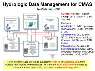
Hydrologic Data for Drought Monitoring in Pennsylvania. Dennis Risser US Geological Survey Shenandoah Valley Water Conference October 28, 2008. PA Drought Management. County. County. County. County. County. County. County. County. County. PEMA. DEP. County. Commonwealth

E N D
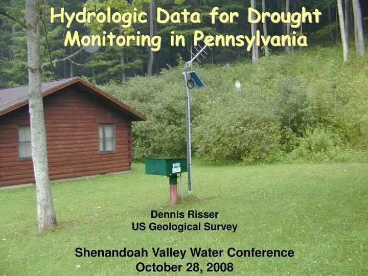
Hydrologic Data for Drought Monitoring in Pennsylvania Dennis Risser US Geological Survey Shenandoah Valley Water Conference October 28, 2008
PA Drought Management County County County County County County County County County PEMA DEP County Commonwealth Drought Coordinator Emergency Management Council Commonwealth Drought Task Force Governor DEP Secretary River Basin Commissions Drought Watch Drought Emergency Drought Warning County County
Hydrologic Drought Indicators • Precipitation • Streamflow • Ground-Water Levels • Soil Moisture • Reservoir Storage
DEC 1998 JAN 1999 JUNE 1999 JULY 1999 SEPT 1999 MAY 2000 Drought 1998-99 PaDEP Drought-Status Maps
Real-Time Monitoring Hydrologic Database, Investigations, And Research Geostationary Environmental Satellite Earth Receiving Station USGS Gage With Telemetry Equipment Drought Monitoring
Precipitation Status Map (Oct 7, 2008)
Oct 7, 2008 PRECIPITATION, IN INCHES Precipitation Status Graph 90-Day NORMAL WATCH WARNING EMERGENCY 25% above mean 25% below mean 35% below mean 45% below mean
Ground-Water Status Map (Oct 7, 2008)
Ground-Water Status Graph (Oct 7, 2006) 75th Percentile 25th Percentile 10th Percentile 5th Percentile NORMAL WATCH WARNING EMERGENCY DEPTH TO GROUND WATER, FT BELOW LAND SURFACE
Composite Map – Sept 4, 2002 Precipitation status based on 120-day departure
Precipitation Status --2002 Drought Cumberland County PRECIPITATION (INCHES) 2002 2003
Streamflow Status --2002 Drought Conodoguinet Cr.
Ground-Water Status – 2002 Drought Well CU-2
Timeliness (Hurricane Floyd) Chester County Well HURRICANE FLOYD Depth to Water, in Feet 12 13 14 15 16 17 18 19 20 21 September, 1999
Chester County Ground-Water Network http://pa.water.usgs.gov/chesco/
SOMERSET COUNTY GW NETWORK http://somersetcd.pacd.org/drought/