Download
1 / 4
40 likes | 159 Views
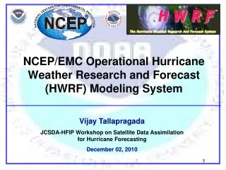
The Hurricane Weather Research & Forecasting (HWRF) Prediction System. Next generation non-hydrostatic weather research and hurricane prediction system Movable, 2- way nested grid (9km; 27km/42L; ~68X68) Coupled with Princeton Ocean Model

E N D
The Hurricane Weather Research & Forecasting (HWRF) Prediction System • Next generation non-hydrostatic weather research and hurricane prediction system • Movable, 2- way nested grid (9km; 27km/42L; ~68X68) • Coupled with Princeton Ocean Model • POM utilized for Atlantic systems, no ocean coupling in N Pacific systems • Vortex initialized through use of modified 6h HWRF first guess • 3-D VAR data assimilation scheme • But with more advanced data assimilation for hurricane core • Plans for use of airborne and land based Doppler radar data • Became operational in 2007 • Under development since 2002 • Runs in parallel with the GFDL
2010 HWRF Upgrades Fixing known bugs in HWRF model (mostly related to radiation) Led to definition of new baseline configuration for HWRF Improved initialization (Additional data in GSI near the storm environment) Surface Physics Changes (Cd/Ch coefficients calculated based on observations) Gravity Wave Drag Parameterization
*HWRF *GFDL *Configurations for 2010 season
2011-2013 HWRF UPGRADE PLAN Data assimilation: Advanced initialization for hurricane core – assimilate airborne Doppler radar observations to define storm strength and storm structure Continuous upgrades to HWRF hurricane core initialization through advanced 4-D data assimilation for winds and reflectivity Model resolution upgrades: Increase resolution: Horizontal resolution 1-6km, Vertical resolution ~100 levels (dependent on results of current studies). Hurricane ensembles: High-resolution hurricane model ensembles. Development of HWRF ensembles in progress Model Physics: Continuous upgrades to gravity wave drag parameterizations, sea spray parameterization, atmospheric/ocean boundary layer (fluxes), microphysics, deep convection (cloud-resolving scales), radiation Ocean coupling Replacement of POM with the HYCOM ocean model for 2011 Other upgrades: Coupling to land surface model with advanced surface physics for improved rainfall forecasts at landfall. Important input to hydrology and stream flow models which will address inland flooding. Advanced Wave Model (WAVEWATCH III) to forecast waves up to the beach, i.e. improve non-linear interactions, surf-zone shallow water physics, wave interactions with currents.