Download
1 / 10
100 likes | 253 Views
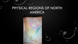
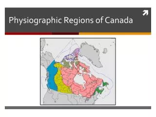
Physiographic Regions of the North. By: Joon, Atcha, and Drew. The Physiographic Regions of the North. There are 5 Physiographic Regions in the Canadian North. Innuitians Arctic Lowlands Canadian Shield Pacific Cordillera Interior Plains. The Innuitians.

E N D
Physiographic Regions of the North By: Joon, Atcha, and Drew
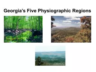
The Physiographic Regions of the North • There are 5 Physiographic Regions in the Canadian North. • Innuitians • Arctic Lowlands • Canadian Shield • Pacific Cordillera • Interior Plains
The Innuitians • Older than the Western Cordillera’s Mountains. • Younger than the Shield’s Mountains. • Formed by folding • Mainly made of sedimentary rock (there is some igneous and metamorphic rock)
The Innuitians (continued) • Mountain tops are not as jagged as the Rockies, but sharper than the shield. • Features caused by erosion. • Due to climate there is limited activity and human uses.
Arctic Lowlands • Made up of the islands in the far north • Mainly sedimentary rock. • Ground remains frozen all year • Poor for farming • Gently rolling landscape
Arctic Lowlands (continued) • Sedimentary rock contains lignite (coal). • Also contains oil and natural gas deposits. • Used for mining. • Bedrock underneath soils are formed from sediments from the Shield.
Interior Plains • Mainly Sedimentary rocks • Digging for oil/ mining • Glaciations (rolling hills) • Wet climate soils • Infertile soils from leaching (in the North) • Minerals washed away by precipitation • Boreal and Taiga forests • Coniferous and some deciduous trees • Spruce, pines, cedar, hemlock
Western Cordillera • Rocky mountains • Youngest mountain range • Tall and rugged • Sedimentary rock • Rock was folded and faulted upwards • Lakes (lorains)were formed by melted glaciers • Complex soils in mountain ranges • Many different varieties of soil types • Cordilleran Vegetation • Coniferous forests • Meadows, flowers shrubs • High altitudes - rocks, snow, ice - no vegetation • Copper, silver mines
Canadian Shield Rock Type: • Igneous • Metamorphic Formed by: • Molting/ Volcanism Topography + Soils: • Valuable minerals (e g. lead, gold) Human uses: • Recreation (Canoeing) • Hydroelectricity • Mining
Canadian Shield (continued) Characteristics: • The oldest rock in Canada • Formed lots of lakes and has disordered lands • Infertile to farm • Covered by a thin layer of soil, and the bedrock is visible in many places