Download
1 / 24
260 likes | 1k Views
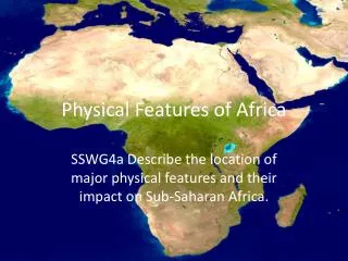
Social Studies Skill Builder. Mapping the Physiographic Features of Africa. Standard: 7.4: Students learn the Geographic Features of Africa. CST3: Students use maps to learn the physical features of Countries in Africa. Standards to Learn. What does “ physiographic feature ” mean?

E N D
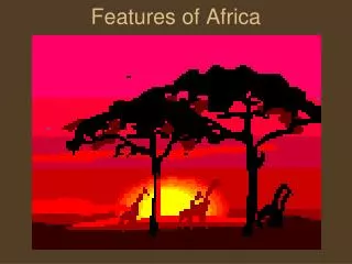
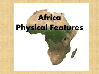
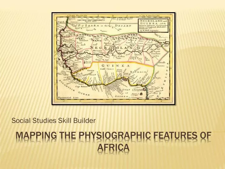
Social Studies Skill Builder Mapping the Physiographic Features of Africa
Standard: 7.4: Students learn the Geographic Features of Africa. CST3: Students use maps to learn the physical features of Countries in Africa. Standards to Learn
What does “physiographic feature” mean? This term comes from the Greeks. “physio” means: physical “graphic” means: written down or recorded. “feature” means: a particular characteristic of something. Thus: “physiographic feature "is a physical characteristic of the land—a lake, a mountain, a river, a desert—that is recorded on a map. starter activity Warm-up
As you preview each slide, you are to identify the important physiographic features of Africa. You will write the name of each of these important physiographic features of Africa after the question. Then you will label the physiographic map of Africa with each of these features in their correct location. Make sure that you draw in each area the symbols that correspond to the map key and label the name of the feature with the letter of each answer. Your task
Mapping Question A A. What is the strip of dry grassland on the southern border of the Sahara Desert? • The Sahel, in Nigeria, is a semiarid region between the Sahara to the north and the savannas to the south, extending from Senegal to Ethiopia. • The Sahel forms a belt that separates the arid Sahara from tropical West Africa. • The Sahel has natural pasture, with low-growing grass and tall trees. • Forage for animals (cattle, camel, pack ox, and sheep) consist of thorn shrubs, and trees such as the baobab and the acacia. • At least 8 months of the year are dry, and rainfall averages four to 8 inches per year.
Mapping Question B B. What is the mountainous region located near the horn of East Africa? • The Ethiopian Highlands, near Harrar, are located on the western section of the Ethiopian Plateau. • Fringed by the Sudan lowlands, these mountains are probably of early volcanic origin. • The Ethiopian Plateau and several of its mountain groups are cut by deep valleys. • The Blue Nile runs from its source, Lake Tana, through the center of the plateau.
Mapping Question c C. What is the tallest mountain in Africa? • Mount Kilimanjaro, located in northeast Tanzania, is the highest mountain in Africa. • An extinct volcano, Mount Kilimanjaro rises in two peaks, Kibo (19340 feet) and Mawenzi (17,564 feet). • Coffee and plantains are raised on Kilimanjaro’s lower slope.
Mapping Question D D. What is Africa’s largest lake? • Lake Victoria is the largest lake in Africa and the chief reservoir of the Nile River. • The lake lies mainly in Tanzania and Uganda, fills a shallow depression in the great plateau that stretches between the Western and Eastern Rift Valley. • This is one of the most densely populated regions in Africa; within 50 miles of its shores live several million people, nearly all Bantu-speaking. • Lake Victoria is a freshwater lake with a wealth of fish.
Mapping Question E E. What is the longest river in Africa? • The Nile River, shown here in Uganda, is 4160 miles long from its remotest headstream in central Africa to its delta on the Mediterranean Sea, making it the longest river in the world. • The Nile flows northward through parts of Egypt, Sudan, Ethiopia, Kenya, Uganda, Rwanda, Burundi, and Zaire. • The Nile River supports practically all agriculture in the most densely populated parts of Egypt and furnishes water for 20% of Sudan’s total crop area. • The Nile is an important source of hydroelectric power.
Mapping Question F F: What extensive rainforest covers a large part of central Africa and is almost completely surrounded by mountains? • The Congo Basin is the worlds largest river basin, comprising as an area of 1,335,000 square miles. • The vast drainage are lies astride the Equator in west central Africa and includes almost all of Zaire, western Zambia, and northern Angola.
Mapping Question G G: What is the largest desert in southern Africa? • The Kalahari Desert, shown here in Botswana, is an arid plateau region that spans three countries and covers 100,000 square miles in southern Africa. • Covered largely by reddish sand, the Kalahari lies between the Orange and Zambezi Rivers and is dotted with dry lake beds. • Grass grows throughout the Kalahari during the rainy season, and grazing and small-scale agriculture are possible in some areas.
Mapping Question H H: What is the major river in western Africa that empties into the Gulf of Guinea? • The Niger River, which is 2600 miles long, rises on the Fouta Djallon plateau in southwest Guinea and flows through Guinea into the Mali Republic. • Near Timbuktu, Mali. The Niger begins a great bend, flowing out of Mali, through the Republic of Niger, and into Nigeria. • The Niger then flows south, emptying through a great delta into the Gulf of Guinea. • The delta—the largest in Africa—is characterized by swamps, lagoons, and navigable channels. • The Niger River is a major source of fish in the region.
Mapping Question I I: What is the enormous desert that stretches across North Africa? • The Sahara Desert, as shown her in Morocco, is the world’s largest desert, comprising and area of 3,500,000 square miles. • Extending from the Atlantic Ocean to the Red Sea, the Sahara is bordered on the north by the Atlas Mountains and the Mediterranean Sea, and on the south by the Sahel. • Regions of sand dunes cover 15 percent of the Sahara;“stone desert,” consisting of plateaus of bare rock or areas of coarse gravel, cover about 70% of the region; mountains, oases, and transition zones account for the remainder. • The Sahara has one of the harshest climates in the world, as the region is subject to strong winds that constantly blow from the northeast. • Other difficulties include lack of water, extremely high daytime temperatures, and sparse vegetation.
Mapping Question J J: What is the mountain range in northwestern Africa? • The Atlas Mountains, as shown here in Tunisia, is a system of ranges and plateaus in northwest Africa, extending 1,500 miles from southwest Morocco through Algeria to north Tunisia. • The Atlas system is most rugged in Morocco, where the highest mountain ranges are found. • Fertile lowlands separate the ranges. • The Atlas Mountains are a climatic barrier between the Mediterranean basin and the Sahara Desert. • The slopes facing north are well watered and have important farmland and forests, while the south are generally covered with shrubbery and have salt lakes and salt flats. • The Atlas Mountains are rich in minerals, especially phosphates, coal, iron, and oil.
Mapping Question K K: What is the largest river flowing through the Congo Basin and emptying into the Atlantic? • The Congo, or Zaire River, shown her between Inga and Matadi, is formed by the waters of the Lualaba, the upper Congo River, and its tributary the Luvua River. • One if the largest rivers in the world, the Congo flows for 2,720 miles through Zaire to the Atlantic Ocean. • In some parts, the Congo is from 4 to 10 miles wide, with many islands and sandbars. • Because the Congo has a fairly constant flow throughout the year. • It is Africa’s largest potential source of hydroelectric power.
Mapping Question L L: What Ocean lies east of Africa? • The Indian Ocean, as shown here off the Kenyan coast, is the third-largest ocean in the world, extending from south Asia to Antarctica and from east Africa to southeast Australia. • The average depth of the ocean’s floor is 11,000 feet. • A large rift (crack or fissure), an extension of the Great Rift Valley, extends along most of the ocean's length.
Mapping Question M M: What is the great valley that extends, with several breaks, from Syria to central Mozambique? • The Great Rift Valley, shown here in Ethiopia, is a geological fault system that extends from central Mozambique to northern Syria. • The valley ranges in elevation from 1,300 feet below sea level at the Dead Sea to 6,000 feet above sea level in southern Kenya. • Erosion has leveled out much of the valley, but in some sections, especially Kenya, there are cliffs that are several thousand feet high.
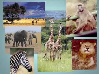
Mapping Question N N: What is the broad, level area of land that is located in north central Tanzania and extends east of the southeastern shore of Lake Victoria? • The Serengeti Plain is located in north central Tanzania. • It extends 100 miles east and southeast from the southeastern shore of Lake Victoria. • With altitudes ranging from 3,000 to 6,000 feet, the Serengeti Plain contains some of the best grassland area in central and east Africa. • Serengeti National Park, a wildlife refuge with more than 500 species of animals, is located on the plain.
Mapping Question O O: What island is located about 240 miles off the southeastern coast of Africa? • Located in the Indian Ocean, Madagascar is separated from the east African coast by the Mozambique Channel. • One of several islands in the Malagasy Republic. • Madagascar is the fourth-largest island in the world. • Madagascar is made up of a highland plateau, which is now largely deforested, that is fringed by a lowland coastal strip with lagoons along much of the eastern coast. • The economy of Madagascar is overwhelmingly agricultural.
Mapping Question P P: What ocean lies west of Africa? • The Atlantic Ocean, shown off the coast of Senegal, is the second-largest ocean in the world, extending in an “S” shape from the arctic to the Antarctic regions. • It is connected with the Arctic Ocean by the Greenland Sea and Smith Sound; with the Pacific Ocean by the Drake Passage, the Straits of Magellan, and the Panama Canal and the expanse between Africa and Antarctica. • The Mediterranean Sea and the Gulf of Guinea are two of the principal arms of the Atlantic Ocean.
Mapping Question Q Q: What is the large body of water that separates Africa from Europe? • The Mediterranean Sea, shown here off the coast of Algeria, is the worlds largest inland sea. • Surrounded by Europe, Africa, and Asia, it covers an area of 965,000 square miles. • The Mediterranean Sea connects with the Atlantic Ocean through the Straits of Gibraltar, with the Black Sea through the Dardanelles, the Sea of Marmara, and the Bosporous; and with the Red Sea through the Suez Canal. • The shores of the sea are mainly mountainous. Fish (close to 400 species), sponges, and corals are abundant here.
Mapping Question R R: What is the sea that is actually an arm of the Indian Ocean and extends northwest between Africa and the Arabian Peninsula? • The Red Sea, shown here off the coast of Ethiopia, is a long, narrow sea that sits between Africa and the Arabian Peninsula. • The Gulf of Aqaba and Gulf of Suez are the sea’s northern arms; between them sits the Sinai Peninsula. • The Red Sea is linked with the Indian Ocean by the Gulf of Aden. • Because it is surrounded by excessively hot and dry deserts and steppes, summer temperatures often exceed 85º F.
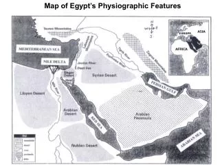
Physiographic Map of Africa Directions: Label the map below with the physiographic features. Draw in the different features with the symbols that correspond with the map key and letter of the feature.
Physiographic Map of Africa Directions: Label the map below with the physiographic features. Draw in the different features with the symbols that correspond with the map key and letter of the feature.