Download
1 / 14
140 likes | 254 Views
a. FY12-13 GIMPAP Project Proposal Title Page version 04 August 2011. Title : Snow Water Equivalent Distributions in the Western U.S . Using GOES/IMS and SnowModel (IMS = Interactive Multisensor Snow and Ice Mapping System, National Ice Center) Status : New

E N D
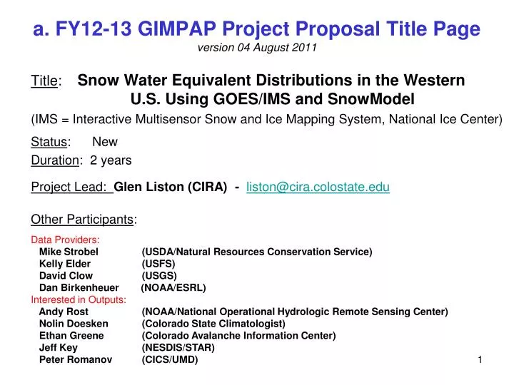
a. FY12-13 GIMPAP Project Proposal Title Pageversion 04 August 2011 Title: Snow Water Equivalent Distributions in the Western U.S. Using GOES/IMS and SnowModel (IMS = Interactive Multisensor Snow and Ice Mapping System, National Ice Center) Status: New Duration: 2 years Project Lead: Glen Liston (CIRA) - liston@cira.colostate.edu Other Participants: Data Providers: Mike Strobel (USDA/Natural Resources Conservation Service) Kelly Elder (USFS) David Clow (USGS) Dan Birkenheuer (NOAA/ESRL) Interested in Outputs: Andy Rost (NOAA/National Operational Hydrologic Remote Sensing Center) Nolin Doesken (Colorado State Climatologist) Ethan Greene (Colorado Avalanche Information Center) Jeff Key (NESDIS/STAR) Peter Romanov (CICS/UMD)
b. Project Summary Create operational, daily, 250-m, gridded maps of snow-water-equivalent covering the western United States. Assimilate NOAA GOES/IMS, daily, 4-km, snow-cover product into a snow modeling and assimilation system. Also assimilate atmospheric analysis datasets from NCEP and NOAA, and snow water equivalent observations from the U.S. Forest Service and USDA SNOTEL sites. Create a fused product, that adds information to GOES/IMSsnow-cover data and produces value-added variables like: snow density, snow-water- equivalent depth, rain on snow events, blowing snow, and snowmelt runoff. Year 1 implementation, testing, and verification work will occur over Colorado. Year 2 will expand the domain to cover the western United States.
c. Motivation / Justification Supports NOAA Mission Goal(s): Climate, Weather and Water The western United States receives the majority (50-80%) of its downstream water resources from melting snow. It is not enough to know where the snow is (or even how deep that snow is). We must know how much water is in the snow. Accurate snow-water-equivalent distributionanalyses are critical for western United States water resource management. Improved representation of snow-related hydrologic distributions is well aligned with NOAA’s latest Next Generation Strategic Plan goals (NGSP, Dec 2010), which mentions specifically the need to predict regional water supplies (Jane Lubchenco, NGSP, page 1).
d. Methodology (1 of 4) Provides NOAA access to a suite of state-of-the-art snow modeling and analysis tools that have been developed over the past 20 years under NSF, NASA, and NOAA funding. The core snow modeling suite includes MicroMet, SnowModel, and SnowAssim. They are physically based, and incorporate the first-order physics required to simulate snow evolution around the world (e.g., Colorado, Wyoming, Idaho, Oregon, Hawaii, Alaska, Arctic Canada, Siberia, Japan, Tibet, Chile, Germany, Austria, Norway, Greenland, and Antarctica). Assimilate ground-based snow-water-equivalent observations and GOES/IMS snow-cover data. For example: GOES/IMS defines where the snow is, and the water-equivalent observations define how much water is held within that snow cover. And the modeling system makes sure everything is internally consistent and physically realistic.
d. Methodology (2 of 4) A Meteorological Distribution System for High Resolution Terrestrial Modeling (MicroMet) Liston and Elder, J. Hydrometeorology (2006a) • MicroMet produces high-resolution (e.g., 10-m to 10-km horizontal grid increments) meteorological data distributions required to run spatially distributed terrestrial models, including snow-evolution models: • air temperature, • relative humidity, • wind speed, • wind direction, • surface pressure, • incoming solar radiation, • incoming longwave radiation, • precipitation. • MicroMet:Station data are interpolated to a regular grid and physically-based adjustments are made to the interpolated fields.
d. Methodology (3 of 4) SnowModel: A Spatially Distributed Snow-Evolution Modeling System (Liston and Elder, 2006b). MicroMet – Micro-Meteorological Distribution Model (Liston and Elder, 2006a) EnBal – Surface Energy Balance/Melt Model (Liston et al., 1999) SnowPack-ML –Multi-Layer Snowpack Model (Liston and Mernild, 2011) SnowTran-3D – Blowing and Drifting Snow Model (Liston and Sturm, 1998; Liston et al., 2007) SnowAssim – Snow Data Assimilation Model (Liston and Hiemstra, 2008)
d. Methodology (4 of 4) Nested-Grid, Snow-Evolution Modeling System (Liston and Hiemstra, In prep) Global Model (200-100 km) Regional Analysis (50-1 km) MicroMet (1000-30 m) SnowModel (1000-30 m) SnowAssim (1000-30 m) Other Terrestrial (1000-30 m) Impacts Models (1000-30 m)
e. Expected Outcomes Ultimate Goal: Create operational, daily, 250-m, gridded maps of snow-related information covering the western United States. Add Value to the GOES/IMS Snow-Cover Product: Increased spatial resolution (from 4-km to 250-m), Conversion of snow-cover to snow-water-equivalent depth, Added snow variables (e.g., snow density and depth, snow water equivalent, albedo, snowmelt fluxes, blowing and drifting snow, snowmelt runoff, and sublimation. And Lead To: Improved Western States water resource information (such as: snowpack storage, and snowmelt flooding and runoff). Improved snow-related hazard forecasting (such as: snow avalanches and blowing-snow visibility).
e. Possible Path to Operations By the end of Year 2, daily, 250-m, gridded maps of snow-related variables will be produced over western United States and made available to a wide range of end-users, including water-resource managers and other parties requiring high-resolution, high-quality, snow information. These products will be distributed within AWIPS to provide forecasters with accurate visual information about snow properties and features, thus making these products available to play key roles in daily weather, water-resource, and snow-related hazard forecasting. These productsare an excellent complement to the GOES-R snow depth algorithm (that covers only the central U.S. prairie States): 1) they will provide snow density values that allow conversion from GOES-R snow depth to snow-water-equivalent depth; 2) they will produce snow data in the western United States where the GOES-R algorithm does not reach.
f. FY 12 Milestones Automate the in-house data access and archiving procedures for collecting the GOES/IMS 4-km snow-cover products, the ground-based snow data, and theatmospheric analysis datasets. Configure MicroMet, SnowModel, and SnowAssim to run using the available snow and atmospheric forcing datasets over the Colorado test domain. Perform initial test runs to ensure the model is working as intended, including comparing results against independent snow datasets (e.g., MODIS). Perform the snow simulations over Colorado for FY 12.
f. FY 13 Milestones Extend the snow and atmospheric access and archive procedures to cover the entire western United States. Configure MicroMet, SnowModel, and SnowAssim to run using the available atmospheric forcing and snow datasets over the western United States simulation domain. Perform test runs to ensure the modeling system is working as intended. Carry out the proposed snow simulations over the western United States for FY 13. Document the work in a refereed journal. Begin moving the products to NOAA operations.
g. Spending Plan FY12 • FY12 $75,000 Total Project Budget Grant to CIRA – $75,000 • 35 % FTE - (G. Liston) • Travel - (G. Liston, relevantconference and PI meetings) $3,000 • Hardware - (Fast Raid 6 disk storage ) $4,000
g. Spending Plan FY13 • FY13 $75,000 Total Project Budget Grant to CIRA – $75,000 • 35 % FTE - (G. Liston) • Travel - (G. Liston, relevantconference and PI meetings) $3,000 • Publication charge - (AMS rates, including color) $4,000