Download
1 / 14
140 likes | 259 Views
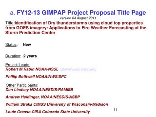
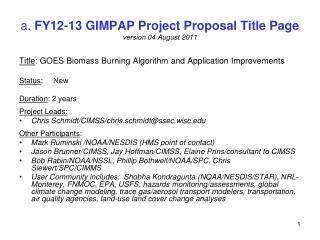
a. FY12-13 GIMPAP Project Proposal Title Page version 18 October 2011. Title : Daytime Enhancement of UWCI/CTC Algorithm For Daytime Operation In Areas of Thin Cirrus Status : New Duration : 2 years Project Leads: Justin Sieglaff / UW-CIMSS / justins@ssec.wisc.edu

E N D
a. FY12-13 GIMPAP Project Proposal Title Pageversion 18 October 2011 Title: Daytime Enhancement of UWCI/CTC Algorithm For Daytime Operation In Areas of Thin Cirrus Status: New Duration: 2 years Project Leads: Justin Sieglaff / UW-CIMSS / justins@ssec.wisc.edu Other Participants: Lee Cronce / UW-CIMSS Wayne Feltz / UW-CIMSS Dan Hartung / UW-CIMSS Mike Pavolonis / NOAA/NESDIS/STAR Andy Heidinger/ NOAA/NESDIS/STAR
b. Project Summary • Refine UWCI/CTC algorithm to fill gap identified by forecasters – allow UWCI/CTC to diagnose/nowcast cloud-top cooling/convective initiation of newly developing convection covered by thin cirrus clouds during daytime hours. • Currently all satellite-based convective initiation/cloud-top cooling algorithms (UW/CIMSS and University of Alabama-Huntsville) do not operate in areas of thin cirrus clouds. • Validate improved UWCI/CTC signal within areas of thin cirrus clouds during daytime hours. • This project builds upon three previous GIMPAP funded projects – development of UWCI/CTC algorithm, WDSS-II object-based UWCI/CTC validation, and GOES-R Cloud Team algorithms ported to current GOES Imagers.
c. Motivation / Justification Supports NOAA Mission Goal(s): Weather and Water, Commerce & Transportation • UWCI/CTC algorithm currently operates day/night to nowcast convective initiation and determine cloud-top cooling rate – in non-ice cloud areas aiding in decision support for aviation and severe storm warning nowcasting. • Feedback from Storm Prediction Center Hazardous Weather Testbed and local National Weather Service Milwaukee/Sullivan Testbed suggests the largest gap with current CI/CTC decision support is inability to operate in areas covered by thin cirrus clouds. • Thin cirrus clouds are commonly observed to ‘mask’ new convective development. These thin cirrus clouds are largely from decayed, earlier convection and associated with jet streaks.
d. Methodology • Work with NOAA/NESDIS Cloud Team at UW/CIMSS to acquire latest GOES daytime cloud optical depth retrievals. • Integrate GOES cloud optical depth retrievals into UWCI/CTC box-average framework (Sieglaff, et al. 2011). • Identify areas of rapidly increasing cloud optical depth in areas of thin cirrus clouds as a means to identify convective cloud growth occurring beneath thin cirrus clouds during daytime hours. This will allow for CTC rates to be calculated and CI nowcasts to be made in areas currently excluded. • Upon completion (year 1) of UWCI/CTC algorithm refinement, perform validation (POD and FAR) of added CTC/CI points beneath areas of thin cirrus clouds. • Following slides outline the gap in current methodology and show examples of the GOES cloud optical depth in areas of developing convection beneath thin cirrus clouds.
d. Methodology • Convection is developing along dry line over central OK • Much of the line is covered by a thin veil of cirrus clouds (next slides)
d. Methodology • Convection is developing along dry line over central OK • Much of the line is covered by a thin veil of cirrus clouds
d. Methodology • The thin cirrus cloud cover prevents all but the southern most storm (fewer cirrus clouds) to be hit by the UWCI/CTC algorithm
d. Methodology • GOES Imager Cloud Optical Depth shows rapidly increasing cloud optical depth associated with convection developing beneath thin cirrus clouds • Use of optical depth is critical in area of thin cirrus since cirrus clouds have very small optical depth and underlying convective clouds will have large optical depths
e. Expected Outcomes • Enhance UWCI/CTC algorithm using cloud optical depth to determine cloud-top cooling (CTC) rate and make CI nowcasts for developing convection beneath thin cirrus clouds during daytime hours. • Validation (POD and FAR) of added CI/CTC points beneath thin cirrus clouds. • Updated algorithm output will be provided to NWS WFOs and future testbeds (SPC HWT and local NWSWFO-MKX) for evaluation and decision support. • Publish peer-reviewed paper detailing technique and validation of CTC/CI points in areas of thin cirrus.
e. Possible Path to Operations • The UWCI/CTC algorithm and University of Alabama-Huntsville convective initiation algorithms are being evaluated for possible PSDI funding. Should the UWCI/CTC algorithm be selected, the thin cirrus improvements described in this proposal will be included upon completion and validation. • The methodology of using cloud optical depth to diagnose cloud-top cooling rates and nowcasting convective initiation in areas of thin cirrus clouds during the daytime could be provided to the GOES-R Convective Initiation Team for possible adoption into the GOES-R CI algorithm.
f. Milestones Year 1 • Acquire and implement latest GOES Imager Cloud Optical Depth Algorithm from NOAA/NESDIS Cloud Team at UW/CIMSS. • Implement UWCI/CTC algorithm modifications to include ability to diagnose CTC/nowcast CI in areas of thin cirrus during daytime hours using cloud optical depth; specifically by identifying rapid increases of cloud optical depth associated with developing convection beneath thin cirrus clouds. Year 2 • Perform validation (POD and FAR) of added CTC/CI points beneath areas of thin cirrus during daytime hours. • Publish peer-viewed paper outlining the daytime thin cirrus enhancement to the UWCI/CTC algorithm and subsequent validation.
g. Spending Plan FY12 • FY12 $73,000 Total Project Budget • Grant to CI – • 60% FTE - $68,000 • Travel - $5,000 (two trips, one to HWT other to conference) • Publication charge - $0 • Federal Travel – $0 • Federal Publication Charges – $0 • Federal Equipment - $0 • Transfers to other agencies – $0 • Other - $0
g. Spending Plan FY13 • FY13 $75,000 Total Project Budget • Grant to CI – • 55% FTE - $65,000 • Travel - $5,000 (two trips, one to AWC or HWT, other to conference) • Publication charge - $5,000 • Federal Travel – $0 • Federal Publication Charges – $0 • Federal Equipment - $0 • Transfers to other agencies – $0 • Other - $0