Download

1 / 31
320 likes | 647 Views
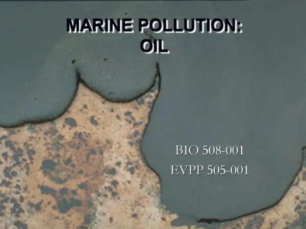
Monitoring and Forecasting of the oil pollution in the marine environment Leonidas Perivoliotis Hellenic Center for Marine Research. Routine monitoring from space. Spaceborne Synthetic Aperture Radar Systems: ERS-2, RADARSAT, ENVISAT 0,056 μ m, 5,3 GHz

E N D
Monitoring and Forecasting of the oil pollution in the marine environment Leonidas Perivoliotis Hellenic Center for Marine Research
Routine monitoring from space • Spaceborne Synthetic Aperture Radar Systems: • ERS-2, RADARSAT, ENVISAT • 0,056 μm, 5,3 GHz • Repeat cycle: 35 days (at the equator, lower at high latitudes) • Resolution: 30m • Swath width: 100km (400km Envisat)
Use of SAR images Synthetic Aperture Radar (SAR) images are extensively used for the determination of oil slicks in the marine environment as they are independent of cloudiness during day and night operations. Oil spills are recognized by the expert’s eye as dark patterns of characteristic shape in particular context. However, the major difficulty is to differentiate between oil spills and look-alikes of natural origin. • Limitations in detection • No wind • Strong winds (above 13m/sec)
SAR image processing islands Dark regions Possible oil spill 100% The basic steps Import SAR image, Georeference, Land Mask, Smoothing, Thresholding, Segmentation, Classification Probability of an object to be an oil spill 0%
SAR image processing (2) Tabular output
Mediterranean Sea An area of high-risk for oil pollution: 220.000 vessels / year (>100 tn) (250-300 tankers / day) 30% of global merchant shipping 20% of oil shipping Reports for oil-spill accidents 1000-2000 tn spilled per year (peak 12000 1991) 60% in ports and oil terminals
Mediterranean Sea SAR detected oil slicks (Illicit vessel discharge) : Spills detected during 1999: 1638 (13500 tn)
Forecasting part : The concept • To predict the spatial and temporal evolution of the oil -spill(s) in order to support a user decision whether an emergency action has to be taken • Accurate slick drift information is essential to efficient pollution recovery at sea and response on the coastline
The elements of oil spill forecasting • To simulate in the most realistic way the fate of the oil spill in the sea, I need to describe: • The transformation of the oil due to interaction with the sea and atmosphere (evaporation, emulsification, sedimentation, beaching) : weathering • The physical movement of the oil in the marine environment.
The elements of oil spill forecasting • It is necessary to have a complete information for the atmosphere and the sea: • Atmospheric conditions: • -Wind speed and direction • -Air temperature • Sea conditions: • Wave data • Currents data in the whole sea column • Temperature and salinity of water in the whole water column • Horizontal and vertical mixing terms
The elements of oil spill forecasting Oil spill processes in the water
The elements of oil spill forecasting • To describe the physical and chemical processes in the air-sea system we use numerical models • For a complete description we need 4 different models: • An oil spill dispersion and weathering model • A weather model • A wave model • A general circulation model
A real example: The operational oceanography POSEIDON system Operates in Greek Seas since 1999
Operational monitoring & forecasting system MFS - FerryBox
POSEIDON network • 11 SeaWatch Buoys • Meteorological Sensors • Air Temperature • Atm. Pressure • Wind Speed/Direction • “Blue” Sensors • Temperature • Salinity • Current • waves • “Green” Sensors • Dissolved Oxygen • Chlorophyll-A • Light Attenuation • Radioactivity 10 Smart-800 Buoys (waves only)
The SeaWatch Buoy Height: 7.9 m Width: 1.75 m Weight: 900 kgr Energy: Solar panels + batteries Communication: Imarsat C, GSM every 3 hours
Forecasting part : Operational models of POSEIDON All numerical models are built using the one-way nesting technique (Coarse and high resolution domains are interconnected) Hydrodynamic forecasts • Based on POM • Resolution: 5km, 31lev • Rivers and Dardanelles outflow simulation • Products: 3-D Velocity, Temperature and Salinity fields Weather Forecast • Based on ETA LAM • Resolution: 20/10 km • Products: Wind, Air temperature, Relative Humidity, Precipitation, Cloud cover, Atm. Pressure, Fog, … Wave forecast • Based on WAM model • Resolution: 5km • Buoy data assimilation • Products : Height, Direction and Period fields
Buoy Data Global Weather Forecasts NCEP POSEIDON Modelling System Meteorological model Off-shore Wave model Hydrodynamic model Near-shore wave model Pollutants model
Validation of model results Weather model : Use of ground and sea stations data • Comparison between the model forecast in specific locations and the recorded data from : • Hellenic Meteo Service network • POSEIDON buoys Forecasting skill over 3 year period Wind (speed): 75% Wind (direction): 80% Surface temperature: 90% Sea level pressure: 100%
Operational Procedure (in UTC time) 16:30 16:35-23:10 23:10-24:00 00:00-03:00 EMED Oceanographic model Mediterranean wave model Mediterranean weather model (25km) Download Global Analysis Fields Aegean weather model (10km) Aegean Oceanographic model Aegean Wave model 1 cpu Web page update 23:20 00:1003:10 http://www.poseidon.ncmr.gr
The POSEIDON oil spill model • Based on: PARCEL model (Koutitas 1988, Johansen 1985) • Processes: • Evaporation (Stiver et al. 1989) • Emulsification (Rasmussen 1985) • Beaching and sedimentation (Gundlach 1987) • Advection – diffusion: • 3-D current field • Horizontal and vertical mixing coefficients from hydrodynamic model (Smagorinsky, Mellor-Yamada) • Wave field (for Stokes drift computation) • Additional data: • Date and the position of the “event” • Initial volume of the pollutant • Density of the different elements • Evacuation time • (Density of evaporation and emulsification, retention time) • Products: • Oil Concentration • Beaching • Evaporation, emulsification Pollani et al., MPB 2000
All this information is necessary for oil spill forecasting?
Accident scenario Surface flow field 29/9/00 – 12 UTC • Time: 29/9/00 – 6/10/00 • Quantity : 100.000 galons Conditions at the time of accident Winds: Blowing from N-NW directions, speed : 3-4 Βeaufort (5.5-8m/sec) Sign. wave height: 0.5-0.8 meters Accident area 6/10/00 – 12 UTC
Accident scenario (2) Case 1 : Initial position of accident :24,4Ε 38,4Ν Time 29/9 – 6/10/00 Winds 3-4Be, N-NW Wave 0.5-0.8 m., sign. wave height
Accident scenario (2) Case 2: Initial position of accident:24,6Ε 38,4Ν-20Κm eastwards Time 29/9 – 6/10/00 Winds 3-4Be, N-NW Wave 0.5-0.8 m., sign. wave height
Summarizing: The requirements for a reliable oil spill forecast • An oil spill weathering and transport numerical model • To avoid simplified approaches, the sea-state and weather information should be provided by: • An operational marine monitoring - forecasting system which includes: • A monitoring network • A complete set of numerical models (weather, waves, currents) to produce daily forecasts
The “Prestige” case (November 2002) Cargo: 77.000 of heavy fuel
GMES : Global Monitoring for Environment and Security (2002-2008) European action • MERSEA - Strand 1(Marine Environment and Security for the European Area), funded by EU : Numerical modelling • ROSES – Real-Time Ocean Services for Environment and Security, funded by ESA: EO data
SAR receiving and processing module The complete service Observations Oil spill detection GIS mapping tool Weather, wave and circulation models Oil spill forecasts Product dissemination module