Download
1 / 37
380 likes | 479 Views
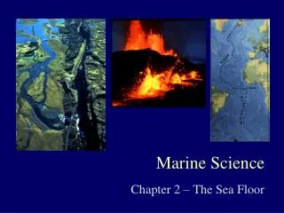
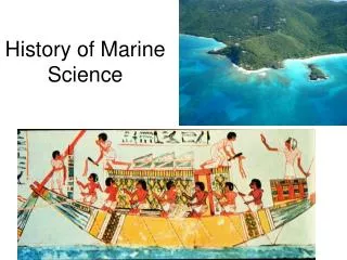
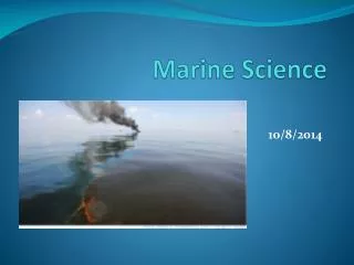
History of Marine Science. Unit 2. The History of Voyaging. Travelling for a specific purpose, especially by sea First navigation was celestial - finding one’s position in reference to heavenly bodies. The Egyptians. 4000 B.C. organize commerce on the Nile.

E N D
History of Marine Science Unit 2
The History of Voyaging • Travelling for a specific purpose, especially by sea • First navigation was celestial - finding one’s position in reference to heavenly bodies.
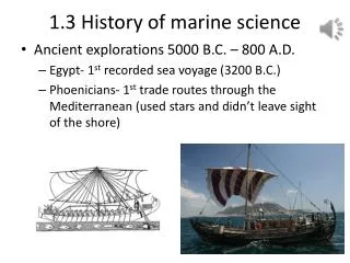
The Egyptians 4000 B.C. organize commerce on the Nile Circa 2300 B.C. established sea trade throughout the Indian Ocean ca 1938 - 1756 B.C. built the Isthmus of Suez, a canal to navigate ships across land which operated until 775 A.D. http://search.eb.com.ezproxy.uhd.edu/eb/article-22787
The Phoenicians 590 B.C. Sailed around Africa A stone carving from the 1st century AD shows the kind of ship that the Phoenicians used on the Mediterranean Sea
The Greeks ca 450 B.C. Herodotus published accurate map of Mediterranean region 336 B.C. Alexander the Great developed trade routes throughout the Mediterranean and expanded their empire http://www.henry-davis.com/MAPS/Ancientimages/109.JPEG
The Greeks 200 B.C. Eratosthenes Chief librarian for the Library of Alexandria in Egypt Housed scrolls copied by law off ships that harbored Burning the library resulted in an incalculable loss of ancient works
The Greeks (Eratosthenes) • mathematically calculated the circumference of the Earth to be 40,000 km. (It actually is 40,032 km. 2,200 years ago his math was good enough to be off only 32 km!) • Realized the Earth must be curved • Estimated Earth size within 8% of true value. • Developed longitude and latitude (present day longitude and latitude was developed by Hipparchus in 120 BC)
The Arabs ca 200 B.C Islamic and Arab Merchants Experienced sailors traded throughout the Mediterranean and Indian Oceans. They are believed to have invented the lateen sail (triangular sail) important in early navigation. http://search.eb.com.ezproxy.uhd.edu/eb/art-12539/A-lateen-rigged-ship-used-by-Arab-merchants
Science Voyaging: Middle Ages 900 A.D. The Vikings crossed the North Atlantic to colonize Iceland, Greenland, and Newfoundland used the North Star to determine latitude Exhumed Viking ship; Viking Ship Museum, Oslo, Norway.
Science Voyaging: 15th Century Chinese Sailed to influence and impress their neighbors. 1492 Columbus Sailing for Spain, sailed the Atlantic and “discovered” the America’s. 1497 Vasco de Gama Sailing for Portugal, sailed around Africa from Portugal to India to establish trade routes. Europeans searched for the Northwest passage through northern Canada to trade with Asia; explored the Arctic.
Science Voyaging16th Century 1519 - Portuguese explorer Ferdinand Magellan the 1st European expedition to circumnavigate the world. 237 men began the voyage; 18 returned. Magellan actually died before the journey was finished, but his crew returned in 1522. http://www.solarnavigator.net/history/explorers_history/ferdinand_magellan_charcoal_fur_robe.jpg
Science Voyaging 18th Century • 1728 John Harrison developed the first chronometer • timepiece governed by a spring instead of a pendulum • allowed longitude to be known; latitude can be known by stars (angle between your eyes, horizon and north star) • 4 are still located in Greenwich, England, which is the 0 meridian.
1762 American Ben Franklin created a chart of the Gulf Stream. The Gulf Stream gives the US its warm climate, bringing warm water north from the equator. Science Voyaging 18th Century
Science Voyaging 18th Century • 1768 James Cook (British Royal Navy) • Sailed thousands of miles across largely uncharted areas on the HMS Endeavor • Mapped lands from New Zealand to Hawaii in the Pacific Ocean in greater detail • First recorded European to encounter Australia • First captain to ward off scurvy (vitamin C deficiency)
1831-1836 HMS Beagle circumnavigated the globe while conducting explorations along the South American coastline and across the South Pacific Science Voyaging 19th Century
Science Voyaging 19th Century 1831-1836 HMS Beagle • Charles Darwin, an accompanying naturalist, keep detailed catalogs of life encountered along the way • His studies of the Galapagos Islands led to modern theories of evolution
Science Voyaging 19th Century • 1838-1842 US Exploring Expedition with the unpopular Lt. Charles Wilkes • first U.S. Navy expedition to explore the Pacific Ocean • first to provide proof of the existence of an Antarctic • last all-sail naval mission to encircle the globe • Information obtained made up 19 volumes of maps, text, and illustrations
Science Voyaging 19th Century • 1840 Matthew Maury (US Navy) • “Father of Modern Oceanography” • Charted winds and ocean currents • Inferred the presence of the Mid-Atlantic Ridge Monument in Richmond, VA
Science Voyaging19th Century • 1872-1876 HMS Challenger Expedition (British) • Charles Wyville Thomson and John Murray (coined the term “oceanography”) • tested water chemistry; made soundings and 151 trawls; charted reefs; and studied currents, meteorology, sediments • discovered 4,727 new species, the Mid-Atlantic Ridge and the world’s deepest ocean trench, Marianas Trench (deepest point is called Challenger Deep)
Science Voyaging19th Century • route of HMS covered more than 68,000 nautical miles and lasted 1,000 days • first pure oceanographic investigation • complied a 50 volume set of information still used today • disproved theory that there were no organisms below 1,800 feet due to pressure and lack of light http://www.nhm.ac.uk/nature-online/science-of-natural-history/expeditions-collecting/hms-challenger-expedition/
Science Voyaging20th Century 1898 John Holland invents 1st gas engine/battery powered submarine bought by US government in 1900. the world wars were the catalyst for US oceanographic research
Science Voyaging20th Century • 1914 German Meteor Expedition • 1st to use echo sounding (depth & contour) • produced the first detailed survey of the south Atlantic ocean floor • established that the mid-Atlantic ridge was continuous
Science Voyaging20th Century • 1934 bathysphere • invented and used by Otis Barton & William Beebe • Sphere shape resists high pressure • Unpowered & lowered on a cable • Had windows for observing undersea wildlife What the?!?
Science Voyaging20th Century • 1943 Jacque Cousteau and Emil Gagnan invent the Aqua-Lung • now known as SCUBA Seriously?!?
Science Voyaging20th Century • 1960 Jacque Piccard and Don Walsch man the US Trieste bathyscaphe (small submarine) • descend 35,801 ft. into the deepest part of the ocean within the Marianas trench • Not repeated until 2012!
Science Voyaging20th Century • 1962 Alvin (DSV-2) • First deep sea submersible to carry passengers built • has completed over 4,400 dives • 1966 located an H-bomb lost in the Mediterranean Sea
Science Voyaging20th Century • 1968 GlomarChallenger • confirmed evidence of seafloor spreading and plate tectonics from core drilling samples.
Alvin (DSV-2) cont. • 1979 Robert Ballard discovered “black smokers” (undersea hydrothermal vents) on the sea floor • 1986 explored Titanic wreck
Science Voyaging20th Century 1985-? JASONs (satellite oceanography monitors) Uses altimeter to measure sea surface height Allows us to look at global ocean circulation, improve climate forecasts and monitor events such as El Niño, hurricanes and sea-level rise (global warming) http://www.sciencelearn.org.nz/Contexts/The-Ocean-in-Action/Sci-Media/Video/The-Argo-and-Jason-projects
Science Voyaging20th Century • 2007 Argo • an array of over 3,000 drifting profiling floats that monitor temperature, salinity and below-surface currents of the ocean • relay their data via satellites • allows us to track ocean heat content • named after the Greek mythical ship that carried Jason (satellite name) in his quest for the golden fleece
Science Voyaging21st Century http://www.deepseachallenge.com/ • 2012 James Cameron piloted the Deep Sea Challenger tothe ocean's deepest point (remember Trieste 1960?) • What’s new? • Ability to collect rock, sediment and biology samples • More powerful lights and a suite of wide-field and macro 3-D high-definition cameras
Research Vessels Submersibles – small underwater vehicles ROV – remotely operated vehicle Bathysphere –lowered by a cable from a ship Drilling ships – take sediment cores Floating and Fixed platforms(FLIP – floating instrument platform) -gather data like temperature, salinity, density, and weather patterns
ROV bathysphere submersible
Fixed platform Drilling ship Floating platform
Other Research Instruments Airplanes Satellites – SEASAT: 1st satellite dedicated to ocean studies Echo-sounding Underwater cameras Side scan sonar – great for sunken ships
Conclusion The ocean represents the Earth’s last frontier for exploration and the key to understanding the future of our planet. The human race depends on the life and sustainability of the ocean for economic, biological, and environmental stability. The world of aquatic science is ever reaching for new discoveries in this blue realm.