Download
1 / 16
160 likes | 164 Views
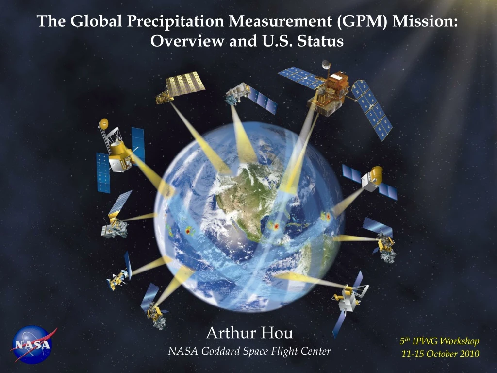
The Global Precipitation Measurement (GPM) Mission: Overview and U.S. Status. Arthur Hou NASA Goddard Space Flight Center. 5 th IPWG Workshop 11-15 October 2010. GPM Mission Concept. Low Inclination Observatory (40 o ) GMI (10-183 GHz) (NASA & Partner, 2014).

E N D
The Global Precipitation Measurement (GPM) Mission: Overview and U.S. Status Arthur Hou NASA Goddard Space Flight Center 5th IPWG Workshop 11-15 October 2010
GPM Mission Concept Low Inclination Observatory (40o) GMI (10-183 GHz) (NASA & Partner, 2014) GPM Core Observatory (65o) DPR (Ku-Ka band) GMI (10-183 GHz) (NASA-JAXA, LRD 2013) An international satellite mission to unify and advance precipitation measurements from space • Enhanced capability for cinear-realtime monitoring ciof hurricanes & cimidlatitude storms • Improved accuracy in cirain accumulation • Precipitation physics observatory • Transfer standard for inter-satellite calibration of constellation sensors Coverage & Sampling Key Contribution Refine constellation sensor retrievals within a consistent framework to provide next-generation global precipitation data products Partner Satellites: GCOM-W1 DMSP F-18, F-19/20 Megha-Tropiques MetOp, NOAA-19 NPP, JPSS (over land) • 1-2 hr revisit time over land • < 3 hr mean revisit time over 90% of globe
A science mission with integrated application goals GPM Science Goals • New reference standards for precipitation measurements from space - using combined information from active and passive microwave sensors • Better understanding of water cycle variability, and freshwater availability - through better description of space-time distribution of precipitation processes • Improved numerical weather prediction skills - through better instantaneous precipitation information and associated error characterization • Improved hydrological prediction capabilities for floods, landslides, and freshwater resources - through downscaling and innovative hydrological modeling • Improved climate modeling and prediction capabilities - through better estimates of latent heating, precipitation microphysics, & surface water fluxes • Key to better global precipitation data products: • Accuracy of instantaneous precipitation estimate • Spatial coverage & temporal sampling (for improved estimation of precipitation accumulation) • Spatial resolution (for local-scale applications) • Data latency (for near real-time operational use)
NASA-JAXA GPM Core Observatory Core Observatory Measurement Capabilities Dual-Frequency (Ku-Ka band) Precipitation Radar (DPR): • Increased sensitivity (~12 dBZ) for light rain and snow detection relative to TRMM • Better measurement accuracy with differential attenuation correction • Detailed microphysical information (DSD mean mass diameter & particle no. density) & identification of liquid, ice, and mixed-phase regions Multi-Channel (10-183 GHz) GPM Microwave Imager (GMI): • Higher spatial resolution (IFOV: 6-26 km) • Improved light rain & snow detection • Improved signals of solid precipitation over land (especially over snow-covered surfaces) • 4-point calibration to serve as a radiometric reference for constellation radiometers Combined Radar-Radiometer Retrieval • DPR & GMI together provide greater constraints on precipitation retrieval for improved accuracy • DPR/GMI-constrained cloud database for constellation radiometer retrievals
- Radar for vertical structural details • Radiometers for horizontal coverage • A radar-radiometer system for a common transfer standard GPM Strategy to Global Precipitation Estimation • DPR Retrievals: • A characteristic size parameter (D0) of the PSD • estimated from the difference (in dB) between • Ku- and Ka-band radar reflectivity factors • Ambiguities include unknown shape parameter • () of the gamma PSD distribution and the snow • mass density () • Characteristic number concentration of PSD • is given by D0 and the radar equation • Step-by-step estimation of attenuation correction • based on PSD estimates • Precipitation rate and the equivalent water • content are derived from the PSD for an • assumed velocity distribution RAIN SNOW Meneghini et al., NASA/GSFC
Using GMI radiance measurements as additional constraints on the • DPR profiling algorithm: • Assumptions regarding the particle size distribution, ice microphysics, cloud water and water vapor vertical distribution are refined using a variational procedure that minimizes departures between simulated and observed brightness temperatures - according to the sensitivity of simulated brightness temperatures to assumptions in DPR retrievals. • Retrievals are consistent with both DPR reflectivities and GMI radiances wwithin a maximum-likelihood estimation framework. • Construction of an a-priori database that relates hydrometeors to bbrightness temperatures over the range of observed Tb values for pprecipitation retrievals from constellation radiometers. • Pre-launch algorithm advances focus on retrievals of solid precipitation pand physical retrievals over land: • Modeling of nonlinear, under-constrained relationships between physical characteristics of precipitation particles and microwave observations • Characterization of land surface variability/emissivity Combined DPR+GMI retrievals
Refine algorithm assumptions & parameters - Characterize uncertainties in satellite retrievals & GV measurements “Truth” is estimated through the convergence of satellite and ground-based estimates Role of GPM Ground Validation • Pre-launch algorithm development & post-launch product evaluation • Three complementary approaches: • Direct statistical validation (surface): • - Leveraging off operational networks to identify and resolve first-order discrepancies between satellite and ground-based precipitation estimates • Physical process validation (vertical column): • - Cloud system and microphysical studies geared toward testing and refinement of physically-based retrieval algorithms • Integrated hydrologic validation/applications (4-dimensional): • - Identify space-time scales at which satellite precipitation data are useful to water budget studies and hydrological applications; characterization of model and observation errors
International Collaborations on GPM GV • Joint field campaigns • National networks and other ground assets (radar, gauges, etc.) • Hydrological validation sites (streamflow gauges, etc.) LPVEx (2010) NASA-EC Snowfall (2012) MC3E (2011) Pre-CHUVA (2010) 15 Active International Projects • GPM Joint Field Campaigns: • Joint campaign with Brazil on warm rain retrieval over land in Alcântara, 3-24 March 2010 • Light Precipitation Validation Experiment (LPVEx): CloudSat-GPM light rain in shallow melting layer situations in Helsinki, Finland, 15 Sept - 20 Oct 2010 • Mid-Latitude Continental Convective Clouds Experiment (MC3E): NASA-DOE field campaign in central Oklahoma, Apr-May 2011 • High-Latitude Cold-Season Snowfall Experiment: Joint campaign with Environment Canada on snowfall retrieval in Ontario, Canada, Jan-Feb 2012 • Hydrological validation with NOAA HMT in 2013 (under development)
LPVEx Real Time Mission Monitor (RTMM) “Golden Day” 21 September 2010 9:20 GMT 10:05 GMT Aircraft spiral from 1 Kft to 12 kft Freezing Level: 1.9 km
Current Capability:< 3h over 45% of globe Extended Life Prime Life GPM Sampling and Coverage Baseline Constellation Schedule GPM (2015):< 3h over 90% of globe GPM Core Launch Hour 1-2 hr revisit time over land with inclusion of sounders
GPM Observations from Non-Sun-Synchronous Orbits Monthly Samples as a Function of the Time of the Day(1o x 1o Resolution) TRMM: 3652 “asynoptic” samples Near real-time observations from the GPM Core and LIO between overpasses by polar orbiters at fixed times of the day for: • Near real-time monitoring of mhurricanes & midlatitude mstorms • Improved accuracy of rain mvolume estimation • Resolving diurnal variability min rainfall climatology • Coincident observations with mconstellation radiometers for mintercalibration over wide mranges of latitudes and climate mregimes GPM Core+LIO: 6175 samples Core+LIO: 4298 samples
Inter-Satellite Calibration of Microwave Radiometers • Objective: Quantify and reconcile differences between similar (but not identical) microwave radiometers to remove relative biases in measurements • X-Cal (Imagers):Convert observations of one satellite to virtual observations of another using a non-Sun-synchronous satellite as transfer standard (e.g. TMI or GMI) • Develop corrections for recurring instrument errors and implementation strategy for routine intercalibration of constellation radiometers • Bias correction a function of orbital phase and solar beta angle • Agreement between different methods ~ 0.3 K TMI Bias Correction Table (K) NOAA 17 183 ±3 GHz (Ocean) Courtesy of Wilheit (Texas A&M) & Jones (UCF) • X-Cal (Sounders): • Double differencing using forecast residual as primary transfer standard to provide a basis for calibration consistency • Collaboration with NWP centers (MHS-ECMWF)-(AMSU_B-ECMWF) Courtesy of Hanna, Weng, & Yan (NOAA) GPM International X-Cal Working Group (NASA, JAXA, NOAA, CNRS, EUMETSAT, CMA, CONAE, GIST, & universities) in coordination with WMO/CGMS GSICS
Next-Generation Global Precipitation Products GPM Core: Reference Standard for Constellation Radiometers • Intercalibrated constellation radiometric data reconciling differences in center frequency, viewing geometry, resolution, etc. • Converting observations of one satellite to virtual observations of another using non-Sun-synchronous satellite as a transfer standard • GMI employsan encased hot load design (to minimize solar intrusion) and noise diodes for nonlinearity removal to attain greater accuracy & stability • Unified precipitation retrievals using a common cloud database constrained by DPR+GMI measurements from the Core Observatory Prototype GPM Radiometer Retrieval Optimally matching observed Tb with simulated Tb from an a priori cloud database Simulated Tb Observed Tb Comparison of TRMM PR surface rain with TMI rain retrieval using an cloud database consistent with PR reflectivity and GMI multichannel radiances TRMM uses a model-generated cloud database GPM uses a DPR/GMI-constrained database
Sensor and Product Resolution • DPR will provide precipitation structure information at 5 km horizontal resolution • GMI on Core Observatory at 407 km will offer the highest resolution radiometric imaging data. AMPR (Aircraft) GMI (Core) AMSR-E TMI SSMIS Courtesy of R. Hood • Dynamically or statistically downscaled precipitation products at 1-2 km resolution Assimilation of rain-affected radiances from TMI and AMSR-E into the NASA/CSU WRF Ensemble Data Assimilation System (EDAS) NOAA Stage IV data (Verification) WRF-EDAS (with AMSR-E, TMI) WRF-GSI (no AMSR-E,TMI) mm Rain accumulation for 15-22 September 2009 over the Southeast U.S. flood region
Mission Status • GPM is in Phase C implementation at NASA • Mission Critical Design Review completed in Dec. 2009 • GMI # 1 & 2 fabrication & assembly underway • Core Spacecraft manufacturing in progress: Integration & Test in Dec 2010 • Core Observatory Launch Readiness Date: 21 July 2013 • NASA in partnership discussion to launch the GPM LIO in late 2014 • NASA Precipitation Processing System currently producing • Prototype inter-calibrated Level-1 products for TMI, SSMI, AMSR-E, SSMIS, & WindSat • Level-3 merged global precipitation products using TMI, SSMI, AMSR-E, AMSU, & MetOp in near real-time for research & applications • International and domestic partnership agreements under development • CNES, ISRO, AEB/INPE, EUMETSAT, NOAA, JPSS, DWSS • NASA is conducting a series of joint field campaigns with domestic and international partners to refine algorithm assumptions and parameters. • GPM is the cornerstone for the CEOS Precipitation Constellation (PC) under development in support of GEOSS and GEO • 9th GPM International Planning Workshop and 4th CEOS PC Workshop will be hosted by INPE/AEB in Fortaleza, Brazil, in April 2011