Download
1 / 106
1.06k likes | 1.29k Views
Climate and Weather. Climates and Seasons. The different climates and seasons we have on Earth are decided mainly by… where our planet lies and how our planet moves around the Sun. Our location in the Solar System. Our Earth is the third planet from the Sun.

E N D
Climates and Seasons The different climates and seasons we have on Earth are decided mainly by… where our planet lies and how our planet moves around the Sun.
Our location in the Solar System Our Earth is the third planet from the Sun. Located approximately 93 million miles (150 million kilometers) from the Sun, our Earth is in an ideal position.
Not too hot, not too cold! • Earth is positioned between Venus and Mars. • Venus’ location is too hot to allow life, and Mars is too cold. • Earth is the only known planet in our Solar System that supports life.
Son, my very excellent mother just sent us nine pizzas. S un M ercury V enus E arth M ars J upiter S aturn U ranus N eptune P luto
Earth revolves around the Sun • The Earth revolves around the sun 1 time every 365¼ days. • The Earth’s axis is tilted23½° • The revolution of the Earth and the tilt of its axis cause our seasons.
The Earth Rotates on its axis • The Earth’s axis is tilted 23½° • The Earth rotates on its axis one time every 24 hours. • This rotation causes our days and nights.
The Sun shines on ½ of the EarthThe other ½ is having night.
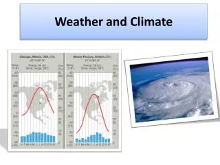
What is Climate? • Climate is the average, year after year conditions of temperature, precipitation, winds, and clouds in an area. • Two main factors, temperature and precipitation determine the climate of an area.
What is weather? • Weather is the day to day events in the atmosphere. It may be rainy and cloudy today and sunny and dry tomorrow. • Weather refers to the condition of the atmosphere at a particular place and time.
What are the factors that make up our weather? • Energy in the atmosphere. • Heat transfer • Winds • Water in the atmosphere • Precipitation
Energy at the Earth’s Surface • Some of the Sun’s energy reaches the Earth’s surface and is reflectedback into the atmosphere. • The remainder of the Sun’s energy is absorbed by the land and the water and changed into heat.
Energy in the atmosphere • The Sun provides nearly all of the energy in the Earth’s atmosphere. • The Sun’s energy is absorbed or reflected by… a. Water vapor b. Carbon dioxide c. Ozone d. Clouds e. Dust f. Other gases
Heat is transferred in three ways • Radiation-the heat you feel from the sun or a campfire travels directly to you as infrared radiation • Conduction-the direct transfer of heat from one object to another. (Hot sand against bare feet) • Convection-the transfer of heat by the movement of molecules in liquids and gases. (Drying your hands under a blow dryer)
Convection and Conduction • Only the first few meters of the atmosphere are warmed by conduction. • Convection causes most of the warming of the troposphere. • The upward movement of warm air and the downward movement of cool air form convection currents. These currents move heat throughout the troposphere.
Temperature • Temperature is one of the most important elements of weather. • Temperature is a measure of how hot or cold a substance is. • Air temperature is usually measured with a thermometer.
Air Pressure • Air pressure is the result of the weight of a column of air pushing down on an area. • Air pressure is greater at sea level and decreases as you go higher into the atmosphere. • Air Pressure is measured with a barometer. • Air pressure is measured in inches or millibars. 1 inch of mercury is equal to 33.87 millibars. (30” = about 1,016mb)
Barometers • Air Pressure is measured with a barometer. • Two types of barometers are … Mercury barometerAneroid barometer
Wind • Wind is the horizontal movement of air from areas of high pressure to areas of low pressure. • All winds are caused by differences in air pressure. • Most differences in air pressure are caused by unequal heating of the atmosphere.
Measuring wind • Winds are described by their direction and speed. • Wind direction is determined by a wind vane. The name of the wind tells you the direction it is blowing from. East Wind is blowing from the east • Wind speed is measured with an anemometer or by using the “Beaufort wind scale.”
Beaufort Wind Scale # MPH Description 0. < 1 Calm - Calm; Smoke rises vertically. 1. 1-3 Light - Air Direction of wind shown by smoke drift not by wind vanes. 2. 4-7 Light Breeze - Wind felt on face; Leaves rustle; Vanes moved by the wind. 3. 8-12 Gentle Breeze - Leaves and small twigs in constant motion; Wind extends light flag. 4. 13-18 Moderate - Raises dust, loose paper; Small branches moved. 5. 19-24 Fresh - Small trees in leaf begin to sway; Crested wavelets form on inland waters. 6. 25-31 Strong - Large branches in motion; Whistling heard in telegraph wires; Umbrellas used with difficulty.
Beaufort Scale Cont. 732-38 Near Gale - Whole trees in motion; Inconvenience felt walking against the wind. 8 39-46 Gale - Breaks twigs off trees; Impedes progress. 9 47-54 Strong Gale -Slight structural damage occurs. 10 55-63 Storm - Trees uprooted; Considerable damage occurs. 11 64-72 Violent Storm - Widespread damage. 12 73-82 Hurricane - Widespread damage.
Sea Breezes and Land Breezes • Sea breezes occur when the land heats up and as the warm air rises above the land it is replaced by cool air moving in from above the nearby water. • Land breezes take place when the water is warmer than the land and the air above the water rises and is replaced by cooler air from the land. (usually occurs at night as the land cools more quickly than the water)
Monsoons • Monsoons are similar to land and sea breezes, but occur over a much larger area. • Sea and Land breezes over a large area that change direction with the seasons are called monsoons. • Monsoons typically bring in warm moist air from the ocean and cause heavy, seasonal rainfall.
Global Winds • Global winds blow steadily from specific directions over long distances. • Like other winds, these are caused by unequal heating of the Earth’s surface. • These winds are also directed by the rotating of the Earth on its axis. (Coriolis effect)
Examples of Global Wind Belts • Trade Winds • Prevailing Westerlies • Polar Easterlies • Doldrums • Horse Latitudes
Jet Streams • Jet streams are bands of high speed winds about 10 Km above the surface of the Earth. • Winds blow from west to east at speeds of 200 to 400Km per hour. • Jet streams wander north and south as they travel around the Earth. • Changes in their location allow warm air from the Equator or cold air from the Polar Regions to affect weather patterns.
Water in the atmosphere • Water enters the atmosphere through the process of evaporation from the oceans, rivers and lakes. • Water also enters the atmosphere by living things. Water enters the roots of plants, rises to the leaves and is released as water vapor. (Transpiration)
Humidity • Humidity is the amount of water vapor in the air. • Relative humidity is the amount of water vapor in the air compared to the amount of water vapor the air could hold at a given temperature.
Measuring Relative Humidity • Relative humidity is read as a percentage (%). If the relative humidity is 50%, it means the air is holding ½ of the moisture it could hold at that particular temperature. Warm air can hold more water vapor than cold air. • Relative humidity is measured with a psychrometer. (Wet/Dry bulb thermometer)
Measuring Relative Humidity • Psychrometer or Wet / Dry Bulb Thermometer • Hygrometer and Sling Psychrometer
Relative Humidity Table RELATIVE HUMIDITY TABLE (SHOWN IN %) • _____________________________________________________________________________ • DRY BULB DIFFERENCE BETWEEN WET AND DRY BULB READINGS IN CELSIUS DEGREES • _____________________________________________________________________________ • C 1 2 3 4 5 6 7 8 9 10 • _____________________________________________________________________________ • 10 88 77 66 55 44 34 24 15 6 • 11 89 78 67 56 46 36 27 18 9 • 12 89 78 68 58 48 39 29 21 12 • 13 89 79 69 59 50 41 32 22 15 7 • 14 90 79 70 60 51 42 34 25 18 10 • 15 90 80 71 61 53 44 36 27 20 13 • 16 90 81 71 63 54 46 38 30 23 15 • 17 90 81 72 64 55 47 40 32 25 18 • 18 91 82 73 65 57 49 41 34 27 20 • 19 91 82 74 65 58 50 43 36 29 22 • 20 91 83 74 67 59 53 46 39 32 26 • 21 91 83 75 67 60 53 46 39 32 26 • 22 92 83 76 68 61 54 47 40 34 28 • 23 92 84 76 69 62 55 48 42 36 30 • 24 92 84 77 69 62 56 49 43 37 31 • 25 92 84 77 70 63 57 50 44 39 33 • ______________________________________________________________________________
Clouds • Clouds of all kinds form when water vapor in the air becomes liquid water or ice crystals. • This process is called condensation. • The temperature at which condensation begins is called the dew point.
Condensation When water vapor condenses on dust particles, salt crystals or smoke, clouds form. • When this takes place near the surface of the Earth, it is called fog.
Dew and Frost • Water vapor that condenses on blades of grass and other solid surfaces is called dew. • Frost is ice that has been deposited directly from the air onto a cold surface.
Why do clouds form? • Air that is warmed near the ground becomes less dense and rises in a convection current. • When this rising air expands and becomes cooler, clouds may form.
Mountains and precipitation • Air rising against the side of a mountain also cools and forms clouds. Rain and snow from these clouds falls on the windward side of the slope. • Often the moisture from these clouds is gone by the time it reaches the other side of the slope. These leeward slopes are often dry and may form deserts.
Windward Slope • Water vapor condenses as air rises up over mountains causing rain and snow to fall on the windward slopes.
Leeward slope • Leeward slopes are usually dry. Most precipitation falls on the windwardside of the mountain. Desert areas are often found on the leeward side.
Types of Clouds • Clouds are classified into three main types. Cumulus – “Heap or mass” Stratus – “Spread out or flat” Cirrus – “Wispy or feathery”
Clouds names refer to height • Cumulus clouds – form less than 2Km above ground but may reach up to 18Km • The prefix Alto refers to “High” clouds. They form between 2 and 6 Km above Earth. • Cirrus clouds only form at levels above 6Km where temperatures are very low. • “Fog,” Clouds that form at or near the ground.
Cumulus Clouds • Fluffy, shape forming clouds that have a base and then extend upward • Fair weather clouds – may develop into Cumulonimbus (Thunderheads).
Stratus • Low, layered cloud – may appear as fog lifting off of the ground
Cirrus Thin clouds at high altitudes, made of ice crystals. Often indicate falling weather within 24 – 48 hours.