Download
1 / 15
150 likes | 237 Views
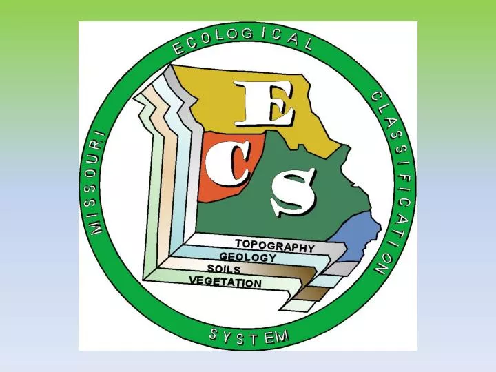
USFS Hierarchy Finer Scale Units for Missouri. ELTs=ESDs=HGM. What We’ve Done in Missouri. Nigh and Schroeder 2002. Electronic Copy: At MDC Public Website go to Interactive Maps/Atlas of Missouri Ecoregions. What is an ELT or ESD?. Geo-Landforms. ELTs/ESDs. Soil Properties.

E N D
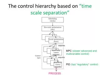
USFS Hierarchy Finer Scale Units for Missouri ELTs=ESDs=HGM
What We’ve Done in Missouri Nigh and Schroeder 2002 Electronic Copy: At MDC Public Website go to Interactive Maps/Atlas of Missouri Ecoregions
What is an ELT or ESD? Geo-Landforms ELTs/ESDs Soil Properties Vegetation
Example ELT/soil legend: Loess FragipanUpland Flatwoods ELT Nelson Community Loess Fragipan Upland Flatwoods MDC Forest Type
Products • Ecological Site Descriptions • Web Soil Survey Mapping with hyperlinks to ELT/ESD Description
Products • Eco-regional Reports • By MLRA • Outlines Methodology • Descriptions of the region, ELT/ESD sequence • Legend of dominant ELTs/ESDs • Cross-sections • DVD including a pre-assembled GIS project and all associated spatial data
Products Hands-on Training Workshops by ecoregion
Products • Ecological Site Description using NRCS format, which includes: • Physiographic, soil narrative • Ecological dynamics of site • Vegetation description • State and Transition Model • Management criteria and guidelines • Web Soil Survey Mapping with hyperlinks to ELT Description