Download
1 / 9
90 likes | 95 Views
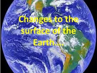
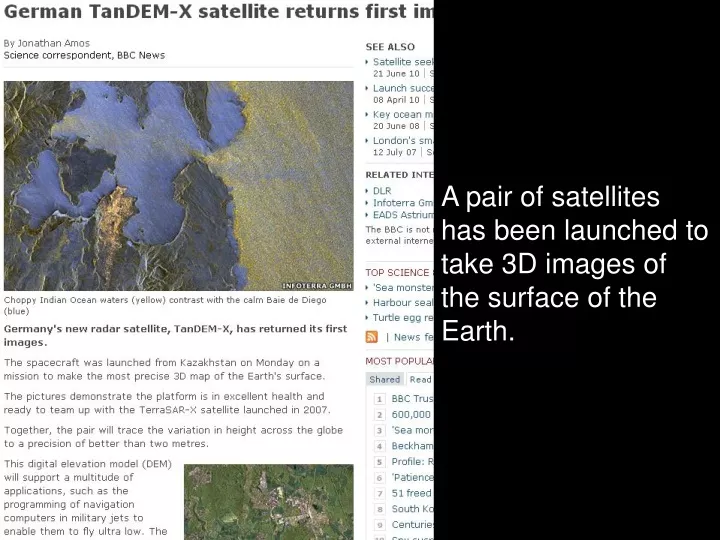
A pair of satellites has been launched to take 3D images of the surface of the Earth. The two satellites orbit at a height of 514 km and at times are just 200 metres apart. The images they send back will allow the Earth to be mapped in 3D for the first time.

E N D
A pair of satellites has been launched to take 3D images of the surface of the Earth.
The two satellites orbit at a height of 514 km and at times are just 200 metres apart. The images they send back will allow the Earth to be mapped in 3D for the first time. All of the satellite images we have at the moment are in 2D from directly above.
Viewed from directly above, in 2D, which of these landmarks could this image represent? The Great Pyramid, Egypt The Empire State Building, New York Canary Wharf, London Big Ben, London
Draw what you think one or two of these 2D images from above could look like from directly in front of the building.
Viewed from directly above, in 2D, which landmarks from around the world could these images represent?
It’s in the News!Satellites Teacher Notes
Satellites Introduction: We’re all familiar with Google Earth’s images of our streets and houses from space but these might soon be supplemented with 3D images from a pair of recently launched German satellites. The TanDEM-X and TerraSAR-X satellites will orbit together, giving a ‘stereo’ view of the planet rather than the familiar two-dimensional images. This resource uses the idea of satellite images as a context for exploring 2D representations of 3D objects by looking at the plan view of some well-known landmarks, asking students firstly what they might look like from the front or side elevation and then to match the image with a photograph of the landmark. Content objectives: This context provides the opportunity for teachers and students to explore a number of objectives. Some that may be addressed are: • visualise and use 2D representations of3D objects; analyse 3D shapes through 2D projections, including plans and elevations • interpret information from a mathematical representation or context. Process objectives: These will depend on the amount of freedom you allow your class with the activity. It might be worth considering how you’re going to deliver the activity and highlighting the processes that this will allow on the diagram below:
Activity: The activity first challenges students to consider which landmark a plan view image might represent, giving them the choice of Big Ben, The Great Pyramid, Canary Wharf and the Empire State Building and, in doing so, allowing students to experience the limitations of viewing from only one direction (they might argue that the image could represent any or all of the landmarks although some are more likely than others). Students are then invited to consider what six different plan views might look like from a front or side elevation before being given photographs of different landmarks and being asked to match the plan view with the photograph of the landmark. This could then be extended to drawing a plan view of the school (or other local landmark) and checking the accuracy of this using Google Earth. Differentiation: You may decide to change the level of challenge for your group. To make the task easier you could: • provide the students with some model buildings or shapes and ask them to draw them as they’d be seen from directly above • reduce the complexity by telling the students that there is no match for the photographs of the Sydney Opera House, Empire State Building and Taj Mahal. To make the task more complex you could: • focus on the possible variety of buildings which the plan views could be and explore what’s the same and what’s different about them • ask students to draw possible plan views for the landmarks that have no match • encourage students to justify and explain how they know the images fit with the landmarks? A written justification might further extend the activity. The resource Building Houses might be used to supplement this It’s in the News! This task offers plenty of opportunities for developing students’ skills in representing and this might be a priority objective for the lesson This resource is designed to be adapted to your requirements. Working in groups: This activity lends itself to paired work and small group work and, by encouraging students to work collaboratively, it is likely that you will allow them access to more of the key processes than if they were to work individually. You will need to think about how your class will work on this task. Will they work in pairs, threes or larger groups? If pupils are not used to working in groups in mathematics you may wish to spend some time talking about their rules and procedures to maximise the effectiveness and engagement of pupils in group work (You may wish to look at the SNS Pedagogy and practice pack Unit 10: Guidance for groupwork). You may wish to encourage the groups to delegate different areas of responsibility to specific group members. Assessment: You may wish to consider how you will assess the task and how you will record your assessment. This could include developing the assessment criteria with your class. You might choose to focus on the content objectives or on the process objectives. You might decide that this activity lends itself to comment-only marking or to student self-assessment. If you use the APP model of assessment then you might use this activity to help you in building a picture of your students’ understanding. Assessment criteria to focus on might be: • use and interpret mathematical symbols and diagrams (Using and applying mathematics level 3) • show understanding of situations by describing them mathematically, using symbols, words and diagrams (Using and applying mathematics level 5) • visualise and use 2D representations of 3D objects (Shape, space and measure level 6).
Probing questions: You may wish to introduce some points into the discussion which might include: • can you draw another shape which would look like a pyramid from above? • if a shape looks circular from above, can it have any corners further down? • if two buildings look the same from a plan view, will they also look the same from a side view? Front view? • can you draw two buildings which look the same from a front and side elevation but have a different plan view? You will need: The PowerPoint presentation and student resource sheets. The PowerPoint has five slides: The first two slides set the scene showing students the satellites and describing how they work together to produce a 3D map. The third slide asks students to consider a plan view of a building and asks students which of the buildings shown it might represent The fourth slide shows six plan views and asks students to consider what the building might look like from other elevations. You might ask them to draw some possibilities accurately or just to describe them. The final slide shows the same images but reveals that they are famous landmarks. Using the two resource sheets, students can try to match the plan views with the photographs.