Download
1 / 14
140 likes | 258 Views
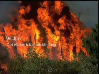
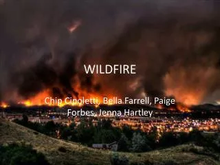
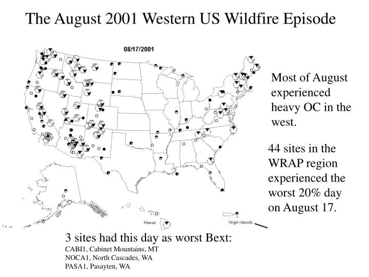
The August 2001 Western US Wildfire Episode. Most of August experienced heavy OC in the west. 44 sites in the WRAP region experienced the worst 20% day on August 17. 3 sites had this day as worst Bext: CABI1, Cabinet Mountains, MT NOCA1, North Cascades, WA PASA1, Pasayten, WA.

E N D
The August 2001 Western US Wildfire Episode Most of August experienced heavy OC in the west. 44 sites in the WRAP region experienced the worst 20% day on August 17. 3 sites had this day as worst Bext: CABI1, Cabinet Mountains, MT NOCA1, North Cascades, WA PASA1, Pasayten, WA
The August 2001 Western US Wildfire Episode: August 11-23 Fires started early in August and lasted all month. 2001 was not a particularly bad fire year in terms of number of acres burned
Databases available • IMPROVE data • Text, photos and maps on fires from NIFC, USFS, newspapers • Text on meteorology from NWS, NCDC • Weather maps from CDC, NCEP, WXP • MODIS satellite images from UWisc, USFS • Coarse fire locations fron MODIS, AVHRR
Large Fire Locations Typical of late season fires, most of the fires are in the northwest and northern Great Basin
August 15 Terra MODIS at 18:38 UTC shows transport of regional smoke plumes
August 17 Terra MODIS at 18:38 UTCCan see thick smoke in NW and coastal areas The Moose Incident was one of the largest fires of the 2001 season. This lightning caused fire occurred August16th on the Flathead National Forest. The Moose fire ultimately burned approximately 71,000 acres before it was controlled.
Conditions According to NIFC National Fire News the national level of preparedness increased to the highest point on the 16th, as more than one half million acres are burning in 42 large firesacross the United States. Nearly 21,000 firefighters are working on the fire lines. Record high temperatures in Oregon, Washington, and Idaho may increase large fire activity. Predicted strong winds will challenge firefighters on the 17th. Media reports on the 16th indicate federal troops will join the 21,000 firefighters. Fire activity as of mid-August was near to or slightly above the 10-year average.
Drought http://lwf.ncdc.noaa.gov/img/climate/research/2001/wildfire/08-07Statewideprank_pg.gif
Morning surface weather 17 August (12:00 UTC) Notice radar echos (see end of presentation)
500mb Height Anomaly The image above shows the departure from normal 500 mb geopotential heights over North America for August 1st through 16th. We can see that all of the U.S. has experienced above normal heights, as noted by the greens, yellows, and oranges. These departures ranged from 1 to about 6 standard deviations above normal. Such a large positive anomaly usually leads to warm conditions.
Fires Fires 5 day backtrajectories from morning of 17 Aug Possible Canadian influence on Montana sites NM sites point toward regional fires in Northwest and upper Great Basin
Convective activity in Arizona On the 17th there was significant convective activity with the development of severe storms and Mesoscale Convective System in south central Arizona. This storm developed and caused most damage from winds in the evening and early morning hours. The following is an excerpt from the paper: Evolution of an Intense MCS over South-Central Arizona on 16-17 August 2001, G.D. Green and D.N. Runyan. 84th AMS Annual Meeting, 11-15 January 2004, Seattle, WA “Between 0730 and 0945 UTC, an organized MCS, with intense, frequent cloud-to-ground lightning, locally heavy rain, and strong to damaging straight line wind, developed and propagated south-southwest, eventually producing significant wind damage, with over 130 power poles (41-230 KV poles; 76-69 KV poles; 15-12 KV poles) downed just north and west of Gila Bend, near an electrical substation operated by Arizona Public Service (APS). Peak gusts near the substation were estimated at 90 to 100 mph (78 to 87 kt) by an APS engineer. A wind sensor south of Gila Bend recorded a peak gust of 66 kt (76 mph) at 0945 UTC, but radar indicated strongest winds occurred ~10 km northwest of that location. As this MCS propagated toward the southwest, wind damage, power outages, and near zero visibili ty due to blowing dust occurred over much of Yuma County, including Yuma, where TV and radio stations were off the air for a time. Strong winds and dense blowing dust reached far southeast California by 1200 UTC 17 August.”
Wind Blown Dust Activity August 17, 2001 IMPROVE Notice coarse mass contributions. These are probably attributable to the blowing dust episode from the thunderstorms