Download
1 / 28
280 likes | 508 Views
BlueSky Western Canada Wildfire Smoke Forecasting System Pilot Project. B.C Prescribed Fire Council Meeting Steve Sakiyama British Columbia Ministry of Environment Victoria, British Columbia, Canada Steve.Sakiyama@gov.bc.ca. Quebec Forest Fires, 2002. Wildfire Smoke Impacts. James Bay.

E N D
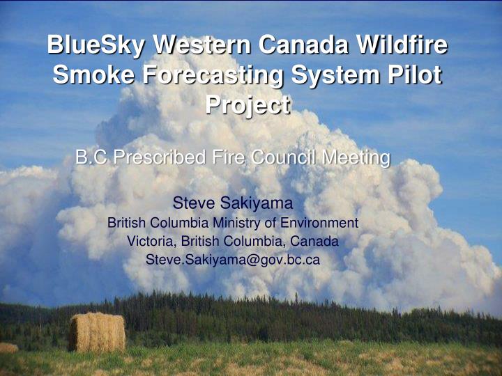
BlueSky Western Canada Wildfire Smoke Forecasting System Pilot Project B.C Prescribed Fire Council Meeting Steve Sakiyama British Columbia Ministry of Environment Victoria, British Columbia, Canada Steve.Sakiyama@gov.bc.ca
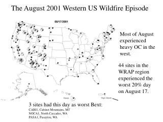
Quebec Forest Fires, 2002 Wildfire SmokeImpacts James Bay Wildfire smoke can drift for 1000s of km, and impact activities of millions of people. Need for smoke forecasts: • Public safety (advisories, evacuations) • Health Authorities (advisories, evacuations) • Transportation (visibility) • Tourism (health, visibility, nuisance) • Fire Management (downstream • effects, air tanker flight safety) • Weather Forecasters (trajectories) • Air Quality Management Agencies • (public alerts, concentrations) • Public (health alerts, nuisance) Lake Huron Toronto
Forecasting Wildfire Smoke • We know roughly where it comes from and where it is, but … • Where will the smoke go? • Will it get worse or better? Aug, 2010 Williams Lake, BC
Smoke Forecasting System BC/Alberta: Origin and Development • Wildfire Smoke Workshop, Edmonton (2007) • Idea: Use existing US Forest Service BlueSky Framework • Modular – Canadian parts swapped in • Multi-Agency pilot project to test feasibility Brew-Sky, BlueSky-Eh?
Partners: Canadian Federal, Provincial and US agencies BC Ministry of Environment, BC Ministry of Forests and Range, Alberta Dept of Environment, Alberta Dept of Sustainable Resource Development, Natural Resources Canada (Canadian Forest Service), Environment Canada, University of British Columbia (School of Environmental Health, Dept of Earth and Ocean Sciences), US Forest Service, Sonoma Technologies Inc.
Forecasting Smoke from Wildfires: What is Needed? Forecast Meteorology • University of British Columbia: Dept of Earth and Ocean Sciences • Weather Prediction Model: MM5 produces forecast hourly meteorology up to 48 hours into the future, for a 4 km grid across BC and Alberta Example: Forecast Winds Okanagan Valley
Forecasting Smoke from Wildfires: What is Needed? Wildfire Location, Fuel Consumption • NOAA satellites: identify & locate active fires (hotspots) daily using remote sensing techniques (MODIS & AVHRR) • Canadian Wildland Fire Information System (CWFIS) downloads hotspot data and estimates fire attributes for each hotspot using the Fire Behaviour Prediction (FBP) system Image courtesy NOAA
Forecasting Smoke from Wildfires: What is Needed? Fuel Consumption / PM2.5 Emissions Modelling • Canadian Forest Fire Behaviour Prediction (FBP) System: estimates fuel consumption • Fire Emission Production Simulator (FEPS): estimates plume rise and PM2.5 emissions (US Forest Service)
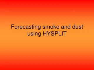
Forecasting Smoke from Wildfires: What is Needed? Smoke Plume Transport and Dispersion Model (Hysplit) • Estimates ground–level PM2.5 concentrations with puffs that simulate plume transport and dispersion • Mixing height, stability, topography, vertical motions included
Forecasting Smoke from Wildfires: What is Needed? BlueSky Framework to Link the Pieces • BlueSky Framework Software with Computer Hardware provided by the US Forest Service • Installed and Operated at UBC
BlueSky Framework: Fitting it All Together Hourly Meteorological Forecast: MM5 Weather Forecast Model: University of BC in Vancouver, B.C. Daily Wildfire Location and Fuel Consumption: Canadian Wildland Fire Information System: Northern Forestry Research Centre in Edmonton, Alberta HYSPLIT and BlueSky Framework: Framework links pieces and produces smoke transport and dispersion forecast (UBC) Web Output: Animations of forecast hourly PM2.5 , ground-level concentrations of for BC/Alberta at www.bcairquality/bluesky/ Total Partner Cost (past 3 years): 95K and In-Kind Support
Output Display via Website (www.bcairquality.ca/bluesky) Forecast hourly Ground LevelPM2.5 concentrations up to 48 hours into the future • Example forecast • issued 0800, Aug 2nd • valid from 1700, Aug 1 to 0400, Aug 4
Output Display: Google Earth FormatAvailable Smoke location and Ground LevelPM2.5 concentrations for each hour up to 48 hours into the future July 21 9:00 pm
System Testing, Evaluation and Application • Stress testing - August 2009 (an extreme wildfire period): • System can handle thousands of fires • Based on a qualitative evaluation using satellite data, reasonable forecasts produced, not perfect • System operational August 2010 (extreme wildfire activity in BC Interior): • Over 60,000 hits on BlueSky website in August • Produced daily forecasts reliably • Informed decisions for air quality alerts and evacuations by BC Health Authorities • Used to assist in health impact studies of wildfire smoke (UBC)
Caveats Output is experimental. Partners are learning from this fire season’s experience. • Clouds or thick smoke will obscure hotspot detection • PM2.5 concentrations should be interpreted as relative levels of concentrations, rather than as absolute values • Smoke from previous hours/days (carry over smoke) is not fully accounted for • Smoke outside the domain is not included. • Odd bull’s eye patterns at distant areas, appear and disappear
System Enhancements for 2011 Wildfire Season • New (faster) computer (testing underway at UBC) • Performance evaluation (UBC, AEnv) • Improved Fuel Consumption, Plume Rise and Emissions Estimates (Canadian Forest Service) • Include 2 day carry over smoke (presently 12 hours) (UBC, BC MoE) • Improve output graphics (BC MoE) • Expanded domain to include portions of U.S., Yukon, NWT and all of Saskatchewan, Manitoba, NW Ontario) • Rework of computer code (STI/AEnv) • Domain size depends on run- times
BlueSky as a Tool to Inform Rx Burn Decisions • In concept, it is possible to input location and size of Rx burns into BlueSky • For different burn scenarios (location, fuels) BlueSky will forecast smoke concentrations every hour for the next 48 hours. • “Gaming” Example: for a proposed burn(s) at a specific location, what would happen if it were to occur today at noon? In the next 48 hours: • where would the smoke go? • what PM2.5 concentrations will occur?
Summary and Final Points • Pilot successful: the BlueSky system works and produces reasonable results to inform decisions • Massive project requiring cooperation and support (in-kind and funding) from several partners • High interest and need for smoke forecasts • Evaluation underway and system enhancements are planned • National system under development: 2012? (Environment Canada) • Manitoba and Saskatchewan public safety/health agencies want in.
Partners and Acknowledgements • S Larkin, R Solomon: US Forest Service • S Raffuse, K Craig: Sonoma Technologies Inc. • E Meyer: BC Ministry of Forests and Range • C Jenkins, S. Sakiyama, G. Okrainetz: BC Ministry of Environment • R Stull, G Hicks, M Brauer: University of British Columbia • L. Cheng, D. Lyder: Alberta Environment • C. Tymstra: Alberta Sustainable Resource Development • A. Pankratz, B. Wiens, R. Vingarzan: Environment Canada • K. Anderson, P. Englefield, S. Taylor: Natural Resources Canada (Canadian Forest Service)