Download
1 / 24
240 likes | 249 Views
Inventory and Monitoring Terrestrial Fauna. Linking Field Activities to Budget Processes. Inventory and Monitoring Activities Are Not Keeping Pace with Issues. Species at risk increasing Regulatory and other requirements increasing Funding not keeping pace Issue-based approaches

E N D
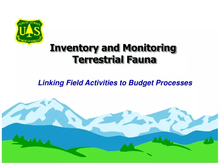
Inventory and Monitoring Terrestrial Fauna Linking Field Activities to Budget Processes
Inventory and Monitoring ActivitiesAre Not Keeping Pace with Issues • Species at risk increasing • Regulatory and other requirements increasing • Funding not keeping pace • Issue-based approaches not effective Requires a “systems” approach and use of corporate data standards to facilitate data exchange and reduce costs
FS Inventory & Monitoring Framework:Applying a Systems Approach QUESTIONS • Translate local and national issues and requirements into inventory questions • Identify basic data needed to develop meaningful answers to inventory questions • Collect/compile basic and digital data and load into NRIS-Fauna • Use automated tools to search for the strongest relationship between field and digital data • Translate data into information/knowledge for decision makers • Prepare inventory and monitoring reports for assessment and planning processes FIELD DATA DIGITAL DATA MODELS EVALUATION REPORTS
FS Resource Information Management - Corporate Standards, Protocols, Data Bases Data Standards & Protocols • FSH or GTR: • Common Stand Exam • TEUI • Aquatic Inventory • Terrestrial Fauna Data Collection NRIS Databases Field Users
Corporate Data and Tools Your Platform for Inventory, Assessment, and Effects Analysis
Corporate Inventory & Monitoring Protocols Corporate inventory & monitoring protocols: - Collect BASIC resource data, not interpreted data - Are linked at various scales - Utilize a systems approach to allow data aggregation - Respond to a wide-range of inventory questions - Include spatial and attribute data collection - Provide direct loading into field data recorders and NRIS-Fauna, other NRIS data bases Documented in Forest Service Handbooks or General Technical Reports to: - Ensure Federal and Agency data standards are met - Incorporate scientific information and processes - Document metadata - Describe QA/QC procedures - Enable replication over the landscape and time
15 Standard Core GIS Layers Core GIS Layers are Linked to Corporate Databases: • NRIS – Fauna linked to: Species Occurrence Layer • NRIS – Terra linked to: TEUI/AEUI • NRIS – Water linked to: Watersheds, Water Bodies, and Stream Network Layers • ALP – linked to: Land Ownership Layer • INFRA – linked to: Roads/Trails, facilities, range allotment boundaries, etc.
NRIS – FaunaYour Platform for Analysis and Documentation NRIS – Fauna Features • Direct link to ABI/TNC and other • non-FS databases • Interactive capability between • spatial and attribute data • Standardized analysis tools • Linked to habitat relationship • models and monitoring systems • Field data recorders support • corporate inventory protocols • Links to other NRIS/INFRA data • Meets all FGDC/Agency standards • Centralized support and help desk • Upgrades based on user needs
FS Budget Framework Understanding Ecological Components of the Budget
Program Budget Direction • Use of NFIM Funds must meet three tests: • Above-Project Purpose • Documented I&M Protocols/Metadata • Integration/Coordination • Inventory, Assessment and Monitoring: • Defined as different and distinct activities • Reported as different accomplishments • Separate direction and funding
NFIM Activity Descriptions • Inventory(IMMAXX job codes) • Consists of data collection and data management • needed to analyze of the resource conditions • Meets multiple information needs at various scales • above the project-level • Assessment(IMMBXX job codes) • Characterization of ecosystems at two scales to • provide context for management • Identify management options – no decisions • Monitoring(IMMCXX job codes) • LRMP monitoring activities • Preparation of Annual Reports
Accomplishment Reporting (MAR) • Inventory(IMMAXX job codes) • Acres of Terrestrial Fauna Inventory • at the Landscape Scale • Acres of Terrestrial Fauna Inventory • at the Subregion Scale • Assessment(IMMBXX job codes) • Number of Broadscale Assessments • Number of Watershed Assessments • No reporting elements for Fauna Assessments • Monitoring(IMMCXX job codes) • Number of Annual Monitoring and Evaluation Reports • No reporting elements for Fauna Monitoring Reports
FS Program Budget Development Understanding Budget Ecological Processes
NFIM Program Connections • NFIM funded Terrestrial Fauna Inventories (IMMAXX Job Codes) supports: • Broadscale Assessments for LRMP • Revision or Amendment • Watershed/Landscape Assessment • NFIM supports participation of wildlife biologists, botanists in Assessments (IMMBXX Job Codes). • Monitoring (IMMCXX Job Codes) funded by NFIM supports: • MIS/Viability Monitoring described in LRMP
NFIM Program Components 2001 2002 2003 2004 2005 Broadscale Assessment X FY02 - 16 Watershed Assessments Broadscale Assessment Y FY03 – 18 Watershed Assessments FY04 - 16 Watershed Assessments Monitoring MA MB MB Plan Revisions MA MB Project Analyses MA MA MB MB MA MB Project Analyses MA MB Project MC MC MC MC MC
Example: FY01 Target Estimates Terrestrial Fauna Inventory - Landscape Scale Number of Assessments x Watershed Assessment Acres 16 x 125,000 = 2.0 million acres Terrestrial Fauna Inventory - Subsection Scale Broadscale Assessment Acres 2 NF & 1 NG (NFS and adjacent lands) 1 x 6.5 million = 6.5 million acres Terrestrial Fauna Monitoring No MAR Item - Information in Annual Report No target Terrestrial Fauna Habitat Inventory No MAR Item – Interpreted from other data No target This methodology is used in lieu of calculating inventory cycle for NFS lands or other methods
Terrestrial Fauna Inventories At the Landscape Scale Supporting Ecosystem Analysis at the Watershed Scale
Terrestrial Fauna Inventoriesat the Landscape Scale Gathering and mapping information on the occurrence, population, and density of terrestrial fauna needed to support Ecosystem Analysis at the Watershed Scale. Habitat inventory is derived from other inventories not reported in this category. • Compile data from existing sources (e.g. ABI/TNC) • Identification of data gaps using habitat relationship models • Determine inventory method • Field inventories to fill data gaps • Document QA/QC procedures • Development of GIS Coverages • Loading data into NRIS-Fauna • Preparing Fauna Report
Terrestrial Fauna Inventory to SupportEcosystem Analysis at the Watershed Scale TYPICAL ACTIVITIES SUPPORTED BY NRIS-FAUNA • Access to existing data on species • occurrence and range in GIS • Use models to evaluate habitat • relationships using NRIS, INFRA • data in models • Identify data gaps • Identify inventory protocol • Load Field sampling/survey data • and metadata in NRIS-Fauna • Analyze data in NRIS-Fauna • Prepare Inventory Report
Product Examples • Species occurrence, population distribution, and density displayed in the NRIS-Fauna database for use in the Willow Creek Watershed Assessment. • Fauna inventory report completed for the Rock Creek Watershed and data loaded into NRIS-Fauna for an upcoming watershed analysis.
Terrestrial Fauna Inventories At the Subsection Scale Supporting LRMP Revision and Amendment
Terrestrial Fauna Inventory at the Subsection Scale Inventories span Ecological Subsections and are independent of administrative unit or land ownership. Data are compiled from available data sources and linked to vegetation and terrestrial ecological inventories to determine data gaps. Inventories are conducted using sampling systems which provide the foundation for future LRMP monitoring, which will determine the validity of assumptions used in planning, identifying focal species, species of concern, and rare components. • Habitat relationship models are adapted from literature or developed for use in LRMP Revision. A variety of model building tools, based in GIS provide wildlife biologists/botanists analysis tools that can be updated as scientific information changes and monitoring results are evaluated.
Terrestrial Fauna Inventories at the Subsection Scale • Inventories at this scale utilize data and ecological characterization to stratify sampling and “mine” data from other sources. • Where observations and field sampling are needed, inventories are conducted. • Links to other inventory systems are developed over time to gather data needed to support these assessments. NRIS – Fauna provides the capability to access data, conduct spatial analysis, develop relationships, and catalogue data
Products and Examples • Blah, Blah, Blah. • Blah, Blah, Blah. Blah, Blah, Blah. • Blah, Blah, Blah. Blah, Blah, Blah. Blah, Blah, Blah.