Download
1 / 32
360 likes | 609 Views
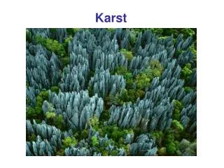
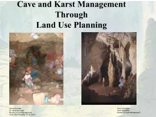
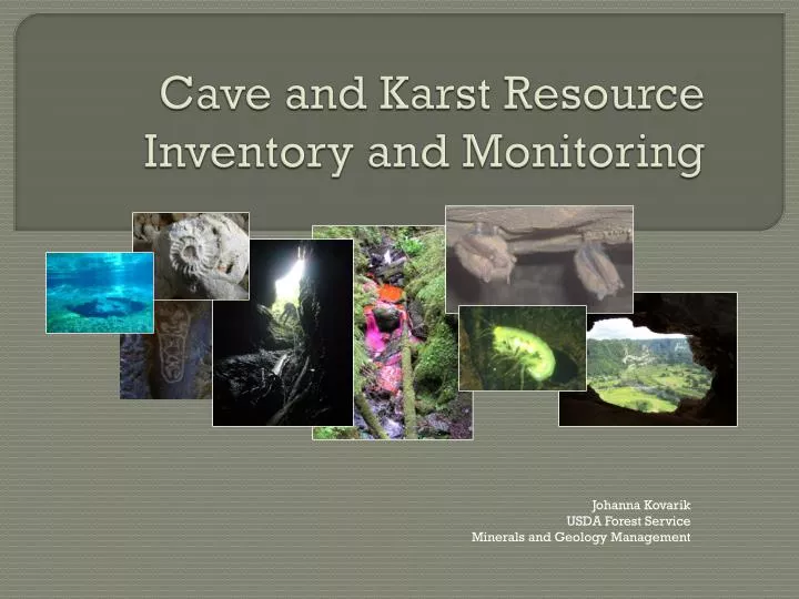
Cave and Karst Resource Inventory and Monitoring. Johanna Kovarik USDA Forest Service Minerals and Geology Management. Cave and Karst Resources. Secondary attributes and features both natural and man-made, that reside within the confines of the cave or karst system

E N D
Cave and Karst Resource Inventory and Monitoring Johanna Kovarik USDA Forest Service Minerals and Geology Management
Cave and Karst Resources Secondary attributes and features both natural and man-made, that reside within the confines of the cave or karst system Karst resources include epikarst development, springs and spring biota, etc.
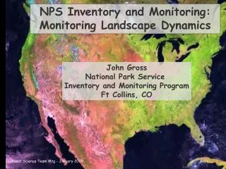
Why Inventory? You’ve got to know what you have and where it is in order to manage: 1. Extent of Karst development (cave systems) 2. Nature of the karst development (# of caves) 3. The resources preserved or endemic within those environments (attributes) - biota, cultural artifacts, paleo specimens, etc. Inventory data provides a BASELINE to which future data can be compared and a valuable collection of data for research
Resource Inventories Geographic Data Photo documentation Maps, databases, and Geographic Information Systems (GIS) Scientific Research Sound Resource Management Decisions Development of monitoring plan and protocol Field data collection Evaluation Analysis
Don’t Panic! Cave and Karst managers often have no funding or personnel Inventory can be time consuming and difficult The subset of resources within caves often falls beyond the scope of the particular resource a manager is familiar with BUT Some data is better than no data Prioritize We have an amazing group of stakeholders, and a wide variety of partnership options. Much of this data may already exist for your unit. Don’t reinvent the wheel - many parks and forests have templates you can adapt!
Inventory Background Work • Determine what you already have • State cave surveys, local grottos, hand written accounts • Maps and remote sensing data • Geologic maps • Topographic maps • Aerial photographs • Google Earth • More advanced: LiDar, etc.
Inventory Fieldwork • Plot known information on base map • Collect location information/ inventory new features (GPS) • Type of karst feature or cave • Cave entrance sheet - photos, tags! • Dye Tracing • Cave survey • General cave resource inventory • Detailed inventory
Resource Inventories • Generally conducted during the cave survey • Sketcher or dedicated inventory team member notes geology, biology, cultural, and paleontological resources • Further, detailed resource inventories for professionals in future projects
Record Keeping Digital as well as hard copy database in safe places (fireproof filing cabinets! Backup hard drives!) GIS provides easy access and spatial viewing Consider where your agency keeps files – also consider keeping a digital copy of all files with stakeholders such as cave surveys
Why Monitor? Adaptive Management – how much use and impact is too much? Documenting use Understanding how management decisions and strategies impact resources
Developing Protocol Existing Condition Desired Future Condition Potential Impacts Measureable Attributes Reference condition / baseline Identify Targets / Goals
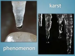
NPS List of Monitored Cave Resources Cave meteorology Airborne sedimentation Direct visitor impacts Permanent or seasonal ice Cave drip and pool water Microbiology Stability-breakdown, rockfall and partings Mineral growth Surface expressions and processes Regional groundwater levels and quantity Fluvial processes
Potential Resource Impacts Sedimentation / pollutants to karst aquifers Damage to formations Loss of habitat for endemic biota Endless list!
Don’t Panic! From simple, recreation permit feedback to complex data logger high resolution monitoring, cavers and volunteers are a great resource! Agencies work together to develop tools – data sheets, monitoring protocol, etc. Prioritize, and come up with a plan and indicators.
Existing Condition • Document Existing condition - Inventory, as discussed above! • Commission further in-depth studies if resources are present (paleo, cultural, biology, etc.) • Also consider past impacts – past harvest in an area, visitation to caves, etc.
Reference Condition Baseline / Background values Can be difficult to achieve in heavily impacted areas Perhaps develop an index based on similar Caves in the same area Springs in the same watershed
Identify Targets/ Future Condition • Again, Rehabilitate – to what values? • Baseline values for a pristine area • Drinking water quality standards • Known prior condition (inventory!) • Maintain • Current values, allow for natural variance and seasonal differences • Plan for impact – what is acceptable?
Human visitation/disturbance • Footprints (“brushing” areas clean) • Scheduled monitoring visits (staff or volunteers-stewards) • Data Loggers (light on/off) – place in entrance areas and in remote sections of caves. • Cave Registers • Photo points– recreate the same photograph • Permit issuance • DON’T LET MONITORING BECOME AN UNACCEPTABLE DISTURBANCE!
Photomonitoring“Worth a thousand words” • Provides clear observable comparisons to present and past. • Can document not only negative human caused impact, but also natural change as well. • Can document success stories! Restoration and responsible use. • Can document effectiveness of current management practices.
Monitoring Macro Impacts-Development in Karst Areas- • Implementation Monitoring following NEPA action were mitigation measures implemented properly? • Site monitoring • Pick an indicator – water quality is often a great one • Sedimentation, debris in sinkholes
Limits of acceptable change/visitor experience and resource protection • Developed for Wilderness Areas and Parks • Defines amount of environmental change measured as indicators • Defines limits of acceptable change (LAC) • As change approaches determined limit, management actions are implemented
Visual Impact Evaluation System (VIES) • Easy to use form of LAC • Can be conducted by anyone • Objective – relies on observations • Provides a record of resource monitoring
VIES Steps • Identify indicators • Create impact scales • Determine LAC • Conduct monitoring
Identify Indicators • Easily observed • Relates to human impact • Examples may include trash, graffiti, impacted formations, critters, altered passages
Impact Scales • Scale indicates how much change the indicator is being impacted or altered • Should be easily understood and observed • Example: • Level 0 – No trash • Level 1 – Limited trash • Level 2 – Trash present • Level 3 – Trash impacts view
Determine LAC • Determine the maximum level of change that is acceptable for each cave “standard” • No change is often the preference and in some cases the only option.
Conduct Monitoring • Use previous monitoring reports for comparison • Establish permanent monitoring points • Document with photos and various methods
Questions? Modified from 2011 A. Stockton Presentation