Download
1 / 18
180 likes | 299 Views
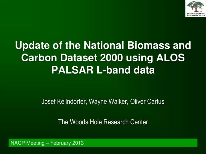
Update of the National Biomass and Carbon Dataset 2000 using ALOS PALSAR L-band data. Josef Kellndorfer, Wayne Walker, Oliver Cartus The Woods Hole Research Center. NACP Meeting – February 2013. Continental-Global Biomass Maps (500-1000m). Baccini et al., 2012, Nature Clim. Change.

E N D
Update of the National Biomass and Carbon Dataset 2000 using ALOS PALSAR L-band data Josef Kellndorfer, Wayne Walker, Oliver Cartus The Woods Hole Research Center NACP Meeting – February 2013
Continental-Global Biomass Maps (500-1000m) Baccini et al., 2012, Nature Clim. Change Santoro et al., 2011, RSE
Outline • National-scale mapping of canopy height and biomass at hectare-scale (scale of disturbance): • using inventory, Lidar and optical/radar remote sensing • using radar (without inventory for calibration) • The National Biomass and Carbon Data Set for the U.S. (Collaborators: Elizabeth LaPoint, Mike Hoppus, James Westfall, USDA FS) • Multi-temporal L-band Radar (ALOS PALSAR ALOS-2, DESDynI-R) (Collaborators: Maurizio Santoro, GAMMA RS)
Pilot Studies for SRTM Height Retrieval: Georgia • Kellndorfer, J.M., W.S. Walker and L.E. Pierce, M.C Dobson, J. Fites, C. Hunsaker, J. Vona, M. Clutter, "Vegetation height derivation from Shuttle Radar Topography Mission and National Elevation data sets." Remote Sensing of Environment, Vol. 93, No. 3, 339-358, 2004.
In the US a unique opportunity (for 2000) to combine several 30m national EO and ancillary data sets to extend plot level FIA height and biomass to wall to wall maps: • Shuttle Radar and Topography Mission (SRTM) • National Elevation Dataset (NED) • Compiled from Topographic Survey data • Cohesive processing for the first time around 2000 • “Bald Earth” model • National Land Cover Database 2001 • Provides Landcover, Treecover, Imperviousness • MRLC Landsat ETM+ Datasets 1999-2002
Modeling Approach Hypotheses: Height = f (SRTM-NED, canopy density, cover type, …) Biomass = f (height, density, cover type, …) Used a statistical approach (ensemble regression-tree algorithm) to model the relationships between remote sensing measurements and FIA plot data Assess at different spatial scales how well height (Lorey’s) and biomass could be predicted Radar Optical
In National Geographic! http://www.whrc.org/mapping/nbcd/index.html http://daac.ornl.gov/NACP/guides/NBCD_2000.html
Plot Level Accuracy via Bootstrap Validation Biomass estimates less accurate than height as biomass integrates vertical and horizontal structure
NBCD multi-scale comparison with Blackardet al. and FIA biomass estimates NBCD Blackard et al. Hexagon Scale Size ~ 650 km2 ~ 25 FIA plots
Update of NBCD with ALOS PALSAR? Continuity of global L-band observations warranted with ALOS-2 and DESDynI-R NBCD represents a unique product because several 30 m remote sensing products were available for the same time frame
USDA project: Towards Spatially Explicit Quantification of Carbon Flux (2000-2007) in Northeastern U.S. Forests Linking Remote Sensing with Forest Inventory DataInvestigators: Kellndorfer, J., Cartus, O., Houghton, R. A., Walker, W. S.Collaboration: Maurizio Santoro, GAMMA RS 655 PALSAR FBD images for 2007/08 Multi-temporal coverage: 1-5
BIOMASAR Algorithm (Santoro et al., 2011) Semi-empirical Model:
Automated Model Calibration and Inversion for each image (or pixel level)
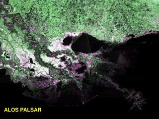
ALOS biomass map for 2007 from 655 HH/HV acquisitions 30m pixel posting
Pixel-level Comparison with NBCD NLCD 2001/06 Change product used to mask areas of forest cover change
Importance of multi-temporal data Pronounced weather (rain) effects on single image retrieval > 4 images per year (available only locally from ALOS PALSAR)
Summary • L-band radar: • continuity warranted with ALOS-2 and • DESDynI-R • Multi-temporal acquisition strategy is key! • Two different methods and data sets: • Good agreement at spatial scales >500m • To be investigated: • Better understanding of uncertainty in the maps • Disturbance/Change, Map difference vs. signal change